Raiya Tunda
| Raiya Tunda रैया टुंडा | |
|---|---|
| village | |
 Raiya Tunda  Raiya Tunda Location in Rajasthan, India | |
| Coordinates: 28°47′15.4″N 74°47′59.8″E / 28.787611°N 74.799944°ECoordinates: 28°47′15.4″N 74°47′59.8″E / 28.787611°N 74.799944°E | |
| Country |
|
| State | Rajasthan |
| District | Churu |
| Languages | |
| • Local | Bagri |
| Time zone | IST (UTC+5:30) |
| ISO 3166 code | RJ-IN |
| Vehicle registration | RJ |
| Climate | Arid (Köppen) |
Raiya Tunda is a gram panchayat in Taranagar sub district of Churu district in the Indian state of Rajasthan.[1] The village has been chosen as Adarash Gram by jaynarayan poonia the member of parliament of Taranagar sub district. Raiya Tunda is 62 KM away from its district head quarter churu.
Transportation
Raiya Tunda is well connected by roads to its nearest cities Taranagar (36 km), Nohar (45 km), Bhadra (52 km) and Sardarsahar (60 km). The nearest railway station is Nohar . Raiya Tunda is about 350 km away from New Delhi. The nearest airport to Raiya Tunda is Bathinda (160 km).
Language and Culture
The people of Raiya Tunda speaks Bagri language and Bagri culture dominants here.
Education
There is one govt. senior high secondary school, two govt. primary school and two private schools in the village. Most of the students of the village go to sahwa for study. Most of the old aged people are uneducated.
Economy
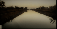
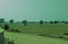
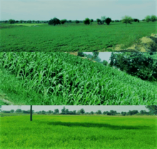
Most of the village economy based on farming. Indra Gandhi lift canal passes through the village ,most of the fields are irrigated but sandy dunes can still be seen in the village.


Dhani Kuan
Dhani kuan is a small Dhani within the village Raiya Tunda . Most of the families are of Jaat calan here . The whole dhani is situated at the top of a tibba .