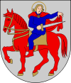
Raisio
| Raisio | ||
|---|---|---|
| Town | ||
| Raision kaupunki | ||
|
Market place in Raisio | ||
| ||
 Location of Raisio in Finland | ||
| Coordinates: 60°29′N 022°10′E / 60.483°N 22.167°ECoordinates: 60°29′N 022°10′E / 60.483°N 22.167°E | ||
| Country |
| |
| Region | Southwest Finland | |
| Sub-region | Turku sub-region | |
| First records | 1292 | |
| City rights | 1974 | |
| Government | ||
| • Town manager | Ari Korhonen | |
| Area (2016-01-01)[1] | ||
| • Total | 48.76 km2 (18.83 sq mi) | |
| • Land | 48.76 km2 (18.83 sq mi) | |
| • Water | 1.3 km2 (0.5 sq mi) | |
| Area rank | 306th largest in Finland | |
| Population (2016-03-31)[2] | ||
| • Total | 24,330 | |
| • Rank | 43rd largest in Finland | |
| • Density | 498.97/km2 (1,292.3/sq mi) | |
| Population by native language[3] | ||
| • Finnish | 94.8% (official) | |
| • Swedish | 1.3% | |
| • Others | 3.9% | |
| Population by age[4] | ||
| • 0 to 14 | 17.3% | |
| • 15 to 64 | 66.6% | |
| • 65 or older | 16.1% | |
| Time zone | EET (UTC+2) | |
| • Summer (DST) | EEST (UTC+3) | |
| Municipal tax rate[5] | 17.5% | |
| Climate | Dfb | |
| Website | www.raisio.fi | |
Raisio (Finnish pronunciation: [ˈrɑisio]; Swedish: Reso) is a town and municipality in south-western Finland and an important junction of major roads. The town has a population of 24,330 (31 March 2016)[2] and is located in the region of Southwest Finland, neighbouring the region's capital, Turku. The town's land area is 48.76 km2 (18.83 sq mi),[1] and has about 5 kilometres (3 mi) of coastline to the Bay of Raisio on its southern tip.
History
The oldest known written records relating to Raisio are from the year 1292, and there is strong evidence of Stone Age settlement in the area, but Raisio did not become a city until 1974. Until the late 20th century, this was an agricultural area. The success of the Raisio Group transformed it into an industrial centre, and triggered a huge increase in population – during the 20th century the population of Raisio grew elevenfold. The town's existence was under threat, as Turku was planning on merging Raisio to it. This changed after Raisio Group became a successful company.
Name
The name Raisio was originally given to its river, Raisionjoki. The earliest form of the river's name is Raisajoki, meaning "marsh/bog river", and etymological evidence of this can be seen in the Estonian word raisnik, meaning "peatland meadow". Another theory behind the etymology of the name Raisio is that it comes from the word raiskio, meaning a forest that's been damaged by poor foresting, because the Raisio landscape was changed due to sloughs and post-glacial rebound after the Ice Age.[6]
Politics
Results of the Finnish parliamentary election, 2011 in Raisio:
- Social Democratic Party 24.2%
- National Coalition Party 22.0%
- True Finns 21.5%
- Left Alliance 12.8%
- Centre Party 5.6%
- Christian Democrats 4.9%
- Green League 4.9%
- Swedish People's Party 1.6%
Economy
The town's location on good traffic connections and near the region's capital has contributed greatly to its growth. Its main industries are services, foodstuffs and chemical manufacturing. The largest employer in the town is the Raisio Group, a manufacturer of foodstuffs, animal feed and health products.
Raisio is also home to the Mylly shopping centre, one of the largest in Scandinavia.
The town also has the third IKEA of Finland
The biggest employers in Raisio:
Points of interest
The town of Raisio has many cultural venues, such as the Friisilä handicrafts center, which offers the visitor a glimpse at traditional Finnish arts and crafts. The cultural center Harkko in the town center comprises an arts museum, an archaeological museum and a theatre. The city library and swimming center Ulpukka are also worth mentioning. In Raisio is also Finland's biggest middle school which is called "Vaisaaren yläkoulu".
Twin towns – sister cities
Raisio is twinned with:
References
- 1 2 "Population density by area 1.1.2016". Statistics Finland. Retrieved 12 February 2017.
- 1 2 "Ennakkoväkiluku sukupuolen mukaan alueittain, maaliskuu.2016" (in Finnish). Statistics Finland. Retrieved 31 March 2016.
- ↑ "Population according to language and the number of foreigners and land area km2 by area as of 31 December 2008". Statistics Finland's PX-Web databases. Statistics Finland. Retrieved 29 March 2009.
- ↑ "Population according to age and gender by area as of 31 December 2008". Statistics Finland's PX-Web databases. Statistics Finland. Retrieved 28 April 2009.
- ↑ "List of municipal and parish tax rates in 2011". Tax Administration of Finland. 29 November 2010. Retrieved 13 March 2011.
- ↑ http://www.raisio.fi/asp/system/empty.asp?P=1083&VID=default&SID=295929519412289&S=1&C=23822
External links
| Wikimedia Commons has media related to Raisio. |
- Town of Raisio – Official website
- Raisio Group
- Mylly shopping center


