Puhoi
| Puhoi | |
|---|---|
 Puhoi | |
| Coordinates: 36°30′53″S 174°39′44″E / 36.51472°S 174.66222°E | |
| Country | New Zealand |
| Region | Auckland Region |
| District | Rodney District |
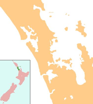
Puhoi is a settlement located approximately 50 km north of Auckland, New Zealand on the banks of the Puhoi River. The name Puhoi is translated as "slow water".[1] (Compare the Māori word "pūhoi", meaning "be slow, sluggish, unhurried.")[2]
It was settled by Europeans on 29 June 1863 by a group of German-speaking migrants from Staab (modern Stod) in Bohemia, now a province of the Czech Republic, under the leadership of Captain Martin Krippner. This has given it the appellation of "Bohemian Settlement". Altogether three batches of migrants arrived between 1863 and 1866.
The migrants were allocated parcels of land by the colonial government. However, when the migrants arrived, the land was covered with forest, which they had to set about clearing before they could begin to use the land.
The original settlers were all of the Roman Catholic faith and one of the first things they turned their attention to was constructing a church. This was completed in 1881 and dedicated to Saints Peter and Paul whose feast day in the Catholic calendar falls on 29 June, the date of the arrival of the first settlers. The church still stands today and serves the community. The hotel and general store also have their origins from the times of the first settlers. There is a museum which occupies premises that were originally built as the Catholic primary school (1923-1964).

Films
- Trespasses (1984)[3] (also known as Finding Katie during filming)[4][5]
- Sylvia (1985)[6]
- Tommyknockers (1992)
- Bridge to Terabithia (2007), including scenes from inside and outside the church[7]
References
- ↑ "Puhoi - Mahurangi West". Warkworth Information Centre. Retrieved 2009-03-14.
- ↑ "Te Aka Online Māori Dictionary". Te Whanake: Māori language online. Retrieved 2013-06-26.
- ↑ "Trespasses aka: Omen of Evil - 1984". New Zealand Films on VHS and DVD. Retrieved 2010-05-05.
- ↑ Puhoi Historical Society records.
- ↑
- ↑ "Sylvia - 1985". New Zealand Films on VHS and DVD. Retrieved 2010-05-03.
- ↑ "Bridge to Terabithia begins production in Auckland". Black Magic. 18 February 2006. Retrieved 2009-03-14.
External links
Coordinates: 36°30′S 174°40′E / 36.500°S 174.667°E