Prättigau
| Prättigau | |
|---|---|
|
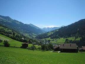
View to the south | |
 Prättigau | |
| Floor elevation | 1,400–600 m (4,600–2,000 ft) |
| Long-axis direction | SE-NW |
| Long-axis length | 33 km (21 mi) |
| Depth | 1,000–1,700 m (3,300–5,600 ft) |
| Geology | |
| Type | glacial |
| Geography | |
| Coordinates | 46°54′59″N 9°51′13″E / 46.9165°N 9.85372°ECoordinates: 46°54′59″N 9°51′13″E / 46.9165°N 9.85372°E |
| Topo map | swisstopo |
| Population centers | |
| Watercourses | Landquart |
The Prättigau, in the canton of Graubünden (Grisons), Switzerland, is the valley of the river Landquart, which drains into the Alpine Rhine in the village of the same name, and is on its upper end home to the world-famous ski resorts of Klosters.
Landquart is a railway junction on the flat floor valley of the Alpine Rhine just north of Chur, the capital of the Grisons.
The Prättigau is a popular tourist destination for winter and summer activities, including downhill and cross country skiing, tobogganing and hiking.
Traditionally, towns in the Prättigau were reliant on the lumber industry, although the income from tourism has largely replaced that.
References
This article is issued from
Wikipedia.
The text is licensed under Creative Commons - Attribution - Sharealike.
Additional terms may apply for the media files.
