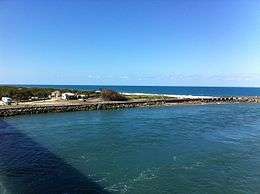
Ponce de León Island

Ponce de León Island was a proposed name for the 45 miles (72 km) long, barrier island stretching from Cape Canaveral to Sebastian Inlet in Brevard County in central Florida, located on the Atlantic Ocean. The population was 67,933 at the 2010 United States Census. The barrier island is 21.4 square miles (55 km2). Another proposed name for this area was Ais Island after the native Ais people who originally inhabited the area. Currently, the island has not yet been designated any official name.
History
Since 2000, historians from Brevard County have worked to name this stretch of land to Ponce de León Island due to a theory originated by Douglas Peck that the Spanish explorer and soldier Juan Ponce de León first landed there in 1513 as the first European to set foot in Florida.[1] This contests the once popular view that Ponce de León first landed in St. Augustine.[1] The American Indian Association of Florida also proposed the name Ais Island for this area, sparking a controversy.[2] Both proposals were considered by the U.S. Board on Geographic Names (BGN) in 2012, but no name was approved.
Many beach-side cities who were formally for the naming of Ponce de Leon have since rescinded their previous decisions based on the revelation of old evidence of Ponce's treatment of the Taino Indians in Puerto Rico and that Peck's theory is not universally accepted as fact.[3]
Pros and cons
Arguments against naming the barrier island include claims that he was actively involved in the Higuey massacre in Hispaniola. and then in 1508 chosen by the Spanish Crown to lead the conquest and exploitation of Puerto Rico and the enslavement of the Taino native people there, for gold mining operations.[4]
Ais Island
There is a proposal with USGS to name the formentioned barrier islands, Ais Island. The reasoning is that this name is more historically accurate than the name Ponce de Leon. The Ais and their ancestors lived in this area for 3000 years. It was named The Province of Ais by the Spanish in the 17th-century. In 1601 the Spanish King commissioned a map of Florida indicating his desires for a fort to be built in Miami. On the map he indicated the land we know as Brevard county as the 'Province of Ais', as it was typical in those days to designate a region of specific tribal domination and generally took its name from the ruling cacique.[5]
Coacoochee Island
A third naming application was submitted to the BGN by the Council of the Original Miccosukee Seminole Nation on May 29, 2012. To be named in honor of a Seminole chief, Coacoochee.
See also
- South Beaches
- Orchid Island (or North Hutchinson Island) -- the barrier island immediately to the south
References
- 1 2 Datzman, Ken. "Did the famous explorer Ponce de Leon first hit Melbourne Beach", Brevard Business News, vol 30, no. 1 (Melbourne, Florida: January 02, 2012), p. 1 and 19.
- ↑ Neale, Rick. "Lines drawn over naming of Brevard's barrier island", Florida Today, January 14, 2012. Retrieved January 16, 2012.
- ↑ Neale, Rick (March 10, 2013). "Theory stirs strife". Florida Today. Melbourne, Florida. pp. 3A.
- ↑ Rouse, Irving. The Tainos- Rise and Decline of the People Who Greeted Columbus pg. 155. Yale University Press. ISBN 0-300-05181-6.
- ↑ Rouse, Irving. Survey of Indian River Archaeology. Yale University Publications in Anthropology 25. ISBN 978-0-404-15668-8.
Coordinates: 28°04′05.95″N 80°33′37.11″W / 28.0683194°N 80.5603083°W