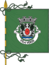
Vila Verde
| Vila Verde | |||
|---|---|---|---|
| Municipality | |||
| |||
 | |||
| Coordinates: 41°39′N 8°26′W / 41.650°N 8.433°WCoordinates: 41°39′N 8°26′W / 41.650°N 8.433°W | |||
| Country |
| ||
| Region | Norte | ||
| Subregion | Cávado | ||
| Intermunic. comm. | Cávado | ||
| District | Braga | ||
| Parishes | 33 | ||
| Government | |||
| • President | António Vilela (PSD) | ||
| Area | |||
| • Total | 228.67 km2 (88.29 sq mi) | ||
| Population (2011) | |||
| • Total | 47,888 | ||
| • Density | 210/km2 (540/sq mi) | ||
| Time zone | WET/WEST (UTC+0/+1) | ||
| Website | http://www.cm-vilaverde.pt | ||
Vila Verde (Portuguese pronunciation: [ˈvilɐ ˈveɾð(ɨ)]) is a municipality in the district of Braga in Portugal. The population in 2011 was 47,888,[1] in an area of 228.67 km².[2]
The present Mayor is António Vilela, of the Social Democratic Party. The municipal holiday is June 13.
The county of Vila Verde has a little bit over 150 years of existence, and is one of the biggest counties in the Minho Province.
Parishes
Administratively, the municipality is divided into 33 civil parishes (freguesias):[3]
- Aboim da Nóbrega e Gondomar
- Atiães
- Cabanelas
- Carreiras (São Miguel e Santiago)
- Cervães
- Coucieiro
- Dossãos
- Escariz (São Mamede e São Martinho)
- Esqueiros, Nevogilde e Travassós
- Freiriz
- Gême
- Lage
- Lanhas
- Loureira
- Marrancos e Arcozelo
- Moure
- Oleiros
- Oriz (Santa Marinha e São Miguel)
- Parada de Gatim
- Pico
- Pico de Regalados, Gondiães e Mós
- Ponte
- Ribeira do Neiva
- Sabariz
- Sande, Vilarinho, Barros e Gomide
- São Miguel do Prado
- Soutelo
- Turiz
- Vade
- Valbom (São Pedro), Passô e Valbom (São Martinho)
- Valdreu
- Vila de Prado
- Vila Verde e Barbudo
Main sights
Vila Verde and surrounding region have many historical monuments.
Gallery
- Saint Michael's church, Carreiras
- Penegate tower
References
- ↑ Instituto Nacional de Estatística Archived November 15, 2016, at the Wayback Machine.
- ↑ Direção-Geral do Território
- ↑ Diário da República. "Law nr. 11-A/2013, pages 552 138-139" (pdf) (in Portuguese). Retrieved 5 August 2014.
External links
| Wikimedia Commons has media related to Vila Verde. |
This article is issued from
Wikipedia.
The text is licensed under Creative Commons - Attribution - Sharealike.
Additional terms may apply for the media files.

.png)