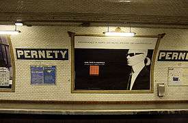
Pernety (Paris Métro)
| Paris Métro station | |||||||||||
 | |||||||||||
| Location |
Rue Raymond-Losserand 14th arrondissement of Paris Île-de-France France | ||||||||||
| Coordinates | 48°50′03″N 2°19′07″E / 48.83421°N 2.31851°ECoordinates: 48°50′03″N 2°19′07″E / 48.83421°N 2.31851°E | ||||||||||
| Owned by | RATP | ||||||||||
| Operated by | RATP | ||||||||||
| Other information | |||||||||||
| Fare zone | 1 | ||||||||||
| History | |||||||||||
| Opened | 21 January 1937 | ||||||||||
| Services | |||||||||||
| |||||||||||
| Location | |||||||||||
 Pernety Location within Paris | |||||||||||
Pernety is a station on line Line 13 of the Paris Métro in the 14th arrondissement.
The station opened on 21 January 1937 as part of the original line 14 between Bienvenüe and Porte de Vanves. This line became part of line 13 on 9 November 1976. The station is named after the Rue Pernety, named after the Joseph Marie de Pernety (1766–1856), who was one of Napoleon's generals and owned the land where the street was built.
Station layout
| Street Level |
| B1 | Mezzanine |
| Line 13 platforms | ||
| Northbound | ← | |
| Southbound | | |
References
- Roland, Gérard (2003). Stations de métro. D’Abbesses à Wagram. Éditions Bonneton.
External links
-
 Media related to Pernety (Paris Métro) at Wikimedia Commons
This article is issued from
Wikipedia.
The text is licensed under Creative Commons - Attribution - Sharealike.
Additional terms may apply for the media files.