Penacova
| Penacova | |||
|---|---|---|---|
| Municipality | |||
|
| |||
| |||
 | |||
| Coordinates: 40°16′14″N 8°17′00″W / 40.27056°N 8.28333°WCoordinates: 40°16′14″N 8°17′00″W / 40.27056°N 8.28333°W | |||
| Country |
| ||
| Region | Centro | ||
| Subregion | Baixo Mondego | ||
| Intermunic. comm. | Região de Coimbra | ||
| District | Coimbra | ||
| Government | |||
| • President | Humberto José Baptista Oliveira | ||
| Area | |||
| • Total | 216.73 km2 (83.68 sq mi) | ||
| Population (2011) | |||
| • Total | 15,251 | ||
| • Density | 70/km2 (180/sq mi) | ||
| Time zone | WET/WEST (UTC+0/+1) | ||
| Website | www.cm-penacova.pt/ | ||
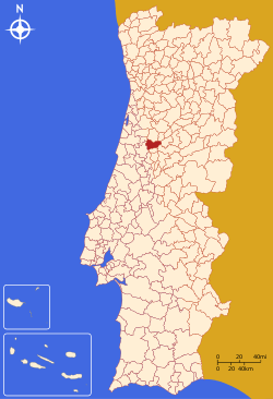
Penacova (Portuguese pronunciation: [pɨnɐˈkɔvɐ] or [pe-]) is a town and a municipality in the Coimbra District, in Portugal. The population in 2011 was 15,251,[1] in an area of 216.73 km².[2]
Parishes
Administratively, the municipality is divided into 8 civil parishes (freguesias):[3]
- Carvalho
- Figueira de Lorvão
- Friúmes e Paradela
- Lorvão
- Oliveira do Mondego e Travanca do Mondego
- Penacova
- São Pedro de Alva e São Paio do Mondego
- Sazes do Lorvão
Demographics
| População do concelho de Penacova (1801–2011) | |||||||||
|---|---|---|---|---|---|---|---|---|---|
| 1801 | 1849 | 1900 | 1930 | 1960 | 1981 | 1991 | 2001 | 2004 | 2011 |
| 8706 | 8593 | 18253 | 16964 | 18704 | 17351 | 16748 | 16725 | 16850 | 15251 |
References
- ↑ Instituto Nacional de Estatística
- ↑ Direção-Geral do Território
- ↑ Diário da República. "Law nr. 11-A/2013, page 552 90" (pdf) (in Portuguese). Retrieved 29 July 2014.
External links
- Official website (in Portuguese)
- Photos from Penacova
| Wikimedia Commons has media related to Penacova. |
This article is issued from
Wikipedia.
The text is licensed under Creative Commons - Attribution - Sharealike.
Additional terms may apply for the media files.

