Patterson Township, Greene County, Illinois
| Patterson Township | |
|---|---|
| Township | |
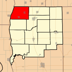 Location in Greene County | |
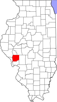 Greene County's location in Illinois | |
| Coordinates: 39°28′57″N 90°31′40″W / 39.48250°N 90.52778°WCoordinates: 39°28′57″N 90°31′40″W / 39.48250°N 90.52778°W | |
| Country | United States |
| State | Illinois |
| County | Greene |
| Established | November 4, 1884 |
| Area | |
| • Total | 47.66 sq mi (123.4 km2) |
| • Land | 47.12 sq mi (122.0 km2) |
| • Water | 0.54 sq mi (1.4 km2) 1.13% |
| Elevation | 433 ft (132 m) |
| Population (2010) | |
| • Estimate (2016)[1] | 600 |
| • Density | 13.5/sq mi (5.2/km2) |
| Time zone | CST (UTC-6) |
| • Summer (DST) | CDT (UTC-5) |
| ZIP codes | 62050, 62078, 62082, 62092 |
| FIPS code | 17-061-58096 |
Patterson Township is one of thirteen townships in Greene County, Illinois, USA. As of the 2010 census, its population was 636 and it contained 282 housing units.[2]
Geography
According to the 2010 census, the township has a total area of 47.66 square miles (123.4 km2), of which 47.12 square miles (122.0 km2) (or 98.87%) is land and 0.54 square miles (1.4 km2) (or 1.13%) is water.[2]
Cities, towns, villages
Unincorporated towns
- Grand Pass at 39°27′28″N 90°35′46″W / 39.457826°N 90.596236°W
- Hanks Station at 39°27′32″N 90°28′14″W / 39.458937°N 90.470679°W
- McClay Orchard at 39°28′00″N 90°31′30″W / 39.466715°N 90.525125°W
- Patterson at 39°28′50″N 90°28′58″W / 39.480603°N 90.482902°W
(This list is based on USGS data and may include former settlements.)
Cemeteries
The township contains these eight cemeteries: Bluefield, Hanks, Johnson Burial Ground, Pinetree, Rawlins, Shelton, Smith and Wilmington.
Airports and landing strips
- Hartwell Ranch RLA Airport
Rivers
Demographics
| Historical population | |||
|---|---|---|---|
| Census | Pop. | %± | |
| Est. 2016 | 600 | [1] | |
School districts
- North Greene Unit School District 3
Political districts
- Illinois' 17th congressional district
- State House District 97
- State Senate District 49
References
- "Patterson Township, Greene County, Illinois". Geographic Names Information System. United States Geological Survey. Retrieved 2010-01-17.
- United States Census Bureau 2007 TIGER/Line Shapefiles
- United States National Atlas
- 1 2 "Population and Housing Unit Estimates". Retrieved June 9, 2017.
- 1 2 "Population, Housing Units, Area, and Density: 2010 - County -- County Subdivision and Place -- 2010 Census Summary File 1". United States Census. Retrieved 2013-05-28.
- ↑ "Census of Population and Housing". Census.gov. Retrieved June 4, 2016.
External links
Adjacent places of Patterson Township, Greene County, Illinois | |||
|---|---|---|---|
 | | ||
Municipalities and communities of Greene County, Illinois, United States | ||
|---|---|---|
| Cities | ||
| Villages | ||
| Townships | ||
| Unincorporated communities | ||
This article is issued from
Wikipedia.
The text is licensed under Creative Commons - Attribution - Sharealike.
Additional terms may apply for the media files.