Patillas Airport
| Patillas Airport | |||||||||||
|---|---|---|---|---|---|---|---|---|---|---|---|
| Summary | |||||||||||
| Airport type | Public | ||||||||||
| Owner | Puerto Rico Ports Authority | ||||||||||
| Location | Patillas, Puerto Rico | ||||||||||
| Elevation AMSL | 10 ft / 3 m | ||||||||||
| Coordinates | 17°58′56″N 066°01′10″W / 17.98222°N 66.01944°WCoordinates: 17°58′56″N 066°01′10″W / 17.98222°N 66.01944°W | ||||||||||
| Map | |||||||||||
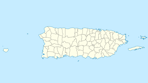
 X64 Location in Puerto Rico | |||||||||||
| Runways | |||||||||||
| |||||||||||
| Statistics (1995) | |||||||||||
| |||||||||||
Patillas Airport (FAA LID: X64) is a public airport located one mile (2 km) southwest of the central business district of Patillas, in Puerto Rico.[1]
Facilities and aircraft
Patillas Airport covers an area of 16 acres (6.5 ha). For 12-month period ending July 15, 1995, the airport had 2,300 aircraft operations, an average of 6 per day, 100% of which were general aviation. There are 10 aircraft based at this airport: 7 single engine and 3 ultralights.[1]
Runways
The only runway in Patillas Airport is runway 10/28. It is 2,000 ft × 50 ft (610 m × 15 m). The surface of the runway is asphalt - as of August 16, 2011, it is in fair condition.
Runway 10
This runway uses left traffic pattern as a primary. The runway does not have an ILS system, nor an approach system. Runway 10 has markings, but are in poor condition.
Runway 28
This runway is rarely used for landing and/or takeoff. This runway does not have an ILS/DME system, nor an approach system. Runway 28 has markings that are in poor condition.
References
External links
- Resources for this airport:
- FAA airport information for X64
- AirNav airport information for X64
- FlightAware airport information and live flight tracker
- SkyVector aeronautical chart for X64