Parakai
| Parakai | |
|---|---|
 Parakai | |
| Coordinates: 36°39′49″S 174°26′10″E / 36.66361°S 174.43611°E | |
| Country | New Zealand |
| Region | Auckland Region |
| District | Auckland City |
| Population (2013) | |
| • Total | 1,620 |
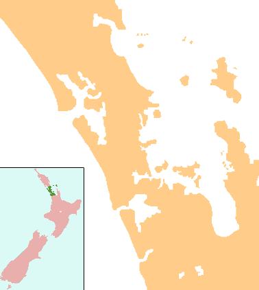
Parakai is a township in the North Island of New Zealand. It is sited 43 kilometres (27 miles) northwest of Auckland, close to the southern extremity of the Kaipara Harbour. Helensville is about 3 km (2 miles) to the south-east, and Waioneke is 22 km (14 miles) to the north-west.[1][2]
The population of Parakai and its surrounds was 1,371 in the 2006 Census, an increase of 189 from 2001.[3]
Parakai is noted for its hot springs with geothermal mineral water occurring naturally. There is a complex of mineral pools and recreational activities.[4]
The main population of Parakai sits in the vicinity of Parkhurst Rd, the main road leading out to South Head. South Head incorporates a significant agricultural, dairy farming, sheep farming and deer farming community. Closer to the town centre is the Fordyce farming community which is mostly agricultural.
The small Maori village situated at Haranui Marae is 6 km north of Parakai and is an integral part of the Parakai community.
A major attraction of Parakai is West Auckland Airport, which has a 7-×-880-metre (23 × 2,887 ft) runway, of which 760 m (2,493 ft) is sealed. Hangarage, maintenance, fuel and other services are available to visiting or local aviators and Skydiving draws people from all over the greater Auckland area. A wide range of light aviation activity has been carried out from the airport since the 1960s, and it is available for General Aviation use.
Parakai Rugby Club existed between 1918 and 1937, before amalgamating with the Helensville Rugby club in 1943.
In the early 1900s a small milk processing factory known as Ambury and English's Creamery existed in Parakai at the corner of Fordyce road and the main road to South Head.[5]
Education
Parakai School is a co-educational full primary school catering for years 1-8, with a decile rating of 3 and a roll of 181.[6] The school opened in 1958, and celebrates its 50th jubilee in 2008.[7] A major programme of rebuilding in 2002-2004 has seen the school totally modernised.[8]
The Parakai School community catchment area reaches from the immediate flats surrounding the Kaipara River and up the South Kaipara Heads Peninsula.
Notes
- ↑ Peter Dowling (editor) (2004). Reed New Zealand Atlas. Reed Books. map 10. ISBN 0-7900-0952-8.
- ↑ Roger Smith, GeographX (2005). The Geographic Atlas of New Zealand. Robbie Burton. map 34. ISBN 1-877333-20-4.
- ↑ "QuickStats About Parakai - Statistics New Zealand". stats.govt.nz. 2011. Retrieved 1 June 2011.
- ↑ "Parakai Travel Guide". Jasons Travel Media.
- ↑ "Parkhurst". The Cyclopedia of New Zealand. 1902.
- ↑ "Te Kete Ipurangi - Parakai School". Ministry of Education.
- ↑ "Parakai School 50th Jubilee". Education Gazette New Zealand. 87 (11). 30 June 2008. Archived from the original (– Scholar search) on 16 October 2008.
- ↑ "Parakai Primary School". Archived from the original on 2008-10-06. Retrieved 2008-09-13.
External links
Coordinates: 36°39′S 174°26′E / 36.650°S 174.433°E