Oxly, Missouri

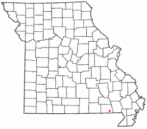
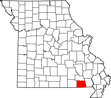
Oxly is a census-designated place in southeastern Ripley County, Missouri.[1] It is located on Route 142 about seven miles east of Doniphan.
A post office called Oxly has been in operation since 1900.[2] The community has the name of F. G. Oxley, a businessperson in the local lumber industry.[3]
Climate
Climate is characterized by relatively high temperatures and evenly distributed precipitation throughout the year. The Köppen Climate Classification subtype for this climate is "Cfa" (Humid Subtropical Climate).[4]
| Climate data for Oxly, Missouri | |||||||||||||
|---|---|---|---|---|---|---|---|---|---|---|---|---|---|
| Month | Jan | Feb | Mar | Apr | May | Jun | Jul | Aug | Sep | Oct | Nov | Dec | Year |
| Average high °C (°F) | 8 (46) |
11 (51) |
16 (61) |
22 (72) |
27 (80) |
31 (88) |
33 (92) |
33 (91) |
29 (84) |
23 (73) |
16 (60) |
9 (48) |
21 (70) |
| Average low °C (°F) | −6 (21) |
−4 (25) |
1 (33) |
6 (42) |
11 (52) |
16 (61) |
18 (65) |
17 (63) |
13 (55) |
6 (42) |
0 (32) |
−4 (24) |
6 (43) |
| Average precipitation mm (inches) | 91 (3.6) |
86 (3.4) |
117 (4.6) |
124 (4.9) |
124 (4.9) |
99 (3.9) |
99 (3.9) |
94 (3.7) |
99 (3.9) |
84 (3.3) |
104 (4.1) |
71 (2.8) |
1,220 (48) |
| Source: Weatherbase [5] | |||||||||||||
References
- ↑ U.S. Geological Survey Geographic Names Information System: Oxly, Missouri
- ↑ "Post Offices". Jim Forte Postal History. Retrieved 14 December 2016.
- ↑ "Ripley County Place Names, 1928–1945". The State Historical Society of Missouri. Archived from the original on June 24, 2016. Retrieved December 14, 2016.
- ↑ Climate Summary for Oxly, Missouri
- ↑ "Weatherbase.com". Weatherbase. 2013. Retrieved on August 6, 2013.
Coordinates: 36°35′42″N 90°41′15″W / 36.594995°N 90.687504°W
This article is issued from
Wikipedia.
The text is licensed under Creative Commons - Attribution - Sharealike.
Additional terms may apply for the media files.
