Onaero
| Onaero | |
|---|---|
 Onaero | |
| Coordinates: 38°59′45″S 174°21′47″E / 38.99583°S 174.36306°E | |
| Country | New Zealand |
| Region | Taranaki |
| District | New Plymouth District |
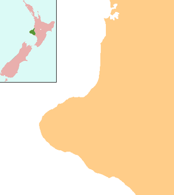
Onaero is a settlement in northern Taranaki, in the North Island of New Zealand. It is located on State Highway 3 close to the shore of the North Taranaki Bight, 15 kilometres (9.3 mi) east of Waitara.[1]
Further reading
General historical works
- Whilst strictly not an historical work (in the sense of being a published book/monograph), the papers of Dick Purdie Jonas (held at "Puke Ariki". in New Plymouth) provide a wealth of historical, archaeological, and anthropological information about this region. See "Jonas, Dick Purdie (ARC2002-166)". Archived from the original on October 14, 2008. Retrieved 2008-01-26.
Environment
- Bristow, Margaret (1978). "Onaero-Mohikatino (i.e. Mohakatino) survey". Stratford, [N.Z.]: Taranaki Catchment Commission.
- Jardine, Edward Handforth (1981). "Water and land use: part I, Tikorangi-Motunui district: part II, Onaero Catchment". Stratford, [N.Z.]: Taranaki Catchment Commission.
Geology
- Hayward, Bruce W. (1981). "Biostratigraphy of Onaero-1 onshore well". Lower Hutt, [N.Z.]: New Zealand Geological Survey, Dept. of Scientific and Industrial Research.
Maori
- See "ARC2002-166 (papers of) Jonas, Dick Purdie". Archived from the original on October 14, 2008. Retrieved 2008-01-26.
Maps
- For a 1969 map of the scenic reserves within north Taranaki (including the Onaero River, whose estuary forms the setting for the community and its beach resort) see "ARC2005-436 Scenic Reserves". Archived from the original on October 14, 2008. Retrieved 2008-01-26. . This is held at "Puke Ariki". in New Plymouth.
Notes
Coordinates: 39°00′S 174°21′E / 39.000°S 174.350°E
This article is issued from
Wikipedia.
The text is licensed under Creative Commons - Attribution - Sharealike.
Additional terms may apply for the media files.