Oling, Netherlands
| Oling | |
|---|---|
|
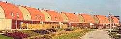
A small piece of Oling | |
 Oling Location of Alteveer in the province of Groningen | |
| Coordinates: 53°19′0″N 6°50′0″E / 53.31667°N 6.83333°ECoordinates: 53°19′0″N 6°50′0″E / 53.31667°N 6.83333°E | |
| Country | Netherlands |
| Province | Groningen |
Oling is a populated place, [1] in the province of Groningen in the Netherlands.[2]
Oling's elevation is −4 metres (−13 ft) from sea level.[3]
Location
Within less than two kilometers of Oling is Garreweer (1.1 km), Tjamsweer (1.1 km) and Appingedam (1.9 km), in the province of Groningen in the Netherlands.[4] Groningen's is approximately 21 kilometres (13 mi) away from Oling, and the distance from Oling to Amsterdam is approximately 168 kilometres (104 mi).[2] Oling is in Appingedam municipality.[5]
See also
References
- ↑ "General information about Oling". Retrieved 22 December 2016.
- 1 2 "Oling, Netherlands". Retrieved 21 December 2016.
- ↑ "Index Mundi". Retrieved 22 December 2016.
- ↑ "Oling, distances". Retrieved 25 December 2016.
- ↑ "Oling". Retrieved 22 December 2016.
External links and references
Municipalities of Groningen | ||
|---|---|---|
 | ||
| ||
This article is issued from
Wikipedia.
The text is licensed under Creative Commons - Attribution - Sharealike.
Additional terms may apply for the media files.