Okmulgee Regional Airport
| Okmulgee Regional Airport | |||||||||||
|---|---|---|---|---|---|---|---|---|---|---|---|
|
1995 USGS 1995 orthophoto | |||||||||||
| Summary | |||||||||||
| Airport type | Public | ||||||||||
| Owner | City of Okmulgee | ||||||||||
| Serves | Okmulgee, Oklahoma | ||||||||||
| Elevation AMSL | 720 ft / 219 m | ||||||||||
| Coordinates | 35°40′05″N 095°56′55″W / 35.66806°N 95.94861°WCoordinates: 35°40′05″N 095°56′55″W / 35.66806°N 95.94861°W | ||||||||||
| Website | OkmulgeeAirport.org | ||||||||||
| Map | |||||||||||
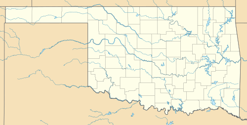
 OKM Location in Oklahoma | |||||||||||
| Runways | |||||||||||
| |||||||||||
| Statistics (2009) | |||||||||||
| |||||||||||
Okmulgee Regional Airport (IATA: OKM[2], ICAO: KOKM, FAA LID: OKM) is in Okmulgee County, Oklahoma, three miles north of the city of Okmulgee, which owns it.[1] The National Plan of Integrated Airport Systems for 2011–2015 categorized it as a general aviation facility.[3]
History
Opened as Okmulgee Field in 1942 as a United States Army Air Forces airfield. Originally had three 6'000 hard surfaced runways, (00/18; 04/27; 15/33). began training United States Army Air Corps cadets under contract to Sooner Air Training Corp. Assigned to Gulf Coast Training Center (later Central Flying Training Command) as a primary (level 1) pilot training airfield. Hangar Six, Inc. conducted pilot training. Airfield had four local auxiliary airfields for emergency and overflow landings. Flying training used Fairchild PT-19s as the primary trainer. Also had several PT-17 Stearmans. Also provided contract glider training using C-47 Skytrains and Waco CG-4 unpowered Gliders.
Inactivated on June 30, 1944 with the drawdown of AAFTC's pilot training program. Declared surplus and turned over to the Army Corps of Engineers on September 30, 1945. Eventually discharged to the War Assets Administration (WAA) and became a civil airport.
Central DC-3s landed for a year or two around 1951-52.
Facilities
The airport covers 1,100 acres (445 ha) at an elevation of 720 feet (219 m). Its one remaining runway, 18/36, is 5,150 by 100 feet (1,570 x 30 m) concrete.[1]
In the year ending March 17, 2009 the airport had 12,410 general aviation operations, average 34 per day. 16 aircraft were then based at the airport: 94% single-engine and 6% multi-engine.[1]
In May 2015, the Tulsa Airports Improvement Trust (TAIT) and the Okmulgee City Council approved a contract to bring operation and management of the Okmulgee Regional Airport under TAIT’s umbrella effective July 1, 2015, while the city would continue to pay airport-related expenses. The one-year contract was intended to bring new clients and businesses to the airport while relieving pressure on the 750-acre TAIT-operated Jones Riverside Airport, 20 minutes north, which has already expanded to capacity.[7] The contract has since been extended.[8]
See also
References
- 1 2 3 4 FAA Airport Master Record for OKM (Form 5010 PDF). Federal Aviation Administration. Effective May 31, 2012.
- ↑ "Airline and Airport Code Search". International Air Transport Association (IATA). Retrieved November 28, 2012.
- ↑ "2011–2015 NPIAS Report, Appendix A" (PDF). National Plan of Integrated Airport Systems. Federal Aviation Administration. October 4, 2010. Archived from the original (PDF, 2.03 MB) on September 27, 2012. External link in
|work=(help) - ↑
 This article incorporates public domain material from the Air Force Historical Research Agency website http://www.afhra.af.mil/.
 - ↑ Shaw, Frederick J. (2004), Locating Air Force Base Sites History’s Legacy, Air Force History and Museums Program, United States Air Force, Washington DC, 2004.
- ↑ Manning, Thomas A. (2005), History of Air Education and Training Command, 1942–2002. Office of History and Research, Headquarters, AETC, Randolph AFB, Texas. ASIN: B000NYX3PC.
- ↑ Casey Smith, “Tulsa Airport board approves operation deal with Okmulgee Regional Airport,” Tulsa World, May 15, 2015.
- ↑ Larry Levy, “Contract awarded for airport control tower," Tulsa Business & Legal News, May 18, 2016.
External links
| Wikimedia Commons has media related to Okmulgee Regional Airport. |
- Okmulgee Regional Airport
- Okmulgee Regional (OKM) at Oklahoma Aeronautics Commission
- Aerial image as of March 1995 from USGS The National Map
- FAA Terminal Procedures for OKM, effective August 17, 2017
- Resources for this airport:
- FAA airport information for OKM
- AirNav airport information for KOKM
- ASN accident history for OKM
- FlightAware airport information and live flight tracker
- NOAA/NWS latest weather observations
- SkyVector aeronautical chart, Terminal Procedures

