Obetz, Ohio
| Obetz, Ohio | ||
|---|---|---|
| Village | ||
|
Obetz Government Center | ||
| ||
 Location of Obetz within Ohio | ||
 Location of Obetz within Franklin County | ||
| Coordinates: 39°52′36″N 82°56′30″W / 39.87667°N 82.94167°WCoordinates: 39°52′36″N 82°56′30″W / 39.87667°N 82.94167°W | ||
| Country | United States | |
| State | Ohio | |
| County | Franklin | |
| Area[1] | ||
| • Total | 5.92 sq mi (15.33 km2) | |
| • Land | 5.78 sq mi (14.97 km2) | |
| • Water | 0.14 sq mi (0.36 km2) | |
| Elevation[2] | 800 ft (228 m) | |
| Population (2010)[3] | ||
| • Total | 4,532 | |
| • Estimate (2012[4]) | 4,628 | |
| • Density | 784.1/sq mi (302.7/km2) | |
| Time zone | Eastern (EST) (UTC-5) | |
| • Summer (DST) | EDT (UTC-4) | |
| ZIP code | 43207 | |
| Area code(s) | 614 | |
| FIPS code | 39-57862[5] | |
| GNIS feature ID | 1065189[2] | |
| Website | Village of Obetz, Ohio | |
Obetz is a village in Franklin County, Ohio, United States. The population was 4,532 at the 2010 census. The community (originally "Obetz Junction", in honor of settler Charles Obetz) was formed in 1838 as a stagecoach junction, and incorporated in 1928. Nearby "Reese Station" served as the railroad station for the immediate area, while other adjacent communities such as Groveport, Lockbourne and Canal Winchester were part of the Ohio and Erie Canal canal and lock system. The close proximity of Obetz Junction to these terminal towns transformed the area into a hub of commerce, travel and trade in mid-19th century. Communities such as Obetz and its neighbors, with their strong ties to transportation helped to further cement Central and Columbus, Ohio's status as the state capital.
Government
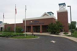
The Village of Obetz’ charter was approved by voters on November 3, 2009 and went into effect on January 1, 2010. This established a Mayor-Council Plan form of government. The current Mayor, D. Greg Scott, was elected in 2015 to serve a four-year term beginning January 1, 2016. There are six council members, each elected to a four-year term of office. James Wiley and Mike Flaherty were elected in 2015 to serve a four-year term beginning January 1, 2016. The remaining members, Louise Crabtree, Angie Kirk, Guiles Richardson, and Bonnie Wiley were elected in 2013, and their terms will end December 31, 2017. The Obetz Council meets on the second and fourth Monday of every month at 6:00 pm. The meetings are held at the Obetz Government Center located at 4175 Alum Creek Drive, and they are open to the public. Mayor Scott is chiefly responsible for ensuring that the laws and ordinances of the Village are enforced and serves as the head of the Executive branch of the Obetz Government. Mayor Scott also serves as the Chief Law enforcement officer of the Village. Additionally, the Mayor is the president of Council and presides over all regular and special meetings. The Mayor is also ultimately responsible for the general supervision of the employees and departments within the Village. The position of Mayor is a part-time position and the day-to-day Village operations are the responsibility of the Village Administrator E. Rod Davisson, Esq.
Geography
Obetz is located at 39°52′36″N 82°56′30″W / 39.87667°N 82.94167°W (39.876763, -82.941801).[6]
According to the United States Census Bureau, the village has a total area of 5.92 square miles (15.33 km2), of which 5.78 square miles (14.97 km2) is land and 0.14 square miles (0.36 km2) is water.[1]
Demographics
| Historical population | |||
|---|---|---|---|
| Census | Pop. | %± | |
| 1940 | 771 | — | |
| 1950 | 1,049 | 36.1% | |
| 1960 | 1,984 | 89.1% | |
| 1970 | 2,248 | 13.3% | |
| 1980 | 3,095 | 37.7% | |
| 1990 | 3,167 | 2.3% | |
| 2000 | 3,977 | 25.6% | |
| 2010 | 4,532 | 14.0% | |
| Est. 2016 | 4,811 | [7] | 6.2% |
2010 census
As of the census[3] of 2010, there were 4,532 people, 1,667 households, and 1,214 families residing in the village. The population density was 784.1 inhabitants per square mile (302.7/km2). There were 1,807 housing units at an average density of 312.6 per square mile (120.7/km2). The racial makeup of the village was 85.8% White, 7.7% African American, 0.5% Native American, 2.1% Asian, 1.6% from other races, and 2.4% from two or more races. Hispanic or Latino of any race were 2.8% of the population.
There were 1,667 households of which 40.2% had children under the age of 18 living with them, 49.6% were married couples living together, 16.8% had a female householder with no husband present, 6.5% had a male householder with no wife present, and 27.2% were non-families. 22.2% of all households were made up of individuals and 6.8% had someone living alone who was 65 years of age or older. The average household size was 2.72 and the average family size was 3.17.
The median age in the village was 35.9 years. 27.6% of residents were under the age of 18; 8.6% were between the ages of 18 and 24; 28.8% were from 25 to 44; 25.2% were from 45 to 64; and 10% were 65 years of age or older. The gender makeup of the village was 49.0% male and 51.0% female.
2000 census
As of the census[5] of 2000, there were 3,977 people, 1,488 households, and 1,104 families residing in the village. The population density was 1,055.3 people per square mile (407.3/km²). There were 1,561 housing units at an average density of 414.2 per square mile (159.9/km²). The racial makeup of the village was 93.71% White, 2.89% African American, 0.70% Native American, 0.15% Asian, 0.03% Pacific Islander, 0.58% from other races, and 1.94% from two or more races. Hispanic or Latino of any race were 1.48% of the population.
There were 1,488 households out of which 37.8% had children under the age of 18 living with them, 55.4% were married couples living together, 14.0% had a female householder with no husband present, and 25.8% were non-families. 20.2% of all households were made up of individuals and 6.7% had someone living alone who was 65 years of age or older. The average household size was 2.67 and the average family size was 3.07.
In the village, the population was spread out with 27.9% under the age of 18, 8.7% from 18 to 24, 33.8% from 25 to 44, 20.7% from 45 to 64, and 8.9% who were 65 years of age or older. The median age was 33 years. For every 100 females there were 95.8 males. For every 100 females age 18 and over, there were 93.4 males.
The median income for a household in the village was $45,000, and the median income for a family was $47,271. Males had a median income of $35,342 versus $25,342 for females. The per capita income for the village was $17,385. About 5.9% of families and 6.4% of the population were below the poverty line, including 5.9% of those under age 18 and 14.9% of those age 65 or over.
Economy
Top Employers
According to the Village's 2014 Comprehensive Annual Financial Report,[9] the top employers in Obetz are:
| # | Employer | Nature of Business | # of employees |
|---|---|---|---|
| 1 | Zulily, Inc. | Retail | 1,075 |
| 2 | Avnet, Inc. | Manufacturing | 1,020 |
| 3 | United Parcel Service, Inc. | Shipping | 1,000 |
| 4 | Columbus Fair Auto Auction, Inc. | Auto Auction | 900 |
| 5 | Bare Escentuals Beauty, Inc. | Retail | 600 |
| 6 | Luxottica Retail North America, Inc. | Eyeware | 425 |
| 7 | Hamilton Local School District | Education | 319 |
| 8 | Aspen Logistics Inc. | Retail | 300 |
| 9 | Goodyear | Retail | 300 |
| 10 | Art Com, Inc. | Retail | 200 |
Sports
The Ohio Aviators is based in Obetz, Ohio and played in the inaugural 2016 PRO Rugby season.[10]
Obetz is home to the EAS Training Center, the training ground of the Columbus Crew Soccer Club. The complex includes locker rooms, meeting rooms, classrooms, athletic training and treatment rooms, weight training equipment, and multiple practice fields of varying sizes to support not only the first team that participates in Major League Soccer, but also the various levels of academies under the club as well.
Education


Primary and secondary schools
The Village of Obetz is home to Hamilton Local Schools and Groveport Madison Schools. The majority of Obetz is located in the Hamilton Local School District, and a much smaller portion of Obetz is located in the Groveport Madison School District. Both Hamilton Local Schools and Groveport Madison Schools have rich histories dating back to the mid-1800s.
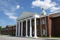
The Hamilton Local School District includes Hamilton Township High School, Hamilton Middle School, Hamilton Intermediate School, Hamilton Elementary School, Hamilton Preschool, and Hamilton Alternative Academy. Hamilton Local Schools counts its enrollment at more than 3,300 students. This total does not include nearly 170 children that are enrolled in the Hamilton Preschool facility. The Hamilton Alternative Academy, which is a separate school district sponsored by the Hamilton Local School District, currently delivers services to more than 100 students. The Hamilton Local School District has 201 certified staff members, 94 classified employees, eight district administrators, and eight building administrators. Children from the communities of Obetz, Reese, Hamilton Township, Lockbourne, and Shadeville are educated in the Hamilton Local School District. In 2015, Hamilton Township High School earned the nation's highest school honor. On September 29, the United States Secretary of Education, Arne Duncan announced that Hamilton earned the premiere designation of National Blue Ribbon School for 2015. Hamilton Local School District was recently named one of central Ohio's Top Workplaces for the third consecutive year by Columbus CEO magazine. The district is rated as one of the area's best midsize workplaces after an independent study found evidence of strength in leadership, company direction, innovation, and workplace environment.
Groveport Madison School District has one high school (Groveport Madison High School), three middle schools, six elementary schools, and Cruiser Academy Community School. There are special needs Pre-K programs in four of the six elementary buildings, and one elementary has a Head-Start Program for preschoolers. The district also has an Extended Day Program that is offered before and after school. The Groveport Madison School District has 416 certified staff members, 189 classified staff members, and 5,811 students. The district covers approximately 42 square miles.
Parks and recreation
Parks
There are seven public parks within the Village of Obetz: Dixon Quarry, Memorial Park, Bridlewood Park, McFadyen Park, Lancaster Park, Veterans Park, and Community Center Park. These parks amount to 136 acres. From fishing to archery or basketball to bocce ball, these parks have a lot to offer. Obetz works to enhance the quality of life for its residents through outgoing efforts toward the preservation/development of indoor and outdoor facilities.

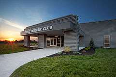
Memorial Park stretches between the Obetz Government Center and the Street Department building, which is at the western end of Orchard Lane. The Obetz Athletic Club is located in Memorial Park, and it's also the location of the Village’s annual Zucchinifest. Memorial Park is also where the Ohio Aviators plays their home games. With a total area of 80 acres, Memorial Park is the largest of all the existing parks. The park has a one-acre fishing pond stocked with largemouth bass, bluegill, and channel catfish. A gravel parking area is near the pond for your convenience. The park contains two basketball courts, three football/soccer fields, a softball/baseball complex, two concession stands, a children’s play area with playground equipment and benches, as well as a large paved parking lot. Paved walking paths are located throughout the park. Dirt nature trails are located in the wooded area around the Columbus Crew Training Facility.
Bridlewood Park is a six-acre park located along Bridlewood Blvd. The park contains a playground with a swing set, slide, spring toys, and climbing toys. The park also has a sand volleyball court and a shelter house with picnic tables and grills.
McFadyen Park is a three-acre park located along Jermoore Road. The park has swing sets and a climbing toy with slides. It also has a basketball court and a paved parking area.
Lancaster Park is a four-and-a-half-acre park located along Lancaster Street. It contains a shelter house, playground equipment, two Bocce ball courts, and the first splash pad/ice rink combination in the country.
Veterans Park is a small half-acre park located along Groveport Road next to Lancaster Park. It contains a gazebo and benches. It also has several memorials to Obetz veterans.

The Community Center Park is a three-acre park located at 1650 Obetz Avenue, next to the Community Center. The park contains a tennis court, two basketball courts, playground equipment, spring toys, and swing set. The park also has a shelter house with picnic tables and grills. There is a small paved walking path and benches in the park as well as paved parking area.
Dixon Quarry includes a six-acre lake for recreational fishing, an archery range, walking paths, park shelters, fitness trails, and a bike path that connects to the Alum Creek Greenway/Olentangy-Scioto Bike Trail that runs all through central Ohio. The pond has been stocked with Largemouth Bass, Bluegill/Sunfish, Channel Catfish, Black Crappie, White Amurs, and Rainbow Trout.

Obetz Athletic Club
The 16,000 square foot Obetz Athletic Club is located in Memorial Park next to the football and baseball fields. In addition to the circuit training, strength training, flexibility training, and cardiovascular training equipment, the OAC offers two golf simulators. Personal fitness training is also available at this facility.
Community Center and Conference Center
The Community Center is located at 1650 Obetz Avenue. It contains two multi-purpose rooms, a small gymnasium, and a lounge. A park with a shelter and playground equipment is adjacent to the Community Center.
The new 7,300 square foot Obetz Conference Center is located directly next to the Community Center at 1650 Obetz Avenue.The Obetz Conference Center is a multi-purpose space complete with audio visual equipment and a catering kitchen. The facility accommodates up to 250 people.
Zucchinifest

Obetz is home to the Zucchinifest. The festival is a four-day, family festival held in Memorial Park.[11] The annual festival occurs the Thursday, Friday, Saturday, and Sunday before Labor Day weekend. There are rides, food, games, and entertainment. The entertainment includes things like concerts, a beer garden, a pageant, a parade, and a car and motorcycle show. Admission to the festival and concerts are free.
References
- 1 2 "US Gazetteer files 2010". United States Census Bureau. Archived from the original on January 24, 2012. Retrieved 2013-01-06.
- 1 2 "US Board on Geographic Names". United States Geological Survey. 2007-10-25. Retrieved 2008-01-31.
- 1 2 "American FactFinder". United States Census Bureau. Retrieved 2013-01-06.
- ↑ "Population Estimates". United States Census Bureau. Archived from the original on June 17, 2013. Retrieved 2013-06-17.
- 1 2 "American FactFinder". United States Census Bureau. Archived from the original on September 11, 2013. Retrieved 2008-01-31.
- ↑ "US Gazetteer files: 2010, 2000, and 1990". United States Census Bureau. 2011-02-12. Retrieved 2011-04-23.
- ↑ "Population and Housing Unit Estimates". Retrieved June 9, 2017.
- ↑ "Census of Population and Housing". Census.gov. Archived from the original on May 11, 2015. Retrieved June 4, 2015.
- ↑ "Comprehensive Annual Financial Report for the fiscal year ended December 31, 2014" (PDF).
- ↑ http://www.dispatch.com/content/stories/sports/2016/02/10/pro-rugby-obetz.html
- ↑ Zucchinifest Webpage http://www.obetzzucchinifest.com/


