Niš
| Niš Град Ниш | ||||||||
|---|---|---|---|---|---|---|---|---|
| City | ||||||||
| City of Niš | ||||||||
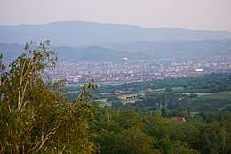
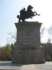
Clockwise, from top: Niš panoramic view , monument of King Alexander I of Serbia, Palace of Justice, panoramic view of city center , Niš Fortress and Holy Trinity Cathedral | ||||||||
| ||||||||
 Location of the city of Niš within Serbia | ||||||||
| Coordinates: 43°19′09″N 21°53′46″E / 43.31917°N 21.89611°E | ||||||||
| Country |
| |||||||
| Region | Southern and Eastern Serbia | |||||||
| District | Nišava | |||||||
| Municipalities | 5 | |||||||
| First mention | 2nd century AD | |||||||
| Liberation from Ottomans | 11 January 1878 | |||||||
| Government | ||||||||
| • Mayor of Niš | Darko Bulatović (SNS) | |||||||
| • Ruling parties | SNS | |||||||
| Area | ||||||||
| • Urban | 597 km2 (231 sq mi) | |||||||
| Area rank | 51st | |||||||
| Elevation | 195 m (640 ft) | |||||||
| Population (2011) | ||||||||
| • Urban |
| |||||||
| • Rank | 3rd | |||||||
| • Density | 435.9/km2 (1,129/sq mi) | |||||||
| • Administrative |
| |||||||
| Time zone | CET (UTC+1) | |||||||
| • Summer (DST) | CEST (UTC+2) | |||||||
| Postal code | 18000 | |||||||
| Area code(s) | +381(0)18 | |||||||
| ISO 3166 code | SRB | |||||||
| Car plates | NI | |||||||
| Website | www.ni.rs | |||||||
Niš (Serbian Cyrillic: Ниш, pronounced [nîːʃ]) is the third largest city in Serbia and the administrative center of the Nišava District in southern Serbia. According to the 2011 census, the urban area of Niš has population of 187,544, while the administrative area has a population of 260,237 inhabitants.
It is one of the oldest cities in the Balkans and Europe, and has from ancient times been considered a gateway between the East and the West.[2] It was founded by the Scordisci in 279 BC, after an invasion of the Balkans. The city was among several taken in the Roman conquest in 75 BC; the Romans built the Via Militaris in the 1st century, with Naissus being one of its key towns; it is also the birthplace of Constantine the Great, the first Christian Emperor and the founder of Constantinople, and Constantius III and Justin I. It is home to one of the oldest churches in Serbia, dating to the 4th century, located in the suburb of Mediana. The Balkans came under the Eastern Roman (Byzantine) Empire. In the 6th century, Slavs started settling the Balkans, while the town was held by the Byzantines until the 9th century, when it came under Bulgar rule. The town switched hands between the two, before being given by the Byzantines to the Serbs in the 12th century. Niš served as Stefan Nemanja's capital. It was conquered by the Ottomans in the 15th century, becoming the seat of a sanjak initially in Rumelia Eyalet (1385-1443, 1448-1846), laterly in Niš Eyalet (1846-1864) and finally in Danube Vilayet (1864-1878). It was liberated by the Serbian Army in 1878 during the Serbian–Ottoman War (1876–78).
Niš is one of the most important industrial centers in Serbia, a center of electronics industry (see Elektronska Industrija Niš), industry of mechanical engineering, textile and tobacco industry. Constantine the Great Airport is its international airport. In 2013 the city was host to the celebration of 1700 years of Constantine's Edict of Milan.[3]
Name

The town was named after the Nišava River, which flows through the city and which was named Navissos by the Celtic in the 3rd century BC; it was then known as Roman Naissus, Byzantine Nysos and Slavic Niš'. Legend has it that Niš was founded by a Prince Nisa, who built it using the nearby Humska Čuka stone. It has been called The Emperor's City.[4] The name is sometimes rendered Nish or Nissa in English.
History


Archaeological evidence shows neolithic settlements in the city and area dating from 5,000 to 2,000 BCE.[5] A notable archeological site is Humska Čuka. The ethnogenesis of the Thracians started in the Iron Age, and one of their chief towns was Aiadava, the Roman Remesiana; specifically, the Triballi dwelled in this region, mentioned as early as 424 BC. In 279 BC, during the Gallic invasion of the Balkans, the Scordisci tribe defeated the Triballi and settled the lands, at which time the city was known as Navissos.[6] At the time of the conquest of the Balkans by Rome in 168-75 BC, Naissos (Latin: Naissus) was used as a base for operations. Naissus was first mentioned in Roman documents near the beginning of 2nd century CE, and was considered a place worthy of note in the Geography of Ptolemy of Alexandria.
The Romans occupied the town in the period of the "Dardanian War" (75-73 BC), and set up a legionary camp.[7] The city (called refugia and vici in pre-Roman relation), because of its strategic position (the Thracians were based to the south[7]) developed as an important garrison and market town of the province of Moesia Superior.[8] In 272 AD, the future Emperor Constantine the Great was born in Naissus. Constantine created the Dacia Mediterranea province of which Naissus was the capital and also included Remesiana of the Via Militaris and the towns of Pautalia and Germania. He lived at Naissus in short periods from 316-322.[9] In 364 AD, Imperial Villa Mediana, 3 km (2 mi) from Naissus was the site where emperors Valentinian and Valens met and divided the Roman Empire and ruled as co-emperors[10]
It was besieged by the Huns in 441, devastated again in 448, and again in 480, when the partly rebuilt town was demolished by the Barbarians. Byzantine Emperor Justinian I restored the town but it was destroyed by the Avars once again. The Slavs, in their campaign against Byzantium, conquered Niš and settled here in 540. In 805, the town and its surroundings were taken by Bulgarian Emperor Krum.[11] In the 11th century Byzantium took control over Niš and the surrounding area again.

During the People's Crusade, on 3 July 1096, Peter the Hermit clashed with Byzantine forces at Niš. Manuel I fortified the town, but his successor, Andronikos I, could not hold it, so Niš was seized by the Hungarian king Béla III. The town was in Greek hands for some time again, then, in 1185, it came under Serbian control. By 1188, Niš became Nemanja's capital.[12] On 27 July 1189, Nemanja received German emperor Frederick Barbarossa and his 100,000 crusaders at Niš.[13] When describing Serbia during the rule of Vukan in 1202, the mentioning of Niš shows its special status.[14] In 1203, Kaloyan of Bulgaria annexed Niš.[15] Stefan Nemanjić later regained the region. The fall of the Serbian state, conquered by Sultan Murad I in 1385, decided the fate of Niš as well. After a 25-day-long siege the city fell to the Turks. It was returned to Serbian rule in 1443. Niš succumbed to Ottomans rule again in 1448. and remained thus for the following 241 years. In the period of Ottomans rule, Niš was one of the seats of Turkish military and civil administration. A Silesian traveler stated in 1596 that the road of his trip from Sofia to Niš was filled with corpses and described the gates of Nis as standing in front of freshly beheaded heads of poor Bulgarian peasants by the Ottoman army.[16] In 1689, Niš was seized by Austrian army during Great Turkish War, but Turks regained it in 1690. In 1737, Niš was seized again, but this time by the Austrian army, in their campaign against the Turks. The Turks retreated and the Austrians reconstructed the Fortress. However, in that same year, the Turks advanced again, and Niš fell to the Turks without resistance.

During the First Serbian Uprising, Serbian revolutionaries attempted to liberate Niš in 1809 when the famous Battle of Čegar took place. After the defeat of the Serbian forces, the Ottoman commander of Niš ordered that the heads of the killed Serbs were to be mounted on a tower to serve as a warning. The tower is known as the Skull Tower (Ćele Kula). In 1821, the Ottomans arrested the Bishop of Niš Milentija and 200 Serbian patriots on charges of preparing an uprising in the Niš area, in support of the Greek War of Independence. On 13 June of that year, Bishop Milentija and other Serbian leaders were hanged in public.
In the 19th century Niš was an important town, but populated by Bulgarians in the 19th century, when the Niš rebellion broke out in 1841.[17] According to Ottoman statistics during the Tanzimat the population of Sanjak of Niš was treated as Bulgarian[18] and according to French travelers such as Jérôme-Adolphe Blanqui and Ami Boue in 1837/1841. According to all authors between 1840-72 the delineation between Bulgarians and Serbs is undisputed and ran north of Nis,[19] although one author Cyprien Robert claims that half of the population of the town was made up by Serbians.[20] The Serbian cartographers (such as Dimitri Davidovic in 1828 and Milan Savić in 1878) also accepted South Morava river as such delineation and added Niš outside the borders of the Serbian people.[19][21]
In 1870, Niš was included in the Bulgarian Exarchate.,[22] before the area had been under the Ecumenical Patriarchate of Constantinople and the Serbian Patriarchate of Peć. The city was also stipulated the area to be ceded to Bulgaria according to the Constantinople Conference in 1876.[23] Niš was finally liberated during the Serbo-Turkish War. The battle for the liberation of Niš started on 29 December 1877 and the Serbian Army entered in Niš on 11 January 1878 and Niš became a part of the Serbian state.
Independent Serbia
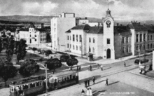
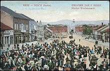
In the following years, the city saw rapid development. The city library was founded in 1879, and its first clerk was Stevan Sremac. The first hotel, Europe, was built in 1879; shortly after a hospital and the first bank started operating in 1881. In 1878, the first Grammar School (Gimnazija), in 1882 the Teacher Training College, and in 1894, the Girls' College were founded in Niš. In 1895, Niš had one girls' and three boys' primary schools. The City Hall was built from 1882-87.
In 1883, Kosta Čendaš established the first printing house. In 1884, the first newspaper in the city Niški Vesnik was started. In 1884, Jovan Apel built a brewery. A railway line to Niš was built in 1884, as well as the city's railway station; on 8 August 1884, the first train arrived from Belgrade. Since 1885, Niš was the last station of the Orient Express, until the railroad was built between Niš and Sofia in 1888. In 1887 Mihailo Dimić founded the "Niš Theatre Sinđelić."
In 1897 Mita Ristić founded the textile factory Nitex. In 1905 female painter Nadežda Petrović established the Sićevo art colony. The first film was screened in 1897, and the first permanent movie theater started operating in 1906.[24] Hydroelectric dam in Sićevo Gorge on Nišava was built in 1908; at the time, it was the largest in Serbia. The airfield was built in 1912 on the Trupale field, and the first airplane arrived on 29 December 1912. City Museum was founded in 1913, hosting archaeological, ethnographic and art collections.
During the First Balkan War, Niš was the seat of The Main Headquarters of Serbian Army, who led the military operations against the Ottoman Empire. In World War I, Niš was the wartime capital of Serbia, hosting the Government and the National Assembly, until Central Powers conquered Serbia in November 1915, when the city was ceded to Bulgaria. After the breakthrough of the Thessaloniki Front, First Serbian Army commanded by general Petar Bojović liberated Niš on 12 October 1918.
During the age and breakup of Yugoslavia
In the first few years after the war, Niš was recovering from the damage. In 1921, Niš became the centre of the Region (oblast), governed by a grand-župan, appointed by royal decree. From 1929-41, Niš was the capital of the Morava Banovina of the Kingdom of Yugoslavia. The tram system in Niš started to run in November 1930. The national airline Aeroput included Niš as a regular destination for the route Belgrade—Niš—Skopje—Thessaloniki on 1930. During the time of German occupation in World War II, the first Nazi concentration camp in Yugoslavia was located in Niš. About 30,000 people passed through this camp, of whom over 10,000 were shot on nearby Bubanj hill. On 12 February 1942, 147 prisoners staged a mass escape. In 1944, the city was heavily bombed by the Allies.[25]
On 14 October 1944, after a long and exhausting battle, the 7th German SS Division 'Prinz Eugen' was defeated and Niš was liberated by Bulgarian Army,[26][27][28] and Partisans. The city was also the site of a unique and accidental friendly fire air war on November 7, 1944 between the air forces of the United States and Soviet Union. On June 23, 1948, Niš was the site of a catastrophic flood during which the Nišava river's water level raised by an unprecedented 5.5 meters.[29]
After World War II, the University of Niš was founded on 15 June 1965.
Over the course of the 1999 NATO bombing of Yugoslavia, Niš was subject to airstrikes on 40 occasions.[30] On May 7, 1999, the city was the site of a NATO cluster bomb raid which killed up to 16 civilians.[30] By the end of the NATO bombing campaign, a total of 56 people in Niš had been killed from airstrikes.[30]
In April 2012, the Russian-Serbian Humanitarian Center was established in the city of Niš.
Geography
The road running from the north down the Morava River valley forks into two major lines at Niš: the southern line, leading to Thessalonica and Athens, and the eastern one leading towards Sofia and Istanbul.
Location

Niš is situated at the 43°19' latitude north and 21°54' longitude east, in the Nišava valley, near the spot where it joins the South Morava. The main city square, the city's central part, is at 194 m (636 ft) above sea level. The highest point in the city area is "Sokolov kamen" (Falcon's rock) on the Suva Planina (Dry Mountain) (1,523 m (4,997 ft)) while the lowest spot is at Trupale, near the mouth of the Nišava (173 m (568 ft)). The city covers 596.71 square kilometres (230 sq mi) of five municipalities. Below Niska Banja and Nis, under the ground is a natural source of hot water, unique potential of clean and renewable geothermal energy at the surface of up to 65 square kilometers. The natural reservoir is at a depth of 500 to 800 meters, and the estimated capacity is about 400 million cubic meters of thermal mineral water.[31]
Climate
Average annual temperature in the area of Niš is 11.9 °C (53.4 °F). July is the warmest month of the year, with an average of 22.5 °C (72.5 °F). The coldest month is January, averaging at 0.6 °C (33.1 °F). The average of the annual rainfall is 580.3 mm (22.85 in). The average barometer value is 992.74 mb. On average, there are 134 days with rain and snow cover lasts for 41 days.
| Climate data for Niš (1981–2010) | |||||||||||||
|---|---|---|---|---|---|---|---|---|---|---|---|---|---|
| Month | Jan | Feb | Mar | Apr | May | Jun | Jul | Aug | Sep | Oct | Nov | Dec | Year |
| Record high °C (°F) | 21.7 (71.1) |
25.0 (77) |
28.6 (83.5) |
33.0 (91.4) |
34.7 (94.5) |
40.3 (104.5) |
44.2 (111.6) |
42.2 (108) |
38.6 (101.5) |
35.0 (95) |
29.0 (84.2) |
22.2 (72) |
44.2 (111.6) |
| Average high °C (°F) | 5.0 (41) |
7.5 (45.5) |
13.0 (55.4) |
18.4 (65.1) |
23.8 (74.8) |
27.1 (80.8) |
29.8 (85.6) |
30.1 (86.2) |
25.0 (77) |
19.3 (66.7) |
11.9 (53.4) |
6.1 (43) |
18.1 (64.6) |
| Daily mean °C (°F) | 0.6 (33.1) |
2.4 (36.3) |
7.0 (44.6) |
12.2 (54) |
17.1 (62.8) |
20.4 (68.7) |
22.5 (72.5) |
22.3 (72.1) |
17.4 (63.3) |
12.3 (54.1) |
6.4 (43.5) |
2.1 (35.8) |
11.9 (53.4) |
| Average low °C (°F) | −2.2 (28) |
−1.4 (29.5) |
2.3 (36.1) |
6.4 (43.5) |
11.0 (51.8) |
13.8 (56.8) |
15.4 (59.7) |
15.4 (59.7) |
11.5 (52.7) |
7.4 (45.3) |
2.6 (36.7) |
−0.8 (30.6) |
6.8 (44.2) |
| Record low °C (°F) | −23.7 (−10.7) |
−19.3 (−2.7) |
−13.2 (8.2) |
−5.6 (21.9) |
−1.0 (30.2) |
4.2 (39.6) |
4.1 (39.4) |
4.6 (40.3) |
−2.2 (28) |
−6.8 (19.8) |
−14.0 (6.8) |
−15.8 (3.6) |
−23.7 (−10.7) |
| Average precipitation mm (inches) | 38.8 (1.528) |
36.8 (1.449) |
42.5 (1.673) |
56.6 (2.228) |
58.0 (2.283) |
57.3 (2.256) |
44.0 (1.732) |
46.7 (1.839) |
48.0 (1.89) |
45.5 (1.791) |
54.8 (2.157) |
51.5 (2.028) |
580.3 (22.846) |
| Average precipitation days (≥ 0.1 mm) | 13 | 13 | 12 | 13 | 12 | 11 | 9 | 8 | 9 | 9 | 11 | 14 | 134 |
| Average snowy days | 10 | 9 | 5 | 1 | 0 | 0 | 0 | 0 | 0 | 0 | 3 | 8 | 37 |
| Average relative humidity (%) | 80 | 74 | 66 | 63 | 65 | 65 | 61 | 61 | 69 | 73 | 77 | 81 | 70 |
| Mean monthly sunshine hours | 64.5 | 93.3 | 147.8 | 171.5 | 220.9 | 251.2 | 286.7 | 274.3 | 201.9 | 150.5 | 85.9 | 49.4 | 1,997.7 |
| Source: Republic Hydrometeorological Service of Serbia[32] | |||||||||||||
Government
Demographics
| Historical population | ||
|---|---|---|
| Year | Pop. | ±% |
| 1878 | 12,801 | — |
| 1884 | 16,178 | +26.4% |
| 1890 | 19,877 | +22.9% |
| 1895 | 21,524 | +8.3% |
| 1900 | 24,573 | +14.2% |
| 1905 | 21,946 | −10.7% |
| 1910 | 24,949 | +13.7% |
| 1921 | 28,625 | +14.7% |
| 1931 | 35,465 | +23.9% |
| 1941 | 44,800 | +26.3% |
| 1948 | 49,332 | +10.1% |
| 1953 | 58,656 | +18.9% |
| 1961 | 81,250 | +38.5% |
| 1971 | 127,654 | +57.1% |
| 1981 | 161,376 | +26.4% |
| 1991 | 173,250 | +7.4% |
| 2002 | 173,724 | +0.3% |
| 2011 | 183,544 | +5.7% |
| Source: Становништво, национална или етничка припадност, подаци по насељима, Републички завод за статистику[33] | ||
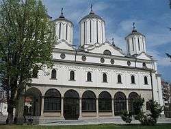
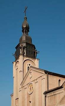
According to the final results from the 2011 census, the population of urban area of Niš was 183,544,[34] while its administrative area had a population of 260,237.[34]
There is still much dispute about the true population of the city, since there are tens of thousands of Kosovo Serb refugees who officially don't live in the city, but are living there with their local family members.
Ethnic composition
Ethnic composition of the city of Niš:[35]
| Demographics of Niš | ||
|---|---|---|
| Ethnic group | City | Urban |
| Serbs | 243,381 | 174,225 |
| Romani | 6,996 | 5,490 |
| Montenegrins | 659 | 579 |
| Bulgarians | 927 | 741 |
| Yugoslavs | 202 | 202 |
| Croats | 398 | 344 |
| Others | 7,674 | 1,963 |
| Total | 260,237 | 183,544 |
Economy
The city of Niš is the administrative, industrial, commercial, financial and cultural center of the south-eastern part of Republic of Serbia. The position of Niš is strategically important, located at the intersection of European highway and railway networks connecting Europe with Asia. Niš is easily accessible, having an airport – Niš Constantine the Great Airport and being a point of intersection of numerous railroad and highway lines.
It is in Niš that the trunk road running from the north down the Morava River valley forks into two major lines:
- the south one, leading to Thessalonica and Athens, along the Vardar River valley,
- and the east one, running along the Nisava and the Marica, leading towards Sofia and Istanbul, and further on, towards the Near East.
These roads have been widely known from ancient times, because they represented the beaten tracks along which peoples, goods and armies moved. Known as 'Via Militaris' in Roman and Byzantine periods, or 'Constantinople road' in Middle Ages, these roads still represent major European traffic arteries. Niš thus stands at a point of intersection of the roads connecting Asia Minor to Europe, and the Black Sea to the Mediterranean. Nis had been a relatively developed city in the former Yugoslavia. In 1981, its GDP per capita was 110% of the Yugoslav average.[36]
Industry
Niš is one of the most important industrial centers in Serbia, well known for its tobacco, electronics, construction, mechanical-engineering, textile, nonferrous-metal, food-processing and rubber-goods industries.

Niš Tobacco Factory was built and opened in 1930 at the present location at Crveni Krst. Its basic production is that of tobacco, cigarettes, filters, the elements of tobacco machinery and equipment, adhesives, etc.
In 1995 a scientific-research institute was built. The Institute selects, produces and protects tobacco, and creates and designs new products. During Operation Allied Force the company was destroyed, allowing Philip Morris to purchase it for a low price. In August 2003, The Philip Morris Corporation purchased the Niš Tobacco Factory (DIN) through the privatization process. Philip Morris' total investment of EUR 580 million makes it the single largest foreign investor in Serbia of the Year 2003.
Construction industry
- Gradjevinar, stock company - originated from the construction firm of Niš County called Grapon in 1961. Gradjevinar has built large structural complexes such as shopping centers, apartment buildings, entire campuses and sections of cities in Niš, Belgrade, East Serbia, Russia, Bulgaria, Israel, Jordan and the United Arabic Emirates. The company has built:
- more than 30,000 apartments, of approximately 180,000 square meters,
- clinics, health facilities and hospitals, of approximately 80,000 square meters,
- department stores, malls of approximately 50,000 square meters,
- hotels, tourist sites, banks, schools, theaters, sports facilities of approximately 50,000 square meters,
- various warehouses, factories, farms and cold-storage buildings of approximately 150,000 square meters.

Electronics Industry
- Elektronska Industrija Niš - Holding Corporation, stock corporation - originated from the foundation of the Institute for the Production of Radio Sets and Roentgen Machines, "RR Niš", in 1948. The basic production encompasses acoustic equipment, electronic tubes, specific installations, printed plates, electronic machine elements, hydraulics, pneumatics, appliances, air-conditioners, medical equipment, X-ray machines.

Rubber-goods Industry
- Vulkan, stock company was built and opened in 1937. Its production is large in scope and comprises various rubber-technical articles with numerous applications in mining and the construction industry (transporters and cranes).
Nonferrous-metal industry
- NISSAL - Stock corporation for aluminum produces tools, metal reproductive materials, metal, wooden and other material constructions, and collects and treats industrial refuse.
Machinery industry
- The Pump Factory "Jastrebac" founded in 1910., produces more than 1,000 different types and sizes of mechanical pumps.
- Mašinska Industrija Niš (Machinery Industry of Niš) Holding, stock corporation founded in 1884, produces various machines, various types of equipment: chemical, petrochemical, mining, metallurgy, railway-transport, diesel-locomotive, pump, hydro- and thermonuclear, water and gas treatment. In 1993 MIN was transformed into a holding company of 37 joint-stock units, 24 of which deal with basic production, six with services, and seven with specialized business.
Textile Industry
- Nitex - Niš Textile Industry produces fabrics, knitted material, continuous embroidery, clothes, etc. The company was founded 1897. by Niš capitalist Mita Ristić with his sons (Dušan and Dragoljub). In 2011. Nitex - Niš was sold to the Benetton
Food-processing industry
- Žitopek, a stock company for the production and trade of bakery goods, was established on 3 March 1947 when 14 bakers formally signed a contract by which they were to join their workshops into "Žitopek".
- The Brewery of Niš, a stock company which produces beer and non-alcoholic drinks. The brewery was founded in 1884 by Jovan Apel.
Culture
Theatre
Niš is a home of National Theatre in Niš, that was founded as "Sinđelić" Theatre in 1889.
Music
From 1981 Niš is the host of Nišville International Jazz music festival which begins in mid-August and lasts for 4 days. Galija, Kerber and Eyot are considered the most notable music bands to have originated from Niš. Other notable Niš music acts include Daltoni, Dobri Isak, Lutajuća Srca, Mama Rock, Hazari, Novembar, Trivalia and others.
Tourism
Tourist sites
- Čegar – The place where Battle on Čegar Hill took place on 19 May 1809.
- Crveni Krst concentration camp – One of the few preserved Nazi concentration camps in Europe. It is located on 12 February Boulevard.
- Memorial to Constantine the Great – built in the city centre in 2013, in commemoration to Constantine the Great who was born in the city, on the anniversary of the Edict of Milan.
- Bubanj – Monument to fallen Yugoslav World War II fighters, forming the shape of three clenched fists. The place where 10,000 civilian hostages from Niš and south Serbia were brutally murdered by German Nazis.
- Kalča, City passage and Gorča – Trade centers situated in Milana Obrenovića Street.
- Memorial Chapel in the memory of NATO bombing victims - The chapel was built by local authorities while the monument was built by the State government in 1999. They are situated in Sumatovacka street near Niš Fortress.
- Niš Fortress - The remaining fortification was built by the Turks, and dates from the first decades of the 18th century (1719–23). It is situated in the city center.
- The fortress-cafes - They are situated near Stambol gate (the main gate of the fortress).
- Mediana - Archeological site, an Imperial villa, from the late Roman period located on the road leading to Sofia, Bulgaria, near EI Nis.
- Niška Banja (Niš spa) - A very popular spa during the summer season. It is located at 10 km (6 mi) from city center on the road leading to Sofia, in the bottom of Suva Planina Mountain.
- Tinkers Alley - An old urban downtown zone in today's Kopitareva Street, built in the first half of 18th century. It was a street full of tinkers and other craftsmen, but today it is packed with cafes and restaurants.
- Skull Tower (Ćele Kula) - A monument to the Serbian revolutionaries (1804–13); a tower made out of skulls of Serbian uprisers, killed and decapitated by the Ottomans. It is situated on Zoran Đinđić Boulevard, on the old Constantinople road leading to Sofia.
Architecture and monuments
Buildings in Niš are constantly being built. Niš is the second largest city after Belgrade for number of high-rises. The Ambassador Hotel is one of the tallest buildings in Niš, but there are also other buildings like TV5 Tower.
Administrative divisions
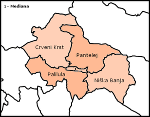
.jpg) Niška Banja - Spa, is one of the five city municipalities of the City. The city of Niš consists of five municipalities. The first four municipalities are located in the urban area of Niš, while Niška Banja is a suburban municipality. Before 2002, the city of Niš had only two municipalities, one of them named "Niš" and another named "Niška Banja". The city of Niš includes further neighborhoods: | ||||
| Medijana | Palilula, Niš | Pantelej | Crveni Krst | Niška Banja |
|---|---|---|---|---|
| Center | Palilula | Pantelej | Crveni Krst | Niška Banja |
| Marger | Staro Groblje | Jagodin Mala (partly) | Beograd Mala | nas. Nikola Tesla (broj 6) |
| Trg Kralja Aleksandra | Crni put | Durlan | Jagodin Mala (partly) | Jelašnica |
| Kičevo | Bubanj | Komren (partly) | Komren (mostly) | Sićevo |
| Čair | Ledena Stena | Čalije | Šljaka | Ostrovica |
| Bulevar Nemanjića | Suvi Do | Somborska | Medosevac | Prva Kutina |
| Bulevar Djindjica | Apelovac | Vrežina | Radikina Bara | |
| Medijana | Kovanluk | Prosek | ||
| Trošarina | Tutunović Podrum | Čukljenik | ||
| Duvanište | Kalač Brdo | Kurča Greda | Donja i gornja Studena | |
| Brzi Brod | Gabrovačka reka | Kurča Greda | ||
Sport
_-_25032012_-_4431x1156_-_SCUL-Smartblend.jpg)
The city of Niš is home to numerous sport clubs including Železničar Niš, Mašinac, OFK Niš, Jastrebac Proleter, Palilulac, Sinđelić Niš and Radnički Niš.
The biggest stadium in Niš is the Stadion Čair, which is currently undergoing renovations and will have a total seating-capacity of 18,151 when renovations are completed.[37] The stadium is part of the Čair Sports Complex that also includes an indoor swimming pool and an indoor arena. Niš was one of four towns which hosting the 2012 European Men's Handball Championship.
Notable natives/residents
The people listed below were born in, residents of, or otherwise closely associated with the city of Niš, and its surrounding metropolitan area.


- Constantine I, the great, (Flavius Valerius Aurelius Constantinus) – ruled 306 to 337
- Constantius III, (Flavius Constantius) – ruled 421
- Justin I, (Flavius Iustinus) – ruled 518 to 527
- Stevan Sinđelić, war leader (vojvoda), died in 1809 in the Battle of Čegar.
- Stevan Sremac (1855–1906), writer, came to Niš shortly after its liberation from the Turkish rule; wrote about life in old Niš (Ivkova slava, Zona Zamfirova).
- Nikola Uzunović, (b. 1873), prime minister of Kingdom of Yugoslavia from 1926 to 1927.
- Dragiša Cvetković (1893–1969), prime minister of Kingdom of Yugoslavia from 1939 to 1941.
- Dušan Radović (1922–84), journalist and writer.
- Nadja Regin, (b. 1931), actress.
- Predrag Antonijević, (b. 1959), film director.
- Branko Miljković (1934–61), poet.
- Šaban Bajramović (1936–2008), Romani singer and composer.
- Kornelije Kovač (b. 1942), rock musician and composer.
- Goran Paskaljević (b. 1947), movie director; raised by his grandparents in Niš 1949-63, after the divorce of his parents.
- Dragan Pantelić (b. 1951), former football goalkeeper, president of Radnički Niš.
- Predrag Miletić (b. 1952), actor.
- Zoran Živković (b. 1954), handball player and coach, Olympic champion
- Aki Rahimovski (b. 1954), rock musician.
- Nenad Milosavljević (b. 1954), rock musician.
- Biljana Krstić (b. 1959), rock and traditional music singer and songwriter.
- Zoran Živković (b. 1960), politician, a former Prime Minister of Serbia.
- Zoran Ćirić (b. 1962), writer.
- Aleksandar Šoštar (b. 1964), water polo goalkeeper, Olympic, World and European champion.
- Dragan Stojković (b. 1965), football player, Olympic bronze medalist.
- Lidija Mihajlović (b. 1968), shooting champion.
- Ivan Miljković (b. 1979), volleyball player, Olympic and European champion.
- Bojana Popović (b. 1979), Montenegrin handball player, Olympic silver medalist.
- Nikola Karabatić (b. 1984), French handball player, Olympic, World and European champion.
- Nemanja Radulović (b. 1985), violinist.
- Ivan Kostic (b. 1989), footballer.
- Stefan Jović (b. 1990), basketball player, Olympic and World Cup silver medalist.
- Sava Ranđelović (b. 1993), water polo player, Olympic, World and European champion.
- Ilija Fonlamov Francisković (b. 1996), painter born in Niš.
- Andrija Živković (b. 1996), footballer, U-20 World champion.
- Georgios Sinas, Austrian banker of Greek and Vlah roots.
Local media
|
|
Transportation
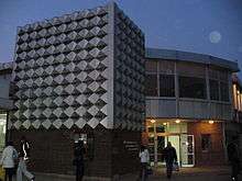
Niš is strategically located between the Morava river valley in North and the Vardar river valley in the south, on the main route between Greece and Central Europe. In the Niš area, this major transportation and communication route is linked with the natural corridor formed by the Nišava river valley, which runs towards East in the direction of Sofia and Istanbul.
Historically, because of its location, the city had always great importance in the region. The first to take advantage of it was the Roman Empire that built the important road Via Militaris, linking the city with Singidunum (current Belgrade) to the North and Constantinople (current Istanbul) to the southeast. Nowadays, the city is connected by the highway E75 with Belgrade and Central Europe in north, and Skopje, Thessaloniki and Athens in the south. The road E80 connects Niš with Sofia, Istanbul towards the Middle East, and Pristina, Montenegro and the Adriatic Sea to the West. The road E771 connects the city with Zaječar, Kladovo and Drobeta-Turnu Severin in Romania.
The city is also a major regional railway junction linking Serbia to Sofia and Istanbul. The Niš Constantine the Great airport is the second most important airport in Serbia. The first airfield was built in 1910. The city public transportation consists nowadays by 13 bus lines. A tram system existed in Niš between 1930 and 1958.[49] Niš Bus Station is the city's largest and main bus station which offers both local urban and intercity transport to international destinations. The largest intercity bus carrier based in the city is Niš-Ekspres, which operates to various cities and villages in Serbia, Montenegro, and Bosnia and Herzegovina.
International relations
Twin towns — Sister cities
Niš is twinned with the following cities, according to their City Hall website:[50]
Other forms of cooperation and city friendship
References
- 1 2 "2011 Census of Population, Households and Dwellings in the Republic of Serbia: Comparative Overview of the Number of Population in 1948, 1953, 1961, 1971, 1981, 1991, 2002 and 2011, Data by settlements" (PDF). Statistical Office of Republic Of Serbia, Belgrade. 2014. p. 84-87. ISBN 978-86-6161-109-4. Retrieved 2014-06-27.
- ↑ "Latest news, Latest News Headlines, news articles, news video, news photos - UPI.com". Metimes.com. 2013-02-14. Archived from the original on September 29, 2007. Retrieved 2013-02-18.
- ↑ "Moderate Patriarch Sets New Course for Serb Church". IPS News. 2010-02-01.
- ↑ "City of Nis". Ni.rs. Retrieved 2013-02-18.
- ↑ Stone Pages, 002763
- ↑ "Nis". Britannica.com. Retrieved 2013-02-18.
- 1 2 The provincial at Rome: and, Rome and the Balkans 80BC-AD14, p. 207. Books.google.com. Retrieved 2013-02-18.
- ↑ http://www.balkaninstitut.com/pdf/izdanja/balcanica/Balcanica%20XXXVII%20(2006).pdf
- ↑ Pannonia and Upper Moesia: a history of the middle Danube provinces p.51
- ↑ "Decline and Fall of the Roman Empire, Vol. 2: Chapter XXV: Reigns Of Jovian And Valentinian, Division Of The Empire. Part II". Sacred-texts.com. Retrieved 2013-02-18.
- ↑ John V.A. Fine, Jr., The Early Medieval Balkans: A Critical Survey from the Sixth to the Late Twelfth Century (1991), p. 94. https://books.google.com/books?id=Y0NBxG9Id58C&printsec=frontcover&source=gbs_ge_summary_r&cad=0#v=onepage&q&f=false
- ↑ The Late Medieval Balkans, p. 7
- ↑ The Late Medieval Balkans, p. 24
- ↑ The Late Medieval Balkans, p. 48
- ↑ The Late Medieval Balkans, p. 54
- ↑ Kultur der Nationen (in German). p. 110.
- ↑ Chalcraft, John. Popular Politics in the Making of the Modern Middle East. Cambridge University Press. ISBN 9781107007505.
- ↑ Ottoman Bulgaria in the First Tanzimat Period — The Revolts in Nish (1841) and Vidin (1850) Mark Pinson, Middle Eastern Studies, Vol. 11, No 2 (May, 1975), pp. 103-146.
- 1 2 Light, Andrew; Smith, Jonathan M. Philosophy and Geography II: The Production of Public Space. Rowman & Littlefield. pp. 240, 241. ISBN 9780847688104.
- ↑ [ Engin Deniz Tanir, October 2005, Middle East Technical University, Ankara, p. 70.
- ↑ "Istorii︠a︡ na bŭlgarskii︠a︡ narod". google.bg.
- ↑ Encyclopedia of the Ottoman Empire Facts on File library of world history, Gábor Ágoston, Bruce Alan Masters, Infobase Publishing, 2009 ISBN 1438110251, P. 104.
- ↑ Encyclopedia of the Ottoman Empire; Gabor Agoston, Bruce Alan Masters; 2009, p. 104
- ↑ "Chronology". Ni.rs. Retrieved 2013-02-18.
- ↑ http://www.danas.rs/20040417/vikend3.html
- ↑ Christopher Chant. The Encyclopedia of Codenames of World War II (Routledge Revivals; 2013); ISBN 1134647875, p. 209.
- ↑ Elisabeth Barker et al., British Political and Military Strategy in Central, Eastern and Southern Europe in 1944, Springer (1988); ISBN 1349193798, p. 249.
- ↑ Jozo Tomasevich. War and Revolution in Yugoslavia: 1941-1945, Volume 2, Stanford University Press (2001); ISBN 0804779244, p. 156.
- ↑ Milan Novaković (August 1, 2008). "Niškevesti.rs: Katastrofalna poplava u Nišu juna 1948. godine" (in Serbian). Retrieved August 10, 2017.
- 1 2 3 D. Stojanović (May 7, 2015). "Novosti: Suze za 16 žrtava kasetnih bombi" (in Serbian). Retrieved August 10, 2017.
- ↑ http://www.politika.rs/sr/clanak/212428/Srbija/Jezero-tople-vode-ispod-Nisa
- ↑ "Monthly and annual means, maximum and minimum values of meteorological elements for the period 1981-2010" (in Serbian). Republic Hydrometeorological Service of Serbia. Retrieved February 25, 2017.
- ↑ "2011 Census of Population, Households and Dwellings in the Republic of Serbia" (PDF). stat.gov.rs. Statistical Office of the Republic of Serbia. Retrieved 11 January 2017.
- 1 2 "2011 Census of Population, Households and Dwellings in the Republic of Serbia: Comparative Overview of the Number of Population in 1948, 1953, 1961, 1971, 1981, 1991, 2002 and 2011, Data by settlements" (PDF). Statistical Office of Republic Of Serbia, Belgrade. 2014. ISBN 978-86-6161-109-4. Retrieved 2014-06-27.
- ↑ "Ethnicity" (PDF). stat.gov.rs. Statistical Office of the Republic of Serbia. Retrieved 23 April 2017.
- ↑ Radovinović, Radovan; Bertić, Ivan, eds. (1984). Atlas svijeta: Novi pogled na Zemlju (in Croatian) (3rd ed.). Zagreb: Sveučilišna naklada Liber.
- ↑ ""Radovi na stadionu idu po planu" : Sport : Južne vesti". Juznevesti.com. Retrieved 2013-02-18.
- ↑ "Narodne novine". narodne.com.
- ↑ "Južne vesti - Leskovac, Niš, Pirot, Prokuplje, Vranje - vesti iz južne Srbije". Južne vesti.
- ↑ "Super Radio". Super Radio Niš.
- ↑ Archived 10 February 2006 at the Wayback Machine.
- ↑ "City". radiocity.rs.
- 1 2 http://www.nisava.org
- 1 2 "belami.rs - najnovije vesti, vesti iz Niša, vesti iz Srbije.". Belle Amie.
- ↑ Banker. "TV BANKER". bankerinter.net.
- ↑ "RTV5 - Nis -". rtv5.rs.
- ↑ "ck0M1". medianis.net.
- ↑ "Televizija Kopernikus TV K::CN". tvkcn.net.
- ↑ "Istorijski Arhiv Niš". Arhivnis.co.rs. Retrieved 18 February 2013.
- 1 2 3 4 5 6 7 8 9 10 11 12 13 14 15 16 "Niš Twinnings". Niš City Hall. Retrieved 2008-04-17.
- ↑ "Twin cities of the City of Kosice". Magistrát mesta Košice, Tr. Retrieved 2013-07-27.
External links
| Wikimedia Commons has media related to Niš. |
| Wikivoyage has a travel guide for Nis. |
Coordinates: 43°18′N 21°54′E / 43.3°N 21.9°E
