Negoslavci
| Negoslavci Негославци (Serbian)[1] | ||
|---|---|---|
| Municipality | ||
|
Municipality of Negoslavci Općina Negoslavci | ||
 | ||
| ||
 | ||
 Negoslavci Location of Negoslavci in Croatia | ||
| Coordinates: 45°17′N 19°00′E / 45.28°N 19°E | ||
| Country |
| |
| Region | Syrmia (Podunavlje) | |
| County |
| |
| Government | ||
| • Municipal mayor | Dušan Jeckov[2] (SDSS[2]) | |
| Area | ||
| • Total | 21.21 km2 (8.19 sq mi) | |
| Population (2011) | ||
| • Total | 1.463[3] | |
| Postal code | 32 239 | |
| Area code(s) | 32 | |
| Vehicle registration | VU | |
| Official languages | Croatian, Serbian[4] | |
| Website | www.opcina-negoslavci.hr | |

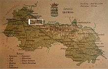
Negoslavci (Serbian Cyrillic: Негославци)[5] is a village and a municipality in Vukovar-Srijem County, Croatia.
Geography
Negoslavci municipality have total area of 21.21km2[6] and is the smallest member municipality of Joint Council of Municipalities. It is connected by D57 highway with rest of country.
History
Negoslavci village is mentioned in historical documents from the 15th century. The assumption is that there was also an ancient Roman settlement at this locality. During Austro-Hungarian administration, settlement of Negoslavci was the seat of the municipality, as was evidenced by the records from 1894. After World War II, the village was settled by the people from Bosnia and Herzegovina.
Demographics
Population
Negoslavci has 1,417 inhabitants, the majority of whom are Serbs, making up 96.86 percent of the population according to the 2011 population census. This makes Negoslavci the municipality with the largest percentage of Serbs in Croatia.[3]
Languages
Due to the local minority population, the Negoslavci municipality prescribe the use of not only Croatian as the official language, but the Serbian language and Serbian Cyrillic alphabet as well.[7][8]
Politics
Multilateral cooperation
Negoslavci municipality is one of seven member municipalities of Joint Council of Municipalities, inter-municipal sui generis organization of Serbian community in eastern Croatia.
Municipality government
The municipality assembly is composed of 11 representatives. As of 2013, the member parties/lists are:
Summary of the 19 May 2013 Croatian local elections
| Party | Votes | % | Seats | ||||
|---|---|---|---|---|---|---|---|
| Independent Democratic Serb Party | 392 | 80,33 | 9 | ||||
| Serb People's Party | 96 | 19,67 | 2 | ||||
| Invalid/blank votes | 44 | 8,27 | — | ||||
| Total | 532 | 100 | — | ||||
| Registered voters/turnout | 1.214 | 43,82 | — | ||||
 | |||||||
| Source: Croatian Bureau of Statistics page 420 | |||||||
Economy
Negoslavci development index is between 50-76% of the Croatian average,[9] and therefore, the municipality is part of the Areas of Special State Concern.[10] According to municipal mayor unemployment is one of the biggest problems of Negoslavci.[11]
Education
Elementary School in Negoslavci is established in 1761.[12] In 1981 was built new school building. Since 1992 school operates as an eight grade school, and due to increased number of students come to upgrade two classrooms with USAID funds.[12] Each year the school celebrates traditional feast slava dedicated to Saint Sava.[13] In 2011, during celebration of 250 anniversary, school issued Chronicle of elementary school in Negoslavci which was jointly funded by Vukovar-Srijem County, Joint Council of Municipalities, Negoslavci municipality, Prosvjeta, Serb National Council and other donors.[14]
Associations and Institutions
In the village exist a volunteer fire department Negoslavci.[15]
Sport
The football team PZ Negoslavci is situated in this village. Football is the main sport played and possibly the only sport played.
Twin municipalities – Sister municipalities
Other forms of cooperation
See also
References
| Wikimedia Commons has media related to Negoslavci. |
- ↑ Government of Croatia (October 2013). "Peto izvješće Republike Hrvatske o primjeni Europske povelje o regionalnim ili manjinskim jezicima" (PDF) (in Croatian). Council of Europe. p. 36. Retrieved 30 November 2016.
- 1 2 "Informacija o rezultatima izbora članova predstavničkih tijela jedinica lokalne i područne (regionalne) samouprave" (PDF). Retrieved 2013-03-10.
- 1 2 http://www.dzs.hr/Hrv/censuses/census2011/results/htm/H01_01_04/H01_01_04_zup16.html
- ↑ Četvrto izvješće Republike Hrvatske o primjeni Europske povelje o regionalnim ili manjinskim jezicima, page 61., Zagreb, 2009
- ↑ "Minority names in Croatia:Registar Geografskih Imena Nacionalnih Manjina Republike Hrvatske" (PDF). Retrieved 2013-03-08.
- ↑ http://www.vukovarsko-srijemska-zupanija.com/vsz.php?stranica=65
- ↑ Izvješće o provođenju ustavnog zakona o pravima nacionalnih manjina i o utošku sredstava osiguranih u državnom proračunu Republike Hrvatske za 2008. godinu za potrebe nacionalnih manjina, Zagreb, 2009.
- ↑ http://www.nipp.hr/UserDocsImages/Registar%20geografska%20imena%20nacionalnih%20manjina%20RH.pdf
- ↑ http://www.zadra.hr/ugovori/odluka_o_razvrstavanju_jedinica_lokalne_i_podrucne_(regionalne)_samouprave_prema_stupnju_razvijenosti.pdf
- ↑ http://www.pravo.unizg.hr/_download/repository/Zakon_o_PPDS.pdf
- ↑ http://www.novossti.com/2010/05/zajedno-do-novca-iz-fondova-eu-a/
- 1 2 http://os-negoslavci.skole.hr/skola/povijest
- ↑ http://os-negoslavci.skole.hr/?news_hk=1&news_id=66&mshow=290#mod_news
- ↑ http://os-negoslavci.skole.hr/?news_hk=1&news_id=41&mshow=290#mod_news
- ↑ http://www.vukovarsko-srijemska-zupanija.com/upload/paragrafi_upload/2009-4-17_31616186_prilog9popisvatrogpostrnovi.pdf
- 1 2 3 4 "Novosti-Zajedno do novca iz fondova EU-a" (PDF). Retrieved 2013-03-13.
Coordinates: 45°17′N 19°00′E / 45.283°N 19.000°E


