River Taff
| River Taff (Afon Taf) | |
| River | |
 | |
| Country | Wales |
|---|---|
| County | Merthyr Tydfil, Rhondda Cynon Taf, Cardiff |
| Tributaries | |
| - left | Afon Bargoed Taf |
| - right | Afon Cynon, Nant Clydach, River Rhondda |
| Settlements | Merthyr Tydfil, Treharris, Pontypridd, Cardiff |
| Source | |
| - location | Cefn-coed-y-cymmer, Merthyr Tydfil, Wales |
| Length | 64.0 km (40 mi) |
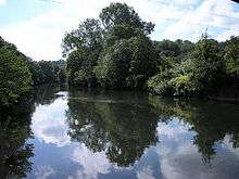
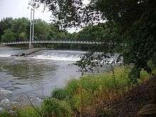

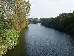
The River Taff (Welsh: Afon Taf) is a river in Wales. It rises as two rivers in the Brecon Beacons — the Taf Fechan (Little Taff) and the Taf Fawr (Big Taff) — before joining to form the Taff north of Merthyr Tydfil. The river supports a number of migratory fish, including salmon, sea trout, and eel.
Course
From its confluence at Cefn-coed-y-cymmer, the river flows south, passing several towns. It picks up a few tributaries, such as the River Cynon, River Rhondda, Bargoed Taf and Nant Clydach. It flows through Pontypridd and through to Taff's Well, the site of Wales' only thermal spring. It flows underneath the M4 Motorway, before turning southeastward and flowing through the Cardiff suburbs of Radyr, Whitchurch, Llandaff, Pontcanna, the city centre and Grangetown, before emptying into Cardiff Bay, near to the mouth of the River Ely.
Diversion in Cardiff
In the early 1840s the South Wales Railway was trying to find a suitable site for a railway station, but the area that is now Cardiff Central railway station was prone to flooding. At this point the main route of the Taff was around Cardiff Castle and down what is now Westgate Street, with the lands where Cardiff Arms Park and the Millennium Stadium are now sited tidal flats which were prone to flood.
It was Isambard Kingdom Brunel's solution to divert the Taff to the west, creating a larger and safer site for the station. The station was opened by the South Wales Railway in 1850.[1]
Taf Fawr
The Taf Fawr rises below Corn Du, south-west of Pen y Fan and flows south through Beacons Reservoir, Cantref Reservoir and Llwyn-on Reservoir.
Taf Fechan
The Taf Fechan rises immediately to the south of Pen y Fan and runs southwards through the two Neuadd Reservoirs, Pentwyn Reservoir and finally Pontsticill reservoir before descending into a wooded gorge known as the Blue Pool and flowing south-westwards around the hamlet of Trefechan. To the south of Cefn-coed-y-cymmer, the Taf Fechan and Taf Fawr merge at the wooded confluence that gives Cefn-coed-y-cymmer its name.
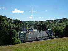
The river holds a large population of wild brown trout, many of which were killed in 2006 when a large quantity of aluminium sulphate was flushed into the river from the Pontsticill Water Treatment Works, which United Utilities operate on behalf of Dwr Cymru Welsh Water. The pollution turned the water white for at least 5km downstream of the works and killed approximately 23,000 fish, including wild brown trout, bullheads, stickleback and pike, and a large number of invertebrates. Environment Agency Wales estimated that the river would take six to twelve years to recover. The trout population had resumed breeding by 2009.
Tributaries
Nant Ffrwd
Underneath the Cefn Coed Viaduct, the Nant Ffrwd, a tributary that runs eastward in a deep wooded gorge before flowing into the Taf Fawr above the confluence with the Taf Fechan, emerges into the river from a deep, narrow gorge.
Nant Morlais and Nant Rhydycar
The Taff continues south through the centre of Merthyr Tydfil, where it is joined by the Nant Morlais which emerges at Abermorlais from a culvert in the east bank. Just south of Merthyr weir, the Nant Rhydycar joins.
Taff Bargoed, Cynon, Nant Clydach and Rhondda
South of Merthyr, the Taff begins to meander its way between Pentrebach and Abercanaid and through Troed-y-rhiw, Merthyr Vale and Aberfan towards Quakers Yard. Here, the Taff Bargoed, Nant Mafon and then down into Abercynon in the Cynon Valley where the Afon Cynon merge with the Taff and, slightly further downstream the Nant Clydach joins.[2] At Pontypridd it is joined by the Afon Rhondda. From Pontypridd, it runs roughly south, through Taff's Well and Radyr, before arriving at the northern boundary of the city of Cardiff in Llandaff.
Mouth of the Taff
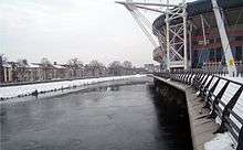
In Cardiff, the natural course of the river was changed during the 19th century; from Cardiff Castle it now follows an artificial riverbed west of where it previously flowed, now following a path through Bute Park and next to the Cardiff Arms Park and the former National Stadium, now the Millennium Stadium, and into Cardiff Bay, which has now become an artificial lake due to the construction of a barrage across the mouth of this river and the River Ely. It then flows out into the Severn Estuary.
"Taffy"
The derogatory term "Taffy" for a Welsh person is sometimes erroneously stated to have originated with the river. This may have given rise to a colloquial usage of the term by Cardiff residents for people from the Taff's northern reaches (Mid Glamorgan Valleys).
The name actually originates as a corruption of the name Dafydd, with the Oxford English Dictionary describing the origin as "representing a supposed Welsh pronunciation of the given name Davy or David (Welsh Dafydd)".[3] It was common for people in times of war to dehumanise an enemy by ascribing a singular name to them all.[4] It is therefore an equivalent of other historic English pejoratives such as Paddy and Jock.
The term is a common nickname within the British army, with individual Welsh troops, units and especially the Welsh Guards sometimes referred to as "The Taffs". However, it has been reported that the guardsmen themselves never use that term.[5]
See also
- Pont-y-Cafnau, world's earliest surviving iron railway bridge
References
- ↑ "Cardiff Arms Park, A short History - The Creation of the Arms Park". Cardiff Council. Retrieved 2008-05-22.
- ↑ River Taff Corridor Action Plan April 2007, page 7
- ↑ "Taffy, n.2". Oxford English Dictionary. Retrieved 2013-04-02.
- ↑ Beard, Mary (11 January 2009). "A Don's Life".
- ↑ Harnden, Toby (2011). Dead men risen : the Welsh Guards and the real story of Britain's war in Afghanistan. London: Quercus. ISBN 978-1849164238., mentioned in "Dead Men Risen: How do the Welsh Guards keep up with the Joneses?". The Daily Telegraph. 21 March 2011.
External links
- Glamorgan-Gwent Archaeological Trust Merthyr Tydfil Features
Coordinates: 51°28′N 3°11′W / 51.467°N 3.183°W
