Mutteristock
| Mutteristock | |
|---|---|
| Redertenstock | |
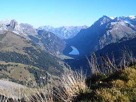
 The Mutteristock (left) and the valley of Klöntal | |
| Highest point | |
| Elevation | 2,294 m (7,526 ft) |
| Prominence | 745 m (2,444 ft) [1] |
| Coordinates | 47°2′54.3″N 8°56′34.9″E / 47.048417°N 8.943028°ECoordinates: 47°2′54.3″N 8°56′34.9″E / 47.048417°N 8.943028°E |
| Geography | |
 Mutteristock Location in Switzerland | |
| Location | Switzerland |
| Parent range | Schwyzer Alps |
The Mutteristock (also named Redertenstock) is a mountain in the Schwyzer Alps, which rises 2294 meters above sea level. It is located between the cantons of Glarus and Schwyz, Switzerland, overlooking the Wägitalersee and the Klöntalersee on its northern and southern side respectively. Its summit is the highest point of the subrange lying north of Pragel Pass. The mountain's slopes display bare limestone.[2]
References
- ↑ Swisstopo maps
- ↑ Waldvogel, Jorg (22 September 1997). "Mutteristock" (PDF). Retrieved 2 August 2010.
External links
This article is issued from
Wikipedia.
The text is licensed under Creative Commons - Attribution - Sharealike.
Additional terms may apply for the media files.