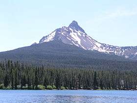
Mount Washington (Oregon)
| Mount Washington | |
|---|---|
 Mount Washington from Big Lake | |
| Highest point | |
| Elevation | 7,798 ft (2,377 m) NAVD 88[1] |
| Prominence | 2,554 ft (778 m) [1] |
| Coordinates | 44°19′56″N 121°50′19″W / 44.3321254°N 121.8385292°WCoordinates: 44°19′56″N 121°50′19″W / 44.3321254°N 121.8385292°W [2] |
| Geography | |
| Location | Deschutes / Linn counties, Oregon, U.S. |
| Parent range | Cascade Range |
| Topo map | USGS Mount Washington |
| Geology | |
| Age of rock | Pleistocene |
| Mountain type | Shield volcano[3] |
| Volcanic arc | Cascade Volcanic Arc |
| Last eruption | About 670 AD |
| Climbing | |
| First ascent | 1923 by E. McNeal and party[4] |
Mount Washington is a deeply eroded shield volcano in the Cascade Range of Oregon. The mountain dates to the Late Pleistocene. However, it does have a line of basaltic andesite spatter cones on its northeast flank which are approximately 1,330 years old according to carbon dating. The main peak is a volcanic plug that was heavily eroded by glaciers in the last ice age.[3]
Mount Washington was first ascended on August 26, 1923 by Ervin McNeal, Phil Philbrook, Armin Furrer, Wilbur Watkins, Leo Harryman, and Ronald Sellars.[5]
See also
References
- 1 2 "Mount Washington, Oregon". Peakbagger.com. Retrieved 2008-04-03.
- ↑ "Mount Washington". NGS data sheet. U.S. National Geodetic Survey. Retrieved 2008-11-18.
- 1 2 Wood, Charles A.; Kienle, Jűrgen (1993). Volcanoes of North America. Cambridge University Press. pp. 181–182. ISBN 0-521-43811-X.
- ↑ "Mount Washington". Skiing the Cascade Volcanoes. Retrieved 2008-04-03.
- ↑ Sellars, Ronald (December 1923). "The Conquest of Mount Washington". Mazama. Portland, OR: Mazamas. 6 (4): 69–75. Retrieved February 18, 2017.
External links
-
 Media related to Mount Washington (Oregon) at Wikimedia Commons
 - "Mount Washington". Geographic Names Information System. United States Geological Survey. Retrieved 2008-11-18.
- "Washington, Oregon". Volcano World. Retrieved 2016-04-26.
This article is issued from
Wikipedia.
The text is licensed under Creative Commons - Attribution - Sharealike.
Additional terms may apply for the media files.