Mozambique–South Africa border

.jpg)
.jpg)
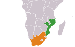
The border between Mozambique and South Africa is divided into two segments, separated by the kingdom of Swaziland. The northern segment, which is 410 kilometres (255 mi) long,[1] runs north-south along the Lebombo Mountains from Zimbabwe to Swaziland. The southern segment, which is 81 kilometres (50 mi) long,[1] runs east-west across Maputaland from Swaziland to the Indian Ocean.
Geography
The tripoint with Zimbabwe is located at Crooks' Corner, in the Limpopo River either at or very close to its confluence with the Luvuvhu River.[2] The border runs in a straight line from this tripoint to the Shingwedzi River, and then along a series of straight lines joining beacons generally along the top of the eastern slope of the Lebombo Mountains.[1] It crosses the Olifants, Sabie and Komati rivers. This segment of the border terminates at the northern Swaziland tripoint at Mpundweni Beacon near Namaacha.
The southern Swaziland tripoint is situated at Abercorn Drift in the Usutu River (Maputo River), where the Mozambique–Swaziland border along the Lebombo Mountains meets the river. From here the border follows the Usuthu to its former confluence with the Pongola River; the location of the confluence has changed since the border was demarcated.[1] The border then runs in an easterly direction along straight lines joining beacons generally at the same latitude as the Usutu-Pongola confluence (approximately 26° 52′ South).[1] It meets the Indian Ocean below Monte Ouro peak, just to the south of Ponta do Ouro.
Crossings
There are four official border crossings, three in the northern segment and one in the southern segment. The main crossing is Ressano Garcia/Lebombo where the Maputo Corridor highway and railway cross the border. The crossings are listed from north to south in the table below.[3]
| Mozambique | South Africa | Opening hours | Notes | Geographical coordinates | ||
|---|---|---|---|---|---|---|
| Road | Border post | Road | Border post | |||
| Northern segment | ||||||
| Pafuri | S63 | Pafuri | 8:00–16:00 | Crossing in the Great Limpopo Transfrontier Park. | 22°26′56″S 31°18′57″E / 22.4490°S 31.3157°E | |
| Giriyondo | H15 | Giriyondo | 8:00–16:00 October–March 8:00–15:00 April–September |
Crossing in the Great Limpopo Transfrontier Park; tourist use only. | 23°35′02″S 31°39′36″E / 23.5840°S 31.6600°E | |
| EN4 | Ressano Garcia | N4 | Lebombo | 6:00–24:00 | 25°26′35″S 31°59′12″E / 25.4431°S 31.9867°E | |
| Southern segment | ||||||
| Ponta do Ouro | R22 | Kosi Bay | 8:00–16:00 | 26°51′51″S 32°49′45″E / 26.8643°S 32.8293°E | ||
References
- 1 2 3 4 5 Mozambique–South Africa Boundary (PDF) (Report). International Boundary Study No. 133. United States Department of State. 16 April 1973. Retrieved 27 April 2013.
- ↑ Brownlie, Ian (1979). "Mozambique–South Africa". African Boundaries: A Legal and Diplomatic Encyclopaedia. London: C. Hurst & Co. pp. 1238–1252. ISBN 0903983877.
- ↑ "South African Ports of Entry". Department of Home Affairs. Retrieved 25 April 2013.