Mount Nōtori
| Mount Nōtori | |
|---|---|
| 農鳥岳 | |
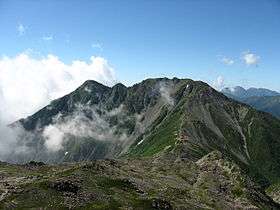
 Mount Nōtori from Mount Aino | |
| Highest point | |
| Elevation | 3,026 m (9,928 ft) [1] |
| Listing | 200 Famous Japanese Mountains |
| Coordinates | 35°37′16″N 138°14′13″E / 35.62111°N 138.23694°ECoordinates: 35°37′16″N 138°14′13″E / 35.62111°N 138.23694°E |
| Naming | |
| Pronunciation | [noːtoɾʲidake] |
| Geography | |
| Location | Chūbu region, Honshū, Japan |
| Parent range | Akaishi Mountains |
| Climbing | |
| Easiest route | Hike |

Mount Nōtori (農鳥岳 Nōtori-dake), or Nōtoridake, is one of the major peaks in the Akaishi Mountains, along with Mount Kita and Mount Aino. The 3,026 m (9,928 ft) peak[2] lies to the south of the other mountains, spanning the town of Hayakawa in Yamanashi Prefecture and Aoi-ku in the city of Shizuoka, Shizuoka Prefecture, Japan.
Geography
The top of the mountain is divided into two peaks. The southeastern peak, known as Mount Nōtori, is 3,026 m (9,928 ft), while the northwestern peak, known as Mount Nishinōtori (西農鳥岳 Nishinōtori-dake), is 3,051 m (10,010 ft).[2] It is located in the Minami Alps National Park.[3]
The main mountains of the Akaishi Mountains are Mount Kitadake, Mount Aino and Mount Nōtori. The three mountains together are called "Shiranesanzan" (白根三山 Shiranesanzan), which means "three white summits".
Mountain huts
The major mountain huts on the mountain are the Nōtori Huts (農鳥小屋 Nōtori Goya) at the base of Mount Nishinōtori. Slightly further down the mountain are the Daimonzawa Huts (大門沢小屋 Daimonzawa Goya).
Gallery
 Nōtori Huts at the base of Mount Nishinōtori
 Mount Nōtori seen from Mount Aino
 Mount Nishinōtori seen from Kumanodaira
 Mount Aino and Mount Nōtori seen from Mount Shiomi
 Mount Notori from Yashajin Pass
See also
| Wikimedia Commons has media related to Mount Noutoridake. |
References
- ↑ "Altitude of the main mountain in Japan (in Yamanashi prefecture)" (in Japanese). Geospatial Information Authority of Japan. Retrieved 2011-03-31.
- 1 2 Mount Nōtori. (in Japanese) Minami Alps Net. Accessed July 1, 2008.
- ↑ "Minami Alps National Park". Ministry of the Environment (Japan). Retrieved 2011-03-31.