Mont Cenis
| Col du Mont Cenis | |
|---|---|
|
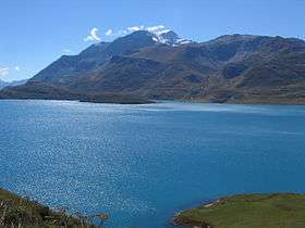
Lake at the pass | |
| Elevation | 2,083 m (6,834 ft) |
| Traversed by | Route nationale 6 |
| Location | Savoie, France |
| Range | Graian Alps/Cottian Alps |
| Coordinates | 45°15′37″N 06°54′03″E / 45.26028°N 6.90083°ECoordinates: 45°15′37″N 06°54′03″E / 45.26028°N 6.90083°E |
 Col de Mont Cenis Location of Col de Mont Cenis | |

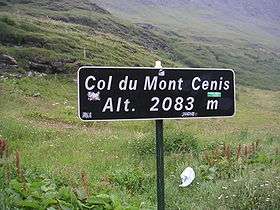
Mont Cenis (Italian: Moncenisio) is a massif (el. 3,612 m / 11,850 ft) and pass (el. 2081 m / 6827 ft) in Savoie (France), which forms the limit between the Cottian and Graian Alps.
The pass connects Val-Cenis in France in the northwest with Susa in Italy in the southeast. In the Middle Ages, pilgrims passing through Moncenisio and Susa Valley came to Turin along a road called Via Francigena, with final destination Rome. It was one of the most used Alpine pass in from the Middle Ages to the nineteenth century. The pass was part of the border between the two countries from the annexion of Savoy to the third French Empire in 1861 until 1947 Treaty of Paris, but is now located completely in France. The treaty allowed Savoy to retrieve its historical and political boundaries.[1]
A road over the pass was built between 1803 and 1810 by Napoleon. The Mont Cenis Pass Railway was opened alongside the road in 1868, but was dismantled in 1871, on the opening of the Fréjus Rail Tunnel. It was the first ever railway based on the Fell mountain railway system and was worked by English engine-drivers.[2] The Fréjus Rail Tunnel acquired the alternative, and geographically incorrect, name of Mont Cenis Tunnel because the traffic which formerly used the Mont Cenis Pass was transferred to it.
This tunnel (highest point 1295 m / 4249 ft) is really 27.4 km 17 miles west of the pass, below the Col du Fréjus. From Chambéry the line runs up the Isère valley, but soon bears through that of the Arc or the Maurienne past Saint-Jean-de-Maurienne to Modane (98.2 km / 61 mi from Chambéry). The tunnel is 13 km in length, and leads to Bardonecchia, some way below which, at Oulx the line joins the road from the Col de Montgenèvre.
Thence the valley of the Dora Riparia is followed to Turin (103.8 km / 64.5 mi from Modane). The carriage road mounts the Arc valley for 25.7 km / 16 mi from Modane to Lanslebourg, whence it is 12.9 km / 8 mi to the hospice, a little way beyond the summit of the pass. The descent lies through the Cenis valley to Susa (49.9 km / 37 mi from Modane) where the road joins the railway.
To the southwest of the Mont Cenis is the Little Mont Cenis (2184.2 m / 7166 ft) which leads from the summit plateau (in Italy) of the main pass to the Etache valley on the French slope and so to Bramans in the Arc valley. This pass was crossed in 1689 by the Vaudois, and is believed by some authors to have been Hannibal's Pass.
Name

The term "Mont Cenis" could derive from mont des cendres ("mountain of ashes"). According to tradition, following a forest fire, a great quantity of ashes accumulated on the ground, thus the name. The path of ashes was found during the building work of the route.[3]
History
Being a pass in the Alps, the Mont Cenis was used in several notable incidents in history. One example is the descent of Constantine I to Italy, to fight against Maxentius. It was the site of a military victory by the French Army of the Alps, led by General-in-Chief Alex Dumas over Piedmontese forces in April 1794, a victory that enabled the French Army of Italy to invade and conquer the Italian peninsula.[4] It was the principal route for crossing the Alps between France and Italy until the 19th century. It was also used as the main passage by which Charlemagne crossed with his army to invade Lombardy in 773, and later by Napoléon I.
When the Kingdom of Sardinia-Piedmont ceded Savoy to France, in 1860, the Mont Cenis became a frontier pass, and consequently a part of Savoy was left on the Italian side. It was therefore highly fortified as a protection against an invasion of the Val di Susa route towards Turin. In 1874-1880 the Italian Regio Esercito built three stone forts: Fort Cassa, Fort Varisello and Fort Roncia, supported by several batteries and fortifications, such as those at top of Mont Malamot. Two further armored batteries, La Court and Paradiso, were added in the early 20th century, while the Fascist government built here part of its underground Alpine Wall. All these fortifications are now in French territory after the boundaries revision in 1947 allowing Savoy to get its historical territory back.
Bicycle racing history
The pass of Mont Cenis has been featured 5 times in the Tour de France. It has been classified hors-catégorie (yielding the highest number of points in the King-of-the-Mountains classification) since 1999. For the 5 years that the pass was on the Tour, the following cyclists have crossed the pass in the lead:[5]
- 1949 - Giuseppe Tacca, France
- 1956 - Federico Bahamontes, Spain
- 1961 - Emmanuel Busto, France
- 1992 - Claudio Chiappucci, Italy
- 1999 - Dimitri Konyshev, Russia
In the 2013 Giro d'Italia, the pass was featured in the 15th stage on May 19, 2013.
Points of interest
- Jardin botanique de Mont Cenis, an alpine botanical garden
See also
Notes
- ↑ Collection de cartes anciennes des Pays de Savoie, 1562-1789, Archives départementales de la Savoie
- ↑ Ransom, P.J.G. (1999), The Mont Cenis Fell Railway, Twelveheads Press
- ↑ Gianni Bisio, article from the newspaper la Stampa, 18 April 2001, p.51, Turin Chronicle.
- ↑ Tom Reiss, The Black Count: Glory, Revolution, Betrayal, and the Real Count of Monte Cristo (New York: Crown Publishers, 2012), chapter 12, "The Battle for the Top of the World," pp. 160-174.
- ↑ Le dico du Tour - Le col du Mont-Cenis dans le Tour de France depuis 1947 (in French)
References
-
 This article incorporates text from a publication now in the public domain: Chisholm, Hugh, ed. (1911). "Mont Cenis". Encyclopædia Britannica. 18 (11th ed.). Cambridge University Press. p. 762.
External links
- Val Cenis official website
- Profile on climbbybike.com
- Both Sides: Cycling Map, Profile, and Photos
- Géologie aux alentours du col du Mont-Cenis (in French)
- Montcenis (in Italian)
- Comment en 1812 le pape Pie VII faillit mourir à l'hospice du Mont-Cenis. (in French)
- Chemin de Fer du Mont-Cenis (in French)
- Lac du Mont-Cenis (in French)
- Col du Petit Mont-Cenis (in French)
- Mont Cenis on Google Maps (Tour de France classic climbs)
