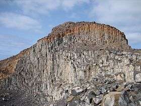
Morrinho de Açúcar
| Morrinho de Açúcar | |
|---|---|
|
Morrinho de Açúcar | |
| Highest point | |
| Elevation | 40.53 m (133.0 ft) [1] |
| Listing | List of mountains in Cape Verde |
| Coordinates | 16°43′12″N 22°57′45″W / 16.72000°N 22.96250°WCoordinates: 16°43′12″N 22°57′45″W / 16.72000°N 22.96250°W [1] |
| Geography | |
 northern Sal | |
| Geology | |
| Mountain type | Formation |
Morrinho de Açúcar (Portuguese meaning "sugar formation”), is a small hill in the northern part of the island of Sal in Cape Verde. It is situated 15 km north of the island capital Espargos.[2] It is also a protected landscape because of its geological value.[3]
It is connected with a track with Espargos and Terra Boa to the south. Northeast is the island's northeasternmost point, Ponta Preta do Norte or Reguinho Fiura. The surrounding area consists a plain but southwest consists of mountains.
See also
References
- 1 2 (in Portuguese) Mapa Topográfico Integrado (Escalas 1:1.000 e 1:5.000)
- ↑ Kapverdische Inseln, Dumont Reisetaschenbuch, p. 3. Oplaag, 2007, ISBN 978-3-7701-5968-0
- ↑ areasprotegidas.gov.cv
Bibliography
- Ricardo A. S. Ramalho, Building the Cape Verde Islands, Springer, 2011, p. 101
This article is issued from
Wikipedia.
The text is licensed under Creative Commons - Attribution - Sharealike.
Additional terms may apply for the media files.

