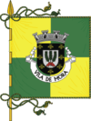
Mora, Portugal
| Mora | |||
|---|---|---|---|
| Municipality | |||
| |||
 | |||
| Coordinates: 38°56′N 8°09′W / 38.933°N 8.150°WCoordinates: 38°56′N 8°09′W / 38.933°N 8.150°W | |||
| Country |
| ||
| Region | Alentejo | ||
| Subregion | Alto Alentejo | ||
| Intermunic. comm. | Alentejo Central | ||
| District | Évora | ||
| Parishes | 4 | ||
| Government | |||
| • President | Luís Simão de Matos (CDU) | ||
| Area | |||
| • Total | 443.95 km2 (171.41 sq mi) | ||
| Population (2011) | |||
| • Total | 4,978 | ||
| • Density | 11/km2 (29/sq mi) | ||
| Time zone | WET/WEST (UTC+0/+1) | ||
| Website | http://www.cm-mora.pt | ||
Mora (Portuguese pronunciation: [ˈmɔɾɐ]) is a municipality in Évora District in Portugal. The population in 2011 was 4,978,[1] in an area of 443.95 km².[2]
The present Mayor is Luis Simão Duarte de Matos, elected by the Unitarian Democratic Coalition in 2013. The municipal holiday is Easter Monday.
Parishes
Administratively, the municipality is divided into 4 civil parishes (freguesias):[3]
- Brotas
- Cabeção
- Mora
- Pavia
Gallery
- Main church of Mora
References
- ↑ Instituto Nacional de Estatística
- ↑ Direção-Geral do Território
- ↑ Diário da República. "Law nr. 11-A/2013, page 552 79" (pdf) (in Portuguese). Retrieved 28 July 2014.
External links
This article is issued from
Wikipedia.
The text is licensed under Creative Commons - Attribution - Sharealike.
Additional terms may apply for the media files.

