Monument Valley

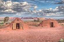
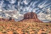
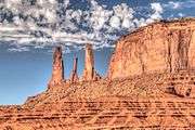
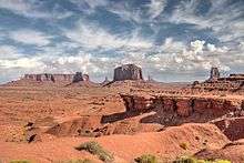
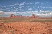
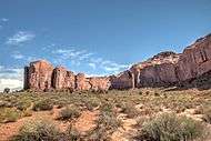
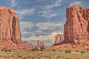
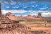
Monument Valley (Navajo: Tsé Biiʼ Ndzisgaii, pronounced [tsʰépìːʔntsɪ̀skɑ̀ìː], meaning valley of the rocks) is a region of the Colorado Plateau characterized by a cluster of vast sandstone buttes, the largest reaching 1,000 ft (300 m) above the valley floor.[1] It is located on the Arizona–Utah border (around 36°59′N 110°6′W / 36.983°N 110.100°WCoordinates: 36°59′N 110°6′W / 36.983°N 110.100°W), near the Four Corners area. The valley lies within the range of the Navajo Nation Reservation and is accessible from U.S. Highway 163.
Monument Valley has been featured in many forms of media since the 1930s. Director John Ford used the location for a number of his best-known films and thus, in the words of critic Keith Phipps, "its five square miles [13 square kilometers] have defined what decades of moviegoers think of when they imagine the American West."[2]
Geography and geology

The area is part of the Colorado Plateau. The elevation of the valley floor ranges from 5,000 to 6,000 feet (1,500 to 1,800 m) above sea level. The floor is largely siltstone of the Cutler Group, or sand derived from it, deposited by the meandering rivers that carved the valley. The valley's vivid red color comes from iron oxide exposed in the weathered siltstone. The darker, blue-gray rocks in the valley get their color from manganese oxide.
The buttes are clearly stratified, with three principal layers. The lowest layer is the Organ Rock Shale, the middle is de Chelly Sandstone, and the top layer is the Moenkopi Formation capped by Shinarump Conglomerate. The valley includes large stone structures including the famed "Eye of the Sun".
Between 1945 and 1967, the southern extent of the Monument Upwarp was mined for uranium, which occurs in scattered areas of the Shinarump Conglomerate; vanadium and copper are associated with uranium in some deposits.[3]
Tourism

Monument Valley is officially a large area that includes much of the area surrounding Monument Valley Navajo Tribal Park, a Navajo Nation equivalent to a national park. Oljato, for example, is also within the area designated as Monument Valley.
Visitors may pay an access fee and drive through the park on a 17-mile (27 km) dirt road (a 2-3 hour trip). Parts of Monument Valley, such as Mystery Valley and Hunts Mesa, are accessible only by guided tour.
Climate
Monument Valley experiences a desert climate with cold winters and hot summers. While the summers may be hot, the heat is tempered by the region's high altitude. Although the valley experiences an average of 54 days above 90 °F (32 °C) annually, summer highs rarely exceed 100 °F (38 °C). Summer nights are comfortably cool, and temperatures drop quickly after sunset. Winters are cold, but daytime highs are usually above freezing. Even in the winter, temperatures below 0 °F (−18 °C) are uncommon, though possible. Monument Valley receives an occasional light snowfall in the winter; however, it usually melts within a day or two.
| Climate data for Monument Valley, Arizona | |||||||||||||
|---|---|---|---|---|---|---|---|---|---|---|---|---|---|
| Month | Jan | Feb | Mar | Apr | May | Jun | Jul | Aug | Sep | Oct | Nov | Dec | Year |
| Record high °F (°C) | 60 (16) |
69 (21) |
77 (25) |
90 (32) |
99 (37) |
101 (38) |
107 (42) |
100 (38) |
97 (36) |
86 (30) |
73 (23) |
62 (17) |
107 (42) |
| Mean maximum °F (°C) | 52.07 (11.15) |
59.41 (15.23) |
70.37 (21.32) |
80.04 (26.69) |
88.27 (31.26) |
96.64 (35.91) |
99.44 (37.47) |
96.13 (35.63) |
90.48 (32.49) |
80.36 (26.87) |
65.18 (18.43) |
51.89 (11.05) |
100.17 (37.87) |
| Average high °F (°C) | 40.6 (4.8) |
47.3 (8.5) |
58.2 (14.6) |
67.3 (19.6) |
77.6 (25.3) |
88.1 (31.2) |
92 (33.3) |
88.8 (31.6) |
80.6 (27) |
67.9 (19.9) |
51.5 (10.8) |
40.9 (4.9) |
66.7 (19.3) |
| Average low °F (°C) | 24.3 (−4.3) |
28.2 (−2.1) |
35.5 (1.9) |
42.4 (5.8) |
52.3 (11.3) |
63.1 (17.3) |
67.0 (19.4) |
63.9 (17.7) |
57.3 (14.1) |
45.1 (7.3) |
32.9 (0.5) |
24.6 (−4.1) |
44.7 (7.1) |
| Mean minimum °F (°C) | 12.25 (−10.97) |
15.25 (−9.31) |
22.04 (−5.53) |
28.69 (−1.84) |
35.24 (1.8) |
47.08 (8.38) |
57.58 (14.21) |
54.73 (12.63) |
44.72 (7.07) |
32.61 (0.34) |
18.75 (−7.36) |
12.78 (−10.68) |
11.50 (−11.39) |
| Record low °F (°C) | −8 (−22) |
−4 (−20) |
9 (−13) |
15 (−9) |
20 (−7) |
31 (−1) |
49 (9) |
38 (3) |
33 (1) |
22 (−6) |
6 (−14) |
−9 (−23) |
−9 (−23) |
| Average precipitation inches (mm) | 0.26 (6.6) |
0.19 (4.8) |
0.19 (4.8) |
0.24 (6.1) |
0.30 (7.6) |
0.10 (2.5) |
0.54 (13.7) |
0.79 (20.1) |
0.73 (18.5) |
0.68 (17.3) |
0.32 (8.1) |
0.19 (4.8) |
4.54 (115.3) |
| Source: The Western Regional Climate Center[4] | |||||||||||||
Gallery
Panoramas


Other images
|
Monument Valley in the media
Monument Valley has been featured in numerous computer games, films, and in print.
See also
References
- ↑ Scheffel, Richard L.; Wernet, Susan J., eds. (1980). Natural Wonders of the World. Reader's Digest. p. 255. ISBN 0-89577-087-3.
- ↑ Phipps, Keith (November 17, 2009). "The Easy Rider Road Trip". Slate. Retrieved December 16, 2012.
- ↑ Roger C. Malan (1968) The uranium mining industry and geology of the Monument Valley and White canyon districts, Arizona and Utah, in Ore Deposits of the United States, 1933-1967, New York: American Institute of Mining Engineers, p.790-804.
- ↑ "Seasonal Temperature and Precipitation Information". Western Regional Climate Center. Retrieved March 24, 2013.
Further reading
- Thomas J. Harvey, Rainbow Bridge to Monument Valley: Making the Modern Old West (2012)
External links
| Wikimedia Commons has media related to Monument Valley. |
| Wikivoyage has a travel guide for Monument Valley. |
- Monument Valley Navajo Tribal Park website
- American Southwest Guide
- Energy Information Administration notes on uranium mining and its decommissioning
- IMDb list of movies and television shows with scenes in Monument Valley
- Complete Monument Valley Guide Drive, Hotels, Camping, Seasons - When To Go
- Photographs and documents of pre-automobile access Monument Valley from the Monument Highway Digital Collection: Utah State University
