Monte Largo
| Monte Largo | |
|---|---|
|
Settlement of Monte Largo | |
 | |
| Coordinates: 14°52′08″N 24°23′01″W / 14.86896°N 24.38359°WCoordinates: 14°52′08″N 24°23′01″W / 14.86896°N 24.38359°W | |
| Country | Cape Verde |
| Island | Fogo |
| Municipality | São Filipe |
| Civil parish | Nossa Senhora da Conceição |
| Population (2010)[1] | |
| • Total | 274 |
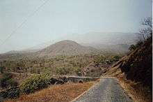
Monte Largo (Cape Verdean Creole: ALUPEK and Fogo: Monti Largu), is a settlement in the southern part of the island of Fogo, Cape Verde. It is situated 13 km east of the island capital São Filipe. Its 2010 census population was 274. Its elevation is about 850 to 900 meters. Monte Largo is connected with a secondary road linking Lomba and Achada Furna along with Cova Figueira bypassing the capital and also is connected with the lesser road with Salto. Nearby places include Cabeça Fundão to the northeast, Achada Furna to the east, Salto to the south and Monte Grande (or Boca Larga) to the northwest. Also it is southwest on the foot of the island's mountain The municipal boundary with Santa Catarina do Fogo is less than a kilometer east.


About the town
The town is named after a small hill that is shaped large and was once a small volcano.
The surrounding landscape is strikingly green. The island receives the most rainfall in the nation. Monte Largo is on the south side of the volcano and that part forms one of the most populated parts of the island.[2] Up to the late 20th century, the landscape was grasslands. The landscape in the earlier centuries were unknown but it was predominatly forested. Much of the areas in Monte Largo along with the west of Fogo has been recently reforested to stop minimal erosion.
Most of the houses consists of a single story with flat roofs, recently several new homes are built but most of the times lives outside Cape Verde. Agriculture is the main source of industry, tourism is not dominant as in other parts of Fogo. Agriculture like other parts of that portion of the island and farms and groves uses droplet irrigation, common in much of Cape Verde as only 15% are arable and produces 10-20% of the required foodstuffs in the nation, its walls protect from erosion, potatoes, corn and vegetables are corn along with papayas and tamarinds and are the main produce of the area. SInce the rainwater seeps quickly into the soft soil of Fogo and there are streams that are predominantly dry, water supply is drilled deep with the help of the German Society of Technical Cooperation.[3]
Aluguer buses connect the village with the capital except for Sundays and holidays, it has no fixed schedule. In São Jorge, there is a school, a small restaurant and a market.
The town was unaffected from the eruptions of 1951, 1995 and 2014 as it is being on the other side of Chã das Caldeiras. Volcanic clouds covered Monte Largo, the last one was in early December 2014.
Climate
Its climate is cooler than the low-lying areas of the island but slightly warmer than the upper parts, also nearby Achada Furna and Monte Grande have nearly the same climate nearly being on the same elevation.
Points of interests
Monte Largo has its own church.[4]
See also
References
- ↑ "2010 Census results". Instituto Nacional de Estatística Cabo Verde (in Portuguese). 17 March 2014.
- ↑ Ingrid and Peter Kirschey, Kapverde, p. 147, Cologne
- ↑ Rolf Osang. Kapverdische Inseln (Cape Verde Islands), p. 140. Cologne, 2001.
- ↑ Nuno Augusto. Cabo Verde - um mundo a descobrir (Cape Verde, a World of Discovery), p. 22. Lisbon 2009.


