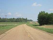
Mississippi Highway 161
| ||||
|---|---|---|---|---|
| Route information | ||||
| Maintained by MDOT | ||||
| Length: | 19.859 mi[1] (31.960 km) | |||
| Location | ||||
| Counties: | Bolivar, Coahoma, Desoto | |||
| Highway system | ||||
| ||||
Mississippi Highway 161 (MS 161) are multiple short highways in the U.S. state of Mississippi, consisting of old alignments of U.S. Route 61 (US 61).
Mount Bayou–Shelby
| |
|---|---|
| Location: | Mound Bayou–Shelby |
| Length: | 10.90 mi[2] (17.54 km) |
| Existed: | 2000–present |
In 2000, US 61 was rerouted between Mount Bayou and Shelby, and its old alignment became MS 161.[3][4]
The entire route is in Bolivar County.
| Location | mi[2] | km | Destinations | Notes | |
|---|---|---|---|---|---|
| | 0.0 | 0.0 | |||
| Shelby | 9.4 | 15.1 | |||
| | 10.9 | 17.5 | |||
| 1.000 mi = 1.609 km; 1.000 km = 0.621 mi | |||||
Clarksdale–Lyon
| |
|---|---|
| Location: | Clarksdale–Lyon |
| Length: | 6.20 mi[5] (9.98 km) |
| Existed: | 2004–present |
In 2004, US 61 was rerouted onto the new bypass around Clarksdale, and MS 161 was designated as its old alignment.[6][7]
The entire route is in Coahoma County.
| Location | mi[5] | km | Destinations | Notes | |
|---|---|---|---|---|---|
| | 0.0 | 0.0 | |||
| Clarksdale | 1.2 | 1.9 | Southern terminus of MS 322 concurrency | ||
| 2.8 | 4.5 | Northern terminus of MS 322 concurrency | |||
| 4.7 | 7.6 | ||||
| | 6.2 | 10.0 | |||
1.000 mi = 1.609 km; 1.000 km = 0.621 mi
| |||||
Walls
| |
|---|---|
| Location: | Walls |
| Length: | 2.80 mi[8] (4.51 km) |
| Existed: | 1999–present |
MS 161 starts at US 61 inside the corporate limits of Walls. It travels along a two-lane road northeastward through farmland. At Sullivan Road, the route enters the center of the town and begins to turn northward. MS 161 passes through multiple buildings through the town, intersecting 2nd Street and Delta View Road. Past the center of the town, the road travels through more farmland and intersects MS 302 at a T-intersection. The route leaves the corporate limits of Walls, and it continues for one mile (1.6 km) before ending at US 61.[8]
In 1999, US 61 was rerouted out of Walls, and MS 161 became the old alignment.[3][9]

The entire route is in DeSoto County.
| Location | mi[8] | km | Destinations | Notes | |
|---|---|---|---|---|---|
| Walls | 0.0 | 0.0 | |||
| 1.7 | 2.7 | ||||
| | 2.8 | 4.5 | |||
| 1.000 mi = 1.609 km; 1.000 km = 0.621 mi | |||||
References
Route map: Google
- ↑ Mississippi Department of Transportation Planning Division (December 31, 2013). Mississippi Public Roads Selected Statistics Extent, Travel, and Designation (PDF) (Report). Mississippi Department of Transportation. p. 172. Retrieved December 19, 2014.
- 1 2 Microsoft; Nokia (April 24, 2014). "Mississippi Highway 161 in Bolivar County" (Map). Bing Maps. Microsoft. Retrieved April 24, 2014.
- 1 2 Mississippi Department of Transportation (1999). Official Highway Map of Mississippi (PDF) (Map). Jackson: Mississippi Department of Transportation. Retrieved December 23, 2014.
- ↑ Mississippi Department of Transportation (2000). Official Highway Map of Mississippi (PDF) (Map). Jackson: Mississippi Department of Transportation. Retrieved December 23, 2014.
- 1 2 Google (March 10, 2017). "Mississippi Highway 161 in Coahoma County" (Map). Google Maps. Google. Retrieved March 10, 2017.
- ↑ Mississippi Department of Transportation (2003). Official Highway Map of Mississippi (PDF) (Map) (2003–04 ed.). Jackson: Mississippi Department of Transportation. Clarksdale inset. Retrieved December 23, 2014.
- ↑ Mississippi Department of Transportation (2004). Official Highway Map of Mississippi (PDF) (Map) (2004–05 ed.). Jackson: Mississippi Department of Transportation. Clarksdale inset. Retrieved December 23, 2014.
- 1 2 3 Microsoft; Nokia (April 24, 2014). "Mississippi Highway 161 in Desoto County" (Map). Bing Maps. Microsoft. Retrieved April 24, 2014.
- ↑ Mississippi Department of Transportation (1998). Official Highway Map of Mississippi (PDF) (Map). Jackson: Mississippi Department of Transportation. Retrieved December 23, 2014.
