Milford Township, Barton County, Missouri
| Milford Township | |
|---|---|
| Township | |
 Location in Barton County | |
| Coordinates: 37°34′52″N 094°06′38″W / 37.58111°N 94.11056°WCoordinates: 37°34′52″N 094°06′38″W / 37.58111°N 94.11056°W | |
| Country | United States |
| State | Missouri |
| County | Barton |
| Area | |
| • Total | 30.03 sq mi (77.79 km2) |
| • Land | 29.98 sq mi (77.66 km2) |
| • Water | 0.05 sq mi (0.13 km2) 0.17% |
| Elevation | 984 ft (300 m) |
| Population (2000) | |
| • Total | 290 |
| • Density | 9.7/sq mi (3.7/km2) |
| GNIS feature ID | 0766281 |
Milford Township is a township in Barton County, Missouri, USA. As of the 2000 census, its population was 290.
Geography
Milford Township covers an area of 30.03 square miles (77.8 km2). The township contains one incorporated settlement, Milford, from which it takes its name.[1] According to the USGS, it contains two cemeteries: Howell and Round Prairie.
The streams of Hyder Branch, Lacey Branch, Patton Branch, Ring Branch and White Oak Branch run through this township.
References
- ↑ "Barton County Place Names, 1928-1945 (archived)". The State Historical Society of Missouri. Archived from the original on 24 June 2016. Retrieved 31 August 2016.
External links
Municipalities and communities of Barton County, Missouri, United States | ||
|---|---|---|
| Cities | 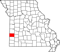 | |
| Villages | ||
| Townships | ||
| CDP | ||
| Other unincorporated communities | ||
| Ghost towns | ||
This article is issued from
Wikipedia.
The text is licensed under Creative Commons - Attribution - Sharealike.
Additional terms may apply for the media files.