Mena, Arkansas
| Mena, Arkansas | |
|---|---|
| City | |
|
Polk County Courthouse in Mena | |
| Motto: "Where good things happen!"[1] | |
 Location of Mena in Polk County, Arkansas. | |
| Coordinates: 34°34′56″N 94°14′21″W / 34.58222°N 94.23917°WCoordinates: 34°34′56″N 94°14′21″W / 34.58222°N 94.23917°W | |
| Country | United States |
| State | Arkansas |
| County | Polk |
| Government | |
| • Mayor | George Lynn McKee |
| Area[2] | |
| • Total | 6.77 sq mi (17.52 km2) |
| • Land | 6.72 sq mi (17.41 km2) |
| • Water | 0.04 sq mi (0.11 km2) |
| Elevation | 1,171 ft (357 m) |
| Population (2010) | |
| • Total | 5,737 |
| • Estimate (2016)[3] | 5,642 |
| • Density | 839.08/sq mi (323.98/km2) |
| Time zone | Central (CST) (UTC-6) |
| • Summer (DST) | CDT (UTC-5) |
| ZIP code | 71953 |
| Area code(s) | 479 |
| FIPS code | 05-45170 |
| GNIS feature ID | 0072626 |
| Website | City of Mena Arkansas |
Mena (/miːnə/ MEE-nə) is a city in Polk County, Arkansas, United States. It is also the county seat of Polk County.[4][5] The population was 5,637 as of 2000 census.
Mena is included in the Ark-La-Tex socio-economic region. Surrounded by the Ouachita National Forest, Mena is a gateway to some of the most visited tourist attractions in Arkansas.
History


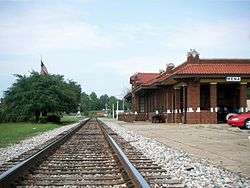
Mena was founded by Arthur Edward Stilwell during the building of the Kansas City, Pittsburg and Gulf Railroad (now the Kansas City Southern), which stretched from Kansas City, Missouri to Port Arthur, Texas. Train service to Mena began in 1896.
Stilwell named the town in honor of Folmina Margaretha Janssen-De Goeijen, the wife of his friend and financier Jan De Goeijen, whom Mr. De Goeijen affectionately called Mena. Janssen Park in the center of Mena is also named for her.
Mena was settled in 1896, and incorporated on September 18, 1896.
In 1897, the Bank of Mena was founded. The following year, the county seat was moved from nearby Dallas, Arkansas to Mena.
Mena's population had grown to 3,423 by 1900.
The town's main industries were timber, agriculture and mineral extraction, though it was advertised as a spa city located within a healthy environment.
Stilwell donated land to the city in 1906, and a park and campground were constructed.
In 1910, the railroad moved its shop facilities from Mena to Heavener, Oklahoma, causing a loss of 800 jobs.
A private school in Mena, Hendrix Academy, closed in 1905.
In 1911, a damaging tornado struck the town.[6]
Sundown town
A black community called Little Africa developed on Board Camp Creek east of Mena. The community was small, with a population of 152 in 1900.
In 1901, a black man there was lynched after an alleged altercation with a white girl. No one was arrested for the crime. Several other instances of racially motivated hate and violence towards Mena's black community had been noted. This, combined with declining job prospects after the railway shops left town, led many blacks to leave Mena. By 1910, just 16 remained.
The Mena Star advertised the town as being "100% white" in its March 18, 1920 edition, and a local chapter of the Ku Klux Klan was organized in 1922. In 1927, the Mena Commercial Club created advertisements which stated that Mena, in addition to having "pure soft water" and "beautiful scenery", also had "no Negroes".[6][7]
Like many other communities in America, Mena had become a sundown town. In the 2010 census, 0.2% of Mena's population was black.
Recent history
In the 1950s, a government program to stockpile manganese led to the reopening of local mines closed since the 1890s. The program ended in 1959, and the mines again closed.[6]
During the 1980s, drug smuggler Barry Seal moved his operations to the Mena Intermountain Municipal Airport, where he owned and operated many planes and helicopters, as well as advanced radar equipment.[6]
On April 9, 2009, a large and violent tornado devastated the town, killing three and injuring 30.[8] Many homes and businesses were damaged or destroyed. The Arkansas National Guard was deployed to the affected area.[8] The tornado was rated as a high-end EF3, with winds near 165 mph (266 km/h), and damages estimated at $25 million.
Some of the businesses in the creative economy are working to create a Downtown Arts District in Mena, anchored by the Mena Art Gallery at 607 Mena Street. The gallery is a non-profit organization which exhibits about 12 shows a year ranging from invitational (a well-known artist is invited to display his or her work in the gallery for approximately 30 days) to open shows featuring primarily local artists in a variety of media. There is also an annual Children's Exhibit and a High School Exhibit. Admission is free. The gallery has one part-time director and is staffed primarily by volunteers.
Geography
According to the United States Census Bureau, the city has a total area of 6.8 square miles (18 km2), of which 6.7 square miles (17 km2) is land; 0.04 square miles (0.10 km2) of it (0.44%) is water.
Climate
Mena's climate is characterized by hot, humid summers and generally mild to cool winters, with precipitation occurring in all seasons. The Köppen Climate Classification subtype for this climate is "Cfa" (Humid Subtropical Climate).[9]
| Climate data for Mena, Arkansas | |||||||||||||
|---|---|---|---|---|---|---|---|---|---|---|---|---|---|
| Month | Jan | Feb | Mar | Apr | May | Jun | Jul | Aug | Sep | Oct | Nov | Dec | Year |
| Average high °C (°F) | 11 (51) |
13 (55) |
17 (63) |
23 (73) |
27 (80) |
31 (88) |
33 (92) |
33 (92) |
30 (86) |
24 (75) |
17 (62) |
12 (53) |
23 (73) |
| Average low °C (°F) | 0 (32) |
1 (34) |
5 (41) |
10 (50) |
14 (58) |
19 (66) |
21 (69) |
21 (69) |
17 (62) |
11 (52) |
5 (41) |
1 (34) |
11 (51) |
| Average precipitation mm (inches) | 107 (4.2) |
94 (3.7) |
119 (4.7) |
145 (5.7) |
163 (6.4) |
122 (4.8) |
104 (4.1) |
104 (4.1) |
100 (4) |
94 (3.7) |
94 (3.7) |
99 (3.9) |
1,350 (53) |
| Average snowfall cm (inches) | 3.3 (1.3) |
5.8 (2.3) |
0.5 (.2) |
0 (0) |
0 (0) |
0 (0) |
0 (0) |
0 (0) |
0 (0) |
0 (0) |
0.5 (.2) |
0.5 (.2) |
10.7 (4.2) |
| Source: Weatherbase [10] | |||||||||||||
Demographics
| Historical population | |||
|---|---|---|---|
| Census | Pop. | %± | |
| 1900 | 3,423 | — | |
| 1910 | 3,953 | 15.5% | |
| 1920 | 3,441 | −13.0% | |
| 1930 | 3,118 | −9.4% | |
| 1940 | 3,510 | 12.6% | |
| 1950 | 4,445 | 26.6% | |
| 1960 | 4,388 | −1.3% | |
| 1970 | 4,530 | 3.2% | |
| 1980 | 5,154 | 13.8% | |
| 1990 | 5,475 | 6.2% | |
| 2000 | 5,637 | 3.0% | |
| 2010 | 5,737 | 1.8% | |
| Est. 2016 | 5,642 | [3] | −1.7% |
As of the census[12] of 2000, there were 5,637 people, 2,431 households, and 1,546 families residing in the city. The population density was 836.4 people per square mile (322.9/km²). There were 2,771 housing units at an average density of 411.2 per square mile (158.7/km²). The racial makeup of the city was 96.91% White, 0.20% Black or African American, 0.87% Native American, 0.27% Asian, 0.05% Pacific Islander, 0.50% from other races, and 1.21% from two or more races. About 2.18% of the population were Hispanic or Latino of any race.
There were 2,431 households, out of which 27.5% had children under the age of 18 living with them, 49.7% were married couples living together, 10.9% had a female householder with no husband present, and 36.4% were non-families. 33.7% of all households were made up of individuals, and 18.9% had someone living alone who was 65 years of age or older. The average household size was 2.24, and the average family size was 2.85.
In the city, the population was spread out, with 23.1% under the age of 18, 7.7% from 18 to 24, 23.8% from 25 to 44, 20.9% from 45 to 64, and 24.5% who were 65 years of age or older. The median age was 41 years. For every 100 females, there were 84.1 males. For every 100 females, age 18 and over, there were 79.9 males.
The median income for a household in the city was $22,671, and the median income for a family was $30,164. Males had a median income of $23,665 versus $18,472 for females. The per capita income for the city was $14,710. About 12.1% of families and 17.6% of the population were below the poverty line, including 22.8% of those under age 18 and 16.8% of those age 65 or over.
Parks and recreation

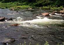
An estimated 1.2 million visitors each year come to Mena to enjoy its nearby natural features, which include the Talimena Scenic Drive, a National Scenic Byway, and the Queen Wilhelmina State Park. The Cossatot River is included in the National Wild and Scenic Rivers System and runs through the Ouachita National Forest. Lake Ouachita, and the Black Fork Mountain Wilderness, are also nearby.
Camp Pioneer is 163 acres (0.66 km2) Boy Scout camp in the foothills of the Ouachita Mountains east of Mena. Camp High Point, a Girl Scout camp is also in the area.
Mena is home of the Mena Gaming Association charity youth organization, founded in 2003.
Media
The local newspaper is the weekly The Mena Star. The Southwest Times Record, based in Fort Smith, is also sold in Mena and covers both Arkansas River Valley news and statewide news. A statewide daily, the Arkansas Democrat-Gazette, based in Little Rock, is distributed there too.
The big four television stations in Mena are KFSM (CBS), KHBS (ABC), KNWA (NBC) and KFTA (Fox). KARK (NBC, Little Rock) is also available on cable, dating from the times when KNWA's signal did not reach Mena. KNWA is available over-the-air via a digital sub-channel and on satellite.
Mena now has a tabloid circular, The Polk County Pulse, locally owned and operated by D&L Publishing Co., LLC – David and LeAnn Dilbeck. This is distributed free of charge in Mena, coming out each Wednesday.
Education
Elementary and secondary education
Public education for elementary and secondary school students is available from two school districts:
- Mena School District, which includes Mena High School.
- Ouachita River School District, which includes Acorn High School that was recognized as a 2012 U.S. Department of Education Green Ribbon School.
Post-secondary education
- Commonwealth College was once located at the base of Rich Mountain and was known for its ties to socialism, as well as for being the one-time college of Orval Faubus, former Governor of Arkansas.
- Rich Mountain Community College is located in Mena.
Infrastructure

Transportation
- The city is served by Mena Intermountain Municipal Airport.
Utilities
- Rich Mountain Electric Cooperative is a non-profit rural electric utility cooperative headquartered in Mena.
- Within the city limits, electricity is provided by the Southwestern Electric Power Company (SWEPCO).
Health care
- The city is served by Mena Regional Health System.
Notable people
- Nate Bell - Republican former member of Arkansas House of Representatives.[13]
- Edwin L. Cox - businessman and philanthropist.
- Norris "Tuffy" Goff - comedian and radio actor, who played Abner Peabody in the famed Lum and Abner radio and television programs (born in Cove, Arkansas, raised in Mena).
- Chester Lauck - second half of the Lum and Abner comedy pair. Lauck played Columbus "Lum" Edwards.
- Herbert A. Littleton - awarded a Medal of Honor for his actions during the Korean War.
- Jim Mabry - former Arkansas Razorbacks football All-American (raised in Memphis, Tennessee), has spent most of his adult life in Mena.
- Dennis L. Montgomery - software designer who sold millions of dollars of useless software to the US Government.
- Marcus Richmond - Republican member of the Arkansas House of Representatives for District 21 in multi-county region; born in Mena in 1956[14]
- Mike Simpson - NFL player
- Dorothy Shaver - first female president of a major Fifth Avenue store.
- Olin E. Teague - longtime Texas's 6th congressional district representative who was born in Oklahoma, but raised here.
- T. Texas Tyler - country singer (The Deck of Cards).
In popular culture
In 1996, Patrick Matrisciana, founder of Jeremiah Films and an organization called Citizens for an Honest Government, produced Obstruction of Justice: The Mena Connection.
References
- ↑ "City of Mena Arkansas". City of Mena Arkansas. Retrieved September 12, 2012.
- ↑ "2016 U.S. Gazetteer Files". United States Census Bureau. Retrieved Jul 18, 2017.
- 1 2 "Population and Housing Unit Estimates". Retrieved June 9, 2017.
- ↑ "Find a County". National Association of Counties. Retrieved 2011-06-07.
- ↑ "Profile for Mena, Arkansas, AR". ePodunk. Retrieved September 12, 2012.
- 1 2 3 4 Lancaster, Guy (2012). "Mena (Polk County)". Encyclopedia of Arkansas History & Culture.
- ↑ Loewen, James W. (2005). Sundown Towns: A Hidden Dimension of American Racism (PDF). New Press.
- 1 2 "Tornado Devastates Small Arkansas Town, Killing 3". London: Associated Press via The Guardian. January 23, 2008. Retrieved 2013-05-20.
- ↑ Climate Summary for Mena, Arkansas
- ↑ "Weatherbase.com". Weatherbase. 2013. Retrieved on August 11, 2013.
- ↑ "Census of Population and Housing". Census.gov. Retrieved June 4, 2015.
- ↑ "American FactFinder". United States Census Bureau. Retrieved 2008-01-31.
- ↑ "Nate Bell, R-20". Arkansas House of Representatives. 2013.
- ↑ "Marcus Richmond's Biography". Project Vote Smart. Retrieved April 1, 2015.
External links
| Wikimedia Commons has media related to Mena, Arkansas. |
| Wikisource has the text of the 1920 Encyclopedia Americana article Mena. |
