McDermitt Caldera
| McDermitt Caldera | |
|---|---|
 McDermitt Caldera Location of the caldera in Oregon and Nevada | |
| Highest point | |
| Coordinates | 42°00′05″N 117°59′48″W / 42.00139°N 117.99667°WCoordinates: 42°00′05″N 117°59′48″W / 42.00139°N 117.99667°W |
| Geography | |
| Location |
Harney County, Oregon Malheur County, Oregon Humboldt County, Nevada |
| Geology | |
| Age of rock | About 19 million years (Miocene) |
| Mountain type | Caldera |
| Last eruption | About 16 million years ago (Miocene) |
The McDermitt Caldera is a large, oval-shaped caldera west of McDermitt in southeastern Oregon and northern Nevada in the United States. It is about 28 miles (45 km) wide north to south and 22 miles (35 km) wide east to west.[1] The western part of the caldera is in the Trout Creek Mountains, and the northern part is in the Oregon Canyon Mountains.[1][2]
The caldera was formed when a lava dome made of rhyolite collapsed about 16 million years ago. The lava dome had been built by volcanic eruptions starting about 19 million years ago.[1][2] Significant ore deposits are buried in the caldera, including mercury and uranium, which were mined at more than eight sites in the caldera during the 20th century. Mercury at these mines was extracted in large amounts, and it came mostly from cinnabar.[1][3] The McDermitt Mine, located on the eastern edge of the caldera in Nevada, was the last active mercury mine in the United States before it shut down in 1992.[4] Uranium was discovered in the caldera in 1953, and it was extracted mainly at the Moonlight mine on the caldera's southwestern edge.[1][5] Other deposits in the caldera contain ores of antimony, cesium, and lithium.[6]
Geology
A lake formed when the caldera collapsed, with subsequent deposition of varved sediments, diatomite, horizons with opal or carbonaceous material, and mafic lavas. Moonlight Mine production is from a rhyolite brecciated fault zone. Ore minerals include uraninite and coffinite. The age of the uranium formation is assumed to be the same as the caldera tuff, which is approximately 16.1 Ma.[8]
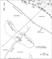
 McDermitt caldera geologic map
 McDermitt caldera geologic cross-section
 Geologic cross-section of Aurora prospect ore zones
References
- 1 2 3 4 5 Rytuba, James J. (1976). "Geology and Ore Deposits of the McDermitt Caldera, Nevada–Oregon" (PDF). United States Geological Survey. Retrieved 3 August 2015.
- 1 2 Ryuba, James J.; Conrad, Walter K. (1981). Goodell, P. C.; Waters, A. C., eds. "Petrochemical Characteristics of Volcanic Rocks Associated with Uranium Deposits In The McDermitt Caldera Complex". Studies in Geology. American Association of Petroleum Geologists: 63. Retrieved 3 August 2015.
- ↑ Orr, Elizabeth L.; Orr, William N. (1999). Geology of Oregon (5th ed.). Dubuque, Iowa: Kendall/Hunt Publishing Company. p. 93. ISBN 0-7872-6608-6. OCLC 42944922.
- ↑ "Mercury" (PDF). United States Geological Survey. January 2012. Retrieved 6 August 2015.
- ↑ Dahlkamp, Franz J. (2010). Uranium Deposits of the World: USA and Latin America. Volume 2. Berlin, Germany: Springer Science+Business Media. pp. 282, 290. ISBN 978-3-540-78559-0.
- ↑ Rytuba, James J.; McKee, Edwin H. (30 September 1984). "Peralkaline ash flow tuffs and calderas of the McDermitt Volcanic Field, southeast Oregon and north central Nevada". Journal of Geophysical Research. 89 (B10): 8616–8628. doi:10.1029/JB089iB10p08616. Retrieved 6 August 2015.
- ↑ Kleinite from McDermitt
- ↑ Nash, J. Thomas (2010). Volcanogenic Uranium Deposits: Geology, Geochemical Processes, and Criteria for Resource Assessment, USGS Open-File Report 2010-1001. Reston: USGS. pp. 17–22.
