Mariko, Mali
| Mariko | |
|---|---|
| Commune | |
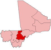
 Mariko Location in Mali | |
| Coordinates: 14°25′6″N 6°0′10″W / 14.41833°N 6.00278°WCoordinates: 14°25′6″N 6°0′10″W / 14.41833°N 6.00278°W | |
| Country |
|
| Region | Ségou Region |
| Cercle | Niono Cercle |
| Area[1] | |
| • Total | 395 km2 (153 sq mi) |
| Population (2009 census)[2] | |
| • Total | 16,986 |
| • Density | 43/km2 (110/sq mi) |
| Time zone | GMT (UTC+0) |
Mariko is a commune in the Cercle of Niono in the Ségou Region of Mali. The commune covers an area of approximately 395 square kilometers and includes 21 villages. In the 2009 census the population was 16,986.[2] The seat of local government is the village of Bouguni.
References
- ↑ "Common and Fundamental Operational Datasets Registry: Mali", United Nations Office for the Coordination of Humanitarian Affairs https://web.archive.org/web/20120106202217/http://cod.humanitarianresponse.info/country-region/mali, archived from the original on 2012-01-06 Missing or empty
|title=(help). commune_mali.zip (Originally from the Direction Nationale des Collectivités Territoriales, République du Mali) - 1 2 Resultats Provisoires RGPH 2009 (Région de Ségou) (PDF) (in French), République de Mali: Institut National de la Statistique.
External links
- Plan de Sécurité Alimentaire Commune Rurale de Mariko 2007-2011 (PDF) (in French), Commissariat à la Sécurité Alimentaire, République du Mali, USAID-Mali, 2007.
This article is issued from
Wikipedia.
The text is licensed under Creative Commons - Attribution - Sharealike.
Additional terms may apply for the media files.