Mallig, Isabela
| Mallig | ||
|---|---|---|
| Municipality | ||
|
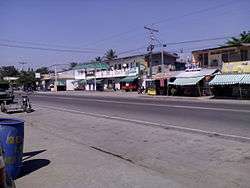
Mallig Town Proper | ||
| ||
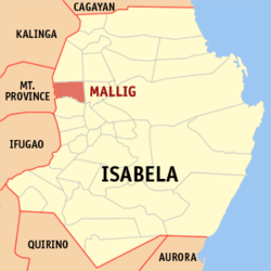 Map of Isabela showing the location of Mallig | ||
.svg.png) Mallig Location within the Philippines | ||
| Coordinates: 17°12′N 121°37′E / 17.2°N 121.62°ECoordinates: 17°12′N 121°37′E / 17.2°N 121.62°E | ||
| Country | Philippines | |
| Region | Cagayan Valley (Region II) | |
| Province | Isabela | |
| District | 5th District of Isabela | |
| Barangays | 18 | |
| Government[1] | ||
| • Mayor | Jose P. Calderon | |
| • Vice Mayor | Dadong Felipe | |
| • Electorate | 17,344 voters (2016 election) | |
| Area [2] | ||
| • Total | 133.40 km2 (51.51 sq mi) | |
| Population (2015 census)[3] | ||
| • Total | 30,459 | |
| • Density | 230/km2 (590/sq mi) | |
| Time zone | PST (UTC+8) | |
| ZIP code | 3323 | |
| PSGC | 023119000 | |
| IDD : area code | +63 (0)78 | |
| Income class | 4th municipal income class | |
| Revenue | ₱ 6,478,643.10 (2016)[4] | |
| Poverty incidence | 18.65 (2012)[5] | |
| Website |
www | |

Mallig is a 4th class municipality in the province of Isabela, Philippines. According to the 2015 census, it has a population of 30,459 people.[3]
History
The municipality of Mallig was named after the Mallig river that traverses it. It was created by virtue of RA 678 authored by congressman Samuel F. Reyes. The act was approved on April 8, 1953 with the former barrio Olango as the seat of government. As separate municipality, the territorial domain of Mallig included in the north, barrios of Tumauini in the midsection, barrios of Ilagan; and in the south, barrios of Gamu - all in the province of Isabela.
In 1939, then President Manuel L. Quezon declared the westernmost part of the province as a resettlement area, historically known as the Mallig Plains Resettlement Area. From then on, the influx of settlers from the Central Plains and the Ilocos Region encouraged more other settlers to migrate westward in these Kalinga-dominated plains.
Mallig was never a ready haven and abode for the migrants at the beginning, particularly because of the hostile and repulsive culture of the natives that formerly dominated the are, and also because of the occurrence of endemic malaria. It took the settlers gradual adaptation and acclimatization before they finally convinced their relatives and other migrants to settle permanently.[6]
Mallig was formed into a town in 1952. The territory comprising Mallig was taken from different neighboring towns:
- from Roxas: barrios of Holy Friday, San Jose (East), and San Jose (West)
- from Ilagan City: barrios of Casili, Olango Primero, Olango Segundo, San Jose Nuevo, and Manano
- from Tumauini: barrios of Barucbuc, Siempre Viva, Bimmonton, Pasurgong, Manga, and Settlement No. 1
- from Sto. Tomas: barrios of Abut and Minagbag[7]
Geography
Mallig is bounded by the towns of Paracelis, Mt. Province on its western limits, Quezon, Isabela on its northern limits, Roxas, Isabela on its southern limits and by both Delfin Albano and Quirino, Isabela on its eastern limits. It is municipality within the Division/Province of Isabela in the region of Cagayan Valley.
Its main gateway is the Santiago-Tuguegarao road which is a part of the national highway. The Ilagan-Delfin Albano-Mallig road, a provincial road, also serves as an important point of entry to Mallig.
It is also an agricultural town mainly composed of agricultural farms such as rice fields and corn fields which makes its rural landscape.
Barangays
Mallig is politically subdivided into 18 barangays. [2]
- San Pedro (Barucbuc Sur)
- Bimonton
- Casili
- Centro I
- Holy Friday
- Jacinto Baniqued (Centro II pob)
- Maligaya
- Manano
- Olango
- Rang-ayan
- San Jose Norte I
- San Jose Sur
- Siempre Viva Norte
- Trinidad
- Victoria
- San Jose Norte II
- San Ramon
- Siempre Viva Sur
Climate
The climate in Mallig is tropical. Mallig has significant rainfall most months, with a short dry season. This location is classified as Am by Köppen and Geiger. The temperature here averages 27.0 °C. The average annual rainfall is 1784 mm.
| Climate data for Mallig, Isabela | |||||||||||||
|---|---|---|---|---|---|---|---|---|---|---|---|---|---|
| Month | Jan | Feb | Mar | Apr | May | Jun | Jul | Aug | Sep | Oct | Nov | Dec | Year |
| Average high °C (°F) | 29 (84) |
30 (86) |
32 (90) |
35 (95) |
35 (95) |
35 (95) |
34 (93) |
33 (91) |
32 (90) |
31 (88) |
30 (86) |
28 (82) |
32 (89.6) |
| Average low °C (°F) | 19 (66) |
20 (68) |
21 (70) |
23 (73) |
23 (73) |
24 (75) |
23 (73) |
23 (73) |
23 (73) |
22 (72) |
21 (70) |
20 (68) |
21.8 (71.2) |
| Average precipitation mm (inches) | 31.2 (1.228) |
23 (0.91) |
27.7 (1.091) |
28.1 (1.106) |
113.5 (4.469) |
141.4 (5.567) |
176.4 (6.945) |
236.6 (9.315) |
224.9 (8.854) |
247.7 (9.752) |
222.9 (8.776) |
178 (7.01) |
1,651.4 (65.023) |
| Average rainy days | 10 | 6 | 5 | 5 | 13 | 12 | 15 | 15 | 15 | 17 | 16 | 15 | 144 |
| Source: World Weather Online[8] | |||||||||||||
Demographics
| Population census of Mallig | |||||||||||||||||||||||||||||||||||||
|---|---|---|---|---|---|---|---|---|---|---|---|---|---|---|---|---|---|---|---|---|---|---|---|---|---|---|---|---|---|---|---|---|---|---|---|---|---|
|
| ||||||||||||||||||||||||||||||||||||
| Source: Philippine Statistics Authority[3][9][10][11] | |||||||||||||||||||||||||||||||||||||
In the 2015 census, the population of Mallig, Isabela, was 30,459 people,[3] with a density of 230 inhabitants per square kilometre or 600 inhabitants per square mile.
References
- ↑ "Official City/Municipal 2013 Election Results". Intramuros, Manila, Philippines: Commission on Elections (COMELEC). 11 September 2013. Retrieved 9 January 2014.
- 1 2 "Province: Isabela". PSGC Interactive. Quezon City, Philippines: Philippine Statistics Authority. Retrieved 12 November 2016.
- 1 2 3 4 Census of Population (2015). "Region II (Cagayan Valley)". Total Population by Province, City, Municipality and Barangay. PSA. Retrieved 20 June 2016.
- ↑ "Isabela : Cities and Municipalities Competitiveness Index". Makati City, Philippines: National Competitiveness Council (Philippines). Archived from the original on 29 January 2017. Retrieved 29 January 2017.
- ↑ "PSA Releases the 2012 Municipal and City Level Poverty Estimates". Quezon City, Philippines: Philippine Statistics Authority. Retrieved 28 January 2017.
- ↑ "Mallig, History". http://www.malligisabela.com/. malligisabela.com. Retrieved 1 April 2015. External link in
|website=(help) - ↑ "An Act Creating the Municipality of Mallig in the Province of Isabela". LawPH.com. Retrieved 2011-04-09.
- ↑ "Mallig, Isabela: Average Temperatures and Rainfall". World Weather Online. Retrieved 31 October 2015.
- ↑ Census of Population and Housing (2010). "Region II (Cagayan Valley)". Total Population by Province, City, Municipality and Barangay. NSO. Retrieved 29 June 2016.
- ↑ Census of Population (1995, 2000 and 2007). "Region II (Cagayan Valley)". Total Population by Province, City and Municipality. NSO. Archived from the original on 24 June 2011.
- ↑ "Province of Isabela". Municipality Population Data. Local Water Utilities Administration Research Division. Retrieved 17 December 2016.
External links
- Municipal Profile at the National Competitiveness Council of the Philippines
- Mallig at the Isabela Government Website
- Local Governance Performance Management System
- Philippine Standard Geographic Code
- Philippine Census Information
- Municipality of Mallig
Adjacent places of Mallig, Isabela | |||
|---|---|---|---|
 | | ||
Ilagan (capital) | |
| Municipalities |
|
| Component Cities | |
| Independent Component City |
|
| Barangays | |