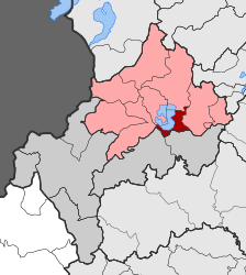
Makednoi
| Makednoi Μακεδνοί | |
|---|---|
 Makednoi | |
|
Location within the regional unit  | |
| Coordinates: 40°30′N 21°20′E / 40.500°N 21.333°ECoordinates: 40°30′N 21°20′E / 40.500°N 21.333°E | |
| Country | Greece |
| Administrative region | West Macedonia |
| Regional unit | Kastoria |
| Municipality | Kastoria |
| • Municipal unit | 37.6 km2 (14.5 sq mi) |
| Population (2011)[1] | |
| • Municipal unit | 3,220 |
| • Municipal unit density | 86/km2 (220/sq mi) |
| Time zone | EET (UTC+2) |
| • Summer (DST) | EEST (UTC+3) |
| Vehicle registration | KT |
Makednoi (Greek: Μακεδνοί) is a former municipality in Kastoria regional unit, West Macedonia, Greece. Since the 2011 local government reform it is part of the municipality Kastoria, of which it is a municipal unit.[2] The municipal unit has an area of 37.614 km2.[3] Population 3,220 (2011). The seat of the municipality was in Mavrochori. It comprises three municipal departments: Dispilio (Δισπηλιό), Mavrochori (Μαυροχώρι) and Polykarpi (Πολυκάρπη).
Name
The name is derived from the Ancient Greek name meaning "Macedonian", Makednos (Μακεδνός). Whereas in Greek the municipality is usually referred to as Dimos Makednon (Δήμος Μακεδνών), using the genitive plural form of the ancient name, Makednoi is the nominative plural form ("Macedonians"). In English, the names Makednon, Makednoi, Makednos and Makednes are occasionally used.
External links
References
- ↑ "Απογραφή Πληθυσμού - Κατοικιών 2011. ΜΟΝΙΜΟΣ Πληθυσμός" (in Greek). Hellenic Statistical Authority.
- ↑ Kallikratis law Greece Ministry of Interior (in Greek)
- ↑ "Population & housing census 2001 (incl. area and average elevation)" (PDF) (in Greek). National Statistical Service of Greece. Archived from the original (PDF) on 2015-09-21.