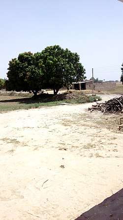
Mahammadpur
| Mahammadpur, India महम्मदपुर | |
|---|---|
| Village | |
 | |
 Mahammadpur, India Location in Bihar, India | |
| Coordinates: 26°06′57″N 84°12′20″E / 26.115748°N 84.205482°ECoordinates: 26°06′57″N 84°12′20″E / 26.115748°N 84.205482°E | |
| Country |
|
| State | Bihar |
| District | Siwan |
| Block | Aandar |
| Gram Panchayat | Samir Kumar Pandey |
| village | महम्मदपुर गाँव,आन्दर (सिवान) |
| Police station | Asaon |
| Government | |
| • Chief Minister | Nitish Kumar (JD(U)) |
| • MP | Om Prakash Yadav (BJP) |
| • MLA | Satyadeo Ram (CPI(M/L)(L)) |
| • Mukhiya | Mithilesh Devi |
| Area | |
| • Total | 1.5 km2 (0.6 sq mi) |
| Area rank | 200 |
| Elevation | 223 m (732 ft) |
| Population (2011) | |
| • Total | 1,343 |
| • Density | 900/km2 (2,300/sq mi) |
| Languages | |
| • Official | Hindi, English |
| • Local | Bhojpuri, Hindi |
| Time zone | IST (UTC+5:30) |
| PIN | 841245-841287[1] |
| Area code(s) | 06154[2] |
| Vehicle registration | BR-29 |
| Lok Sabha constituency | Siwan |
| Vidhan Sabha constituency | Darauli |
| Website |
siwan |
Mahammadpur is a village in the Siwan district of Bihar, India.[3] It has a population of approximately 1,243[4] and has a size of 1.5 km2 (0.58 sq mi).[5]
Government
Mahammadpur is represented by a Sarpanch, who is elected by the people of the village and has judicial powers.[6]
Geography
Mahammadpur is located at 26°06′36″N 84°12′18″E / 26.11°N 84.2050°E.[7] It has an average elevation of 223 metres (223 feet).
Roadways
According to Census 2011 information the location code or village code of Mahammadpur village is 232392. Mahammadpur village is located in Andar Tehsil of Siwan district in Bihar, India. It is situated 10 km away from sub-district headquarter Andar and 20 km away from district headquarter Siwan. As per 2009 stats, Arakpur is the gram panchayat of Mahammadpur village.
The total geographical area of village is 151.2 hectares. Mahammadpur has a total population of 1,343 peoples. There are about 205 houses in Mahammadpur village. Siwan is nearest town to Mahammadpur which is approximately 20 km away.
References
- ↑ http://www.codepin.in/India/PINcode/Siwan/Andar/Mahammadpur
- ↑ http://www.onefivenine.com/india/villages/Siwan/Andar/Mahammadpur
- ↑ "Mhammadpur village in siwan, bihar". villagesinindia.in. Retrieved 2017-01-20.
- ↑ "Mahammadpur Village Population - andar- Siwan, Bihar". www.census2011.co.in. Retrieved 2017-01-20.
- ↑ "Google Maps". Google Maps. Retrieved 2017-01-20.
- ↑ info@biharprabha.com, Bihar Reporter :. "Over 8000 Village Courts in Bihar allotted Judicial Powers". The Biharprabha News. Retrieved 2017-01-20.
- ↑ "Falling Rain Genomics, Inc – Mahammadpur".