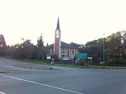
Maclear, Eastern Cape
| Maclear | |
|---|---|
|
Maclear | |
 Maclear  Maclear  Maclear
| |
| Coordinates: 31°04′12″S 28°21′0″E / 31.07000°S 28.35000°ECoordinates: 31°04′12″S 28°21′0″E / 31.07000°S 28.35000°E | |
| Country | South Africa |
| Province | Eastern Cape |
| District | Joe Gqabi |
| Municipality | Elundini |
| Established | 1876 |
| Area[1] | |
| • Total | 9.2 km2 (3.6 sq mi) |
| Elevation | 1,272 m (4,173 ft) |
| Population (2011)[1] | |
| • Total | 10,521 |
| • Density | 1,100/km2 (3,000/sq mi) |
| Racial makeup (2011)[1] | |
| • Black African | 93.1% |
| • Coloured | 4.3% |
| • Indian/Asian | 0.2% |
| • White | 2.0% |
| • Other | 0.4% |
| First languages (2011)[1] | |
| • Xhosa | 88.3% |
| • Afrikaans | 5.1% |
| • English | 2.7% |
| • Sotho | 2.1% |
| • Other | 1.8% |
| Postal code (street) | 5480 |
| PO box | 5480 |
| Area code | 045 |
| Website | http://www.maclear.co.za/ |
Maclear is a small town situated in the Eastern Cape province of South Africa, near the Mooi River (a tributary of the Tsitsa River), 172 km north of East London and 80 km north-east of Elliot. It was founded in 1876 as a military camp, called Nqanqaru Drift and developed rapidly, reaching municipal status in 1916. Was named after Sir Thomas Maclear (1794-1879), a famous astronomer who laid the foundation for a trigonometrical survey of the Cape Colony.
It lies just north-east of Ugie. The land to the east and south was part of the former homeland of Transkei.
Tourism
Maclear is a popular trout-fishing resort set in beautiful surroundings.[2]
Geographic location
Maclear lies between Mount Fletcher and Ugie.
References
- 1 2 3 4 Sum of the Main Places Sonwabile and Maclear from Census 2011.
- ↑ "Dictionary of Southern African Place Names (Public Domain)". Human Science Research Council. p. 289.
- ↑ saexplorer - travel distances from Maclear
This article is issued from
Wikipedia.
The text is licensed under Creative Commons - Attribution - Sharealike.
Additional terms may apply for the media files.


.svg.png)