Mackenzie Glacier
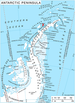
Mackenzie Glacier (64°17′S 62°16′W / 64.283°S 62.267°WCoordinates: 64°17′S 62°16′W / 64.283°S 62.267°W) is a glacier 4 nautical miles (7 km) long flowing eastward from Mount Parry to join Malpighi Glacier at the east coast of Brabant Island, in the Palmer Archipelago, Antarctica. It was first roughly charted by the Belgian Antarctic Expedition, 1897–99, under Gerlache, was photographed by Hunting Aerosurveys Ltd in 1956–57, and was mapped from these photos in 1959. The glacier was named by the UK Antarctic Place-Names Committee for English physician Sir James Mackenzie, a pioneer of studies of heart disease.[1]
Maps
- Antarctic Digital Database (ADD). Scale 1:250000 topographic map of Antarctica. Scientific Committee on Antarctic Research (SCAR). Since 1993, regularly upgraded and updated.
- British Antarctic Territory. Scale 1:200000 topographic map. DOS 610 Series, Sheet W 64 62. Directorate of Overseas Surveys, Tolworth, UK, 1980.
- Brabant Island to Argentine Islands. Scale 1:250000 topographic map. British Antarctic Survey, 2008.
References
- ↑ "Mackenzie Glacier". Geographic Names Information System. United States Geological Survey. Retrieved 2013-07-17.
![]() This article incorporates public domain material from the United States Geological Survey document "Mackenzie Glacier" (content from the Geographic Names Information System).
This article incorporates public domain material from the United States Geological Survey document "Mackenzie Glacier" (content from the Geographic Names Information System).