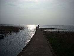
Lough Gill (Kerry)
| Lough Gill | |
|---|---|
 | |
 Location in Ireland | |
| Location | County Kerry |
| Coordinates | 52°15′38″N 10°2′44″W / 52.26056°N 10.04556°WCoordinates: 52°15′38″N 10°2′44″W / 52.26056°N 10.04556°W |
| Catchment area | 16.43 km2 (6.3 sq mi) |
| Basin countries | Ireland |
| Max. length | 2.2 km (1.4 mi) |
| Max. width | 0.9 km (0.6 mi) |
| Surface area | 1.4 km2 (0.54 sq mi) |
| Average depth | 0.5 m (1 ft 7.7 in) |
| Surface elevation | 3 m (9.8 ft) |
| References | [1][2][3] |
Lough Gill is a freshwater lake in the southwest of Ireland. It is located on the Dingle Peninsula in County Kerry.
Geography
Lough Gill measures about 2 km (1.2 mi) long and 1 km (0.6 mi) wide. It is about 30 km (19 mi) west of Tralee, near the village of Castlegregory.[1]
Hydrology
Lough Gill is considered a natural lagoon, draining into Tralee Bay. It is fed by the Killiney River and another unnamed stream. The lake is shallow, with depths of less than 0.5 m (1 ft 8 in).[3]
Natural history
Fish species in Lough Gill include three-spined stickleback, sand goby, brown trout, flounder and the critically endangered European eel.[3] The lake is part of the Tralee Bay and Magharees Peninsula, West to Cloghane Special Area of Conservation.[4]
See also
References
- 1 2 Google (29 Dec 2015). "Lough Gill" (Map). Google Maps. Google. Retrieved 29 Dec 2015.
- ↑ "A Reference Based Typology and Ecological Assessment System for Irish Lakes" (PDF). Environmental Protection Agency (Ireland). 2006. p. 17. Retrieved 29 Dec 2015.
- 1 2 3 "Sampling Fish for the Water Framework Directive : Lough Gill" (PDF). Inland Fisheries Ireland. 2013. Retrieved 29 Dec 2015.
- ↑ "Tralee Bay and Magharees Peninsula, West to Cloghane SAC" (PDF). National Parks and Wildlife Service (Ireland). Retrieved 29 Dec 2015.
This article is issued from
Wikipedia.
The text is licensed under Creative Commons - Attribution - Sharealike.
Additional terms may apply for the media files.