Liugui District, Kaohsiung
Coordinates: 22°59′49″N 120°38′54″E / 22.996955°N 120.648315°E
| Liougui 六龜區 Liugui | |
|---|---|
| District | |
| Liougui District[1] | |
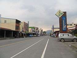 | |
 Liugui District in Kaohsiung City | |
| Country | Taiwan |
| Region | Southern Taiwan |
| Population (January 2016) | |
| • Total | 13,435 |
| Website | Official Website (in Chinese) |
Liougui District (Chinese: 六龜區; Hanyu Pinyin: Liùguī Qū; Tongyong Pinyin: Liòuguei Cyu; Wade–Giles: Liu4-kuei1 Ch'ü1) is a rural district of Kaohsiung City, Taiwan. It is the third largest district in Kaohsiung City after Tauyuan District and Namasia District.
History
Japanese Era
The former name of the area is Lakkuli (Chinese: 六龜里社; Pe̍h-ōe-jī: La̍k-ku-lí-siā).[2] In 1902, in the early Japanese era, the area was administered as "Lakkuli Village" (六龜里庄). In 1910, it was modified to Rokkiri Subprefecture (Japanese: 六龜里支廳), Akō Prefecture (阿緱廳). In 1920, it was under Rokuki Village (六龜庄), Heitō District (屏東郡), Takao Prefecture. In 1932, Rokuki was annexed into Kizan District (旗山郡) under Takao Prefecture.
Administrative divisions
Liougui District consists of 12 villages.
Tourist attractions
- 18 Arhats Mountain
- Sinwei Forest Ecological Park
See also
| Wikimedia Commons has media related to Liugui District, Kaohsiung. |
References
- ↑ "Administrative Districts". 高雄市政府. 30 September 2016. Retrieved 4 April 2017.
- ↑ "Entry #40046 (六龜里社)". 臺灣閩南語常用詞辭典 [Dictionary of Frequently-Used Taiwan Minnan] (in Chinese and Hokkien). Ministry of Education, R.O.C. 2011.
External links
Districts of Kaohsiung | ||
|---|---|---|
| Urban area | .svg.png) | |
| Fongshan region | ||
| Gangshan region | ||
| Cishan region | ||
| Mountain indigenous districts | ||
Note: Although Hanyu Pinyin is the national standard, the Kaohsiung Government names its districts based on Tongyong Pinyin. | ||
- ↑ "Administrative Districts". 高雄市政府. 30 September 2016. Retrieved 4 April 2017.