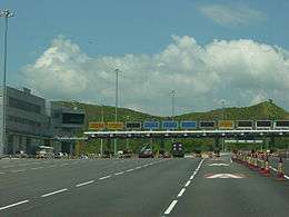
List of roads in Lantau
The following is an incomplete list of roads in Lantau, Islands District, Hong Kong.
List
| Name | Location and length | History and Notes | Notable Places | Photo | Coordinates |
|---|---|---|---|---|---|
| Chung Yan Road (松仁路) | In Tung Chung, near Yat Tung Estate. | North Lantau Hospital | .jpg) | ||
| Keung Shan Road (羗(羌)山道) | |||||
| Lantau Link (青嶼幹線) | Roadway linking Hong Kong International Airport to the urban areas in Hong Kong. 3.5 kilometres (2.2 mi) long. | Officially opened on 27 April 1997. Opened to traffic on 22 May 1997. It carries a railway as well as roads. | Tsing Ma Bridge, Ma Wan Viaduct, Kap Shui Mun Bridge |  | |
| Ngong Ping Road (昂平路) | From Sham Wat Road to Ngong Ping. | Ngong Ping Village | |||
| Sham Wat Road (深屈道) | |||||
| South Lantau Road (嶼南道) | Connects Mui Wo in the east to Shek Pik in the west. Majority portion of the road is along the southern shore of Lantau Island | Construction started in 1955.[1] | Nam Shan, Pui O, San Shek Wan, Cheung Sha, Tong Fuk, Shui Hau. | | 22°14′10″N 113°57′01″E / 22.236°N 113.9504°E |
| Tai O Road (大澳道) | The west-most part of the main roads in south Lantau Island. It starts halfway down the side of Keung Shan, near Kwun Yam Monastery, and runs downhill to the fishing town of Tai O. | .jpg) | |||
| Tung Chung Road (東涌道) | Connects the north and south coasts of Lantau Island. It meets South Lantau Road at Cheung Sha. | .jpg) | |||
See also
List of streets and roads in Hong Kong
References
- ↑ Hayes, James (2006). The great difference: Hong Kong's New Territories and its people, 1898-2004. Hong Kong University Press. p. 132. ISBN 9789622097940.
This article is issued from
Wikipedia.
The text is licensed under Creative Commons - Attribution - Sharealike.
Additional terms may apply for the media files.