List of Toronto parks
| Wikimedia Commons has media related to Parks in Toronto. |
The following is a list of the parks in the city of Toronto, Ontario, Canada. The appearance of Toronto's ravines was altered by floods caused by Hurricane Hazel in October 1954 and many of Toronto's parks were established in the resulting floodplain.[1]
Municipal parks
The following parks are maintained by Toronto Parks, Forestry and Recreation Division:
A
- Abbotsford Park
- Acacia Park
- Academy Soccer Field
- Adams Park
- Adanac Park
- Addington Greenbelt
- Agincourt Park
- Agnes Macphail Square
- Ailsa Craig Parkette
- Alamosa Park
- Alan - Oxford Parkette
- Albert Campbell Square
- Albert Crosland Parkette
- Albert Standing Parkette
- Albion Gardens Park
- Alderwood Memorial Park
- Aldwych Park
- Alex Marchetti Park
- Alex Murray Parkette
- Alex Wilson Community Gardens
- Alexander Muir Memorial Gardens
- Alexander Park
- Alexander Street Parkette
- Alexander the Great Parkette
- Alexandra Park
- Alexmuir Park
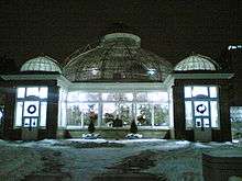
- Allan Gardens
- Allan Lamport Stadium and Park
- Allanhurst Park
- Amberdale Ravine
- Ambrose Parkette
- Ames Park
- Amesbury Park
- Amos Waites Park
- Amsterdam Square
- Ancaster Park
- Ancona Park
- Aneta Circle Parkette
- Anewen Greenbelt
- Anniversary Park
- Anson Park
- Anthony Road Public School Park
- Antibes Park
- Apted Park
- Arena Gardens
- Arlington Parkette
- Arsandco Park
- Art Eggleton Park
- Arthur Dyson Parkette
- Ashbridge's Bay Park
- Ashtonbee Reservoir Park
- Asquith Green Park
- Asterfield - Plumrose Blvd Parkette
- Audrelane Park
- Aura Lee Playing Field (University of Toronto Grounds)[2]
- Austin Terrace Boulevard Lands
- Avalon Parkette
- Avoca Ravine (see Vale of Avoca)
- Avondale Park
- Avonshire Park
- Avonshire Parkette
- Avro Park
B
- Baby Point Club Park (private)
- Bain Avenue Parkette
- Baird Park
- Bakerton Parkette
- Balcarra Park
- Balliol Parkette
- Balmoral Park
- Balmy Beach Park
- Bamburgh Park
- Banbury Park
- Banting Park
- Barbara Hall Park
- Barkdene Park
- Bartlett Parkette
- Bartley Park
- Basswood Parkette
- Bathurst Quay
- Bathurst - Wilson Parkette
- Battery Park
- Baycrest Park
- Bayhampton Parkette
- Bayview - York Mills Parkette
- Bayview Parkette
- Bayview Village Park
- Beach Skatepark
- Beaches Park
- Beaty Avenue Parkette
- Beaty Parkette
- Beaumonde Heights Park
- Beaumont Park
- Beaver - Lightbourn Parkette
- Bedford Parkette
- Beechgrove Park
- Beecroft Park
- Bell Manor Park
- Bellamy Park
- Bellbury Park
- Bellevue Square Park
- Belmar Park
- Belmont Parkette
- Ben Nobleman Park
- Bendale Park
- Benjamin Boake Greenbelt
- Benner Park
- Bennett Park
- Bennington Heights Park
- Berczy Park (named for William Berczy)
- Beresford Park
- Berner Trail Park
- Berry Road Park
- Bert Robinson Park
- Bessarion Parkette
- Bestview Park
- Bethune Park (named for Norman Bethune)
- Betty Sutherland Trail Park
- Beverly Glen Park
- Bickford Park
- Bill Hancox Park
- Bill Johnston Park
- Birch Park
- Birchcrest Park
- Birchmount Park and Stadium
- Birchview Boulevard Parkette
- Birkdale Ravine
- Birunthan Park
- Bishop Park
- Bisset Park
- Black Creek Parkland
- Black Creek Site East
- Black Creek Site West
- Blackfriar Park
- Blantyre Park
- Bloor - Bedford Parkette
- Bloor - Parliament Parkette
- Bloordale Park North
- Bloordale Park South
- Blue Ridge Park
- Bluehaven Park

- Bluffer's Park
- Blythdale Greenbelt
- Blythwood Ravine Park
- Bob Hunter Park
- Bobbie Rosenfeld Park
- Bond Park
- Bonspiel Park
- Boswell Parkette
- Botany Hill Park
- Boulton Drive Parkette
- Bowan Court Parkette
- Boyington Property
- Bramber Woods Park
- Brandon Avenue Parkette
- Bratty Park
- Breadalbane Park
- Brendwin Circle Parkette
- Briar Crest Park
- Briar Hill - Chaplin Park
- Briar Hill Parkette
- Bridletowne Park
- Bridlewood Park
- Bright Street Playground
- Brimley Woods
- Bristol Avenue Parkette
- Bristol Avenue Parkette West
- Broadacres Park
- Broadlands Park
- Broadview Subway Station Parkette
- Brookbanks Park
- Brookdale Park
- Brookfield Parkette
- Brooks Road Park
- Brookwell Park
- Browns Line-Lakeshore Parkette
- Bruce Mackey Park
- Brunswick - College Parkette
- Budapest Park
- Budd Sugarman Park
- Burnett Park
- Burnhamill Park
- Burrows Hall Park
- Buttonwood Park
- Byng Park
C
- Cairns Avenue Parkette
- Caledonia Park
- Camborne Parkette
- Campbell Avenue Playground
- Canadian Ukrainian Memorial Park
- Candlebrook Crescent Park
- Canmore Park
- Canoe Landing Park
- Canterbury Place Park
- Capri Park
- Caribou Park
- Carlton Park
- Cathedral Bluffs Park
- Cedar Brook Park

- Cedarvale Park
- Centennial Park in the former city of Etobicoke
- Centennial Park in the former city of Scarborough
- Central Park
- Centre Park
- Chalkfarm Park
- Charles Sauriol Conservation Reserve
- Chartwell Park
- Chatsworth Ravine
- Chelsea Park
- Cherry Beach
- Chorley Park
- Christie Pits
- Clanton Park
- Clarence Square
- Clarke Beach Park
- Cliff Lumsdon Park
- Cliffwood Park
- Cloud Gardens (Bay Adelaide Gardens and the Cloud Forest Conservatory)
- Collingwood Park
- Colonel Danforth Park
- Colonel Samuel Smith Park
- Colony Park
- Corktown Common
- Coronation Park
- Cotsworth Park
- Coxwell Ravine Park
- Cresthaven Park
- Crothers Woods
- Cudia Park
- Cummer Park
D
- David A. Balfour Park
- David Crombie Park
- Dell Park
- Delo Park
- Dempsey Park
- Denfield Park
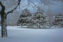
- Dentonia Park
- Dentonia Park Golf Course
- Derrydowns Park
- Dieppe Park
- Dixie Park
- Donald Russell Memorial Park
- Don Valley Brick Works
- Don Valley Golf Course
- Doris McCarthy Trail
- Douglas B. Ford Park
- Dovercourt Park
- Downsview Dells Park
- Dufferin Grove Park
- Duplex Parkette
E
- Earl Bales Park, Barry Zukerman Amphitheatre and North York Ski Centre
- Earlscourt Park
- East Don Parklands
- East Lynn Park
- East Point Park
- Eastview Park
- Ed & Anne Mirvish Parkette
- Edwards Gardens
- Eglinton Flats
- Eglinton Park
- Elizabeth Simcoe Park
- Empringham Park
- Esther Lorrie Park
- Étienne Brûlé Park
- E.T. Seton Park
F
- Fairbank Memorial Park
- Farquarson Park
- Fergy Brown Park
- Finch Parkette
- Flemington Park
- Forestry Island Park
- Fountainhead Park
- Frank Stollery Parkette
- Fundy Bay Park
G
- Garnier Park
- Garrison Creek Park
- Garthdale Park
- George Faludy Park
- Glen Agar Park
- Glen Cedar Park
- Glendora Park
- Glen Long Park
- Glenn Gould Park
- Glen Rouge Park and Campgrounds (adjacent to Bead Hill site)
- Goldhawk Park
- G. Ross Lord Park
- Grandravine Park
- Grange Park
- Greenwood Park
- Grey Abbey Trail and Ravine
- Guild Park and Gardens
- Gwendolyn MacEwen Park
H

- Habitant Park
- Healey Willan Park
- Heathrow Park
- Hendon Park
- High Park
- Hillcrest Park
- Hillside Park
- Highland Creek
- Home Smith Park
- Howard Talbot Park
- HTO Park
- Hullmar Park
- Humber Arboretum
- Humber Bay Park
- Humberline Park
- Humber Marshes
- Humber Valley Golf Course
- Humewood Park
- Huntsmill Park
- Hupfield Park
I–K
- Ireland Park
- Iroqouis Park
- Island Park
- Jack Goodland Park
- James Gardens
- Jean Sibelius Square
- Jesse Ketchum Park
- Jimmie Simpson Park
- John Tabor Park
- June Callwood Park
- June Rowlands Park (formerly Davisville Park)
- Kay Gardner Beltline Park
- Keelesdale Park
- Kempton Howard Park
- Kew Gardens Park
- King's Mill Park
L
- Lambton Woods
- Lake Shore Boulevard Parklands
- L'Amoreaux Park and Cricket Grounds
- Laughlin Park
- Laura Park
- Lawrence Park
- Leaside Park
- Leaside Spur Trail

- Lescon Park
- Leslie Park
- Lillian Park
- Lindylou Park
- Linus Park
- Lissom Park
- Lithuania Park
- Little Norway Park
- Littles Road Park
- Loring-Wyle Parkette
- Lower Don Parklands
- Lower Highland Creek Park
- Lytton Park
M

- McAllister Park
- McCleary Park
- McDairnud Woods Park
- McLevin Park
- McNicoll Park
- Magwood Park
- Malta Park
- Maple Leaf Forever Park
- Maple Leaf Park
- Marie Curtis Park
- Marilyn Bell Park
- Market Lane Park
- Martin Goodman Trail
- Maryvale Park
- Matt Cohen Park
- McCowan District Park
- Milliken Park
- Millwood Park
- Mitchell Field Park
- Monarch Park
- Moore Park Ravine
- Moorevale Park
- Morningside Park
- Morningview Trail Ravine
- Moss Park
- Muirlands Park
N–O
- Natal Park
- Neilson Park
- Newtonbrook Park
- Nicol MacNicol Parkette
- North Park
- North Kipling Park
- Northwood Park
- Oak Park
- Olympia Park
- Olympic Island Park
- Orchard Park
- Oriole Park
- Owen Park
P–R
- Palace Pier Park
- Palmerston Gardens
- Pantry Park
- Park Drive Reservation Land
- Park Lawn Park
- Pinetree Park
- Pinto Park
- Pine Point Park
- Port Royal Park
- Prince Edward Viaduct Parkette
- Prince of Wales Park
- Princess Margaret Park
- Queen's Greenbelt (not to be confused with Queen's Park downtown)
- Ramsden Park
- Raymore Park
- Rennie Park
- Riverdale Park
- Roding Park
- Rosebank Park
- Rosedale Park
- Rosetta McLain Gardens
- Rouge Beach Park
- Rouge Park East
- Roundhouse Park
- Rowntree Mills Park
- Runnymede Park
S

- St. Andrew's Market and Playground
- St. James Park
- St. Lucia Park
- Scarborough Heights Park
- Scarlett Mills Park
- Scarlett Woods Golf Course
- Sculpture Gardens
- Seaton Park
- Sentinel Park
- Serena Gundy Park
- Sergeant Ryan Russell Parkette[3]
- Shawnee Park
- Sherbourne Common
- Sherwood Park
- Sheppard East Park
- Skymark Park
- Silvercreek Park
- Silverview Park
- Sir Casimir Gzowski Park
- Sir Winston Churchill Park
- Smythe Park
- Snake Island Park
- Snider Parkette
- Snowhill Park
- Sonya's Park
- South Humber Park
- South Marine Drive Park
- Stan Wadlow Park
- Stanley Park
- Stanley Park South
- Stratford Park
- Sugar Beach
- Summerlea Park
- Sunnybrook Park (and Sunnybrook Stables)
- Sunnyside Park
- Sun Row Park
- Sylvan Park and Gates Gully
T–V
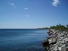
- Taddle Creek Park
- Talwood Park
- Tam O'Shanter Golf Course
- Taylor Creek Park
- Terry Fox Park
- Thistletown Area
- Thomson Memorial Park
- Tommy Thompson Park
- Thomson Riley Park
- Tip Top Park
- Todmorden Mills Park
- Toronto Botanical Garden in Edwards Gardens
- Toronto Music Garden
- Toronto Islands
- Toronto Track and Field Centre
- Town Hall Square
- Trace Mane Park
- Trinity Bellwoods Park
- Trinity Square and Labyrinth Park
- Underpass Park
- Vale of Avoca
- Valleyfield Park
- Varna Park
- Viewmount Park
W–Z
- Wallace-Emerson Park
- Wanless Park
- Washington Street Parkette
- Waterfront Park
- Warden Woods Park
- Wedgewood Park
- Wells Hill Park
- Wellsworth Park
- Wellesley Park
- Wenderley Park
- West Don Park
- West Humber Parkland
- Weston Lions Park
- West Rouge Park
- Westlake Memorial Park (formerly Jasper Park)
- Westview Greenbelt
- White Haven Park
- Wickson Trail Park
- Wilket Creek Park
- Willesden Park
- Willowdale Park
- Wilmington Park
- Windfields Park
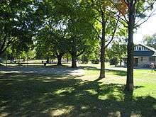
- Withrow Park
- Winchester Park
- Woodbine Park
- Woodbine Beach Park
- Wychwood Barns Park
- York Mills Valley Park
- Yorkdale Park
- Yorkminister Park
- Yorkville Park
- Zooview Park
Future parks
Provincial parks
There are three provincially managed parks in the City of Toronto and only one is a natural park.
The following parks are owned by the Government of Ontario:
- Ontario Place - artificially constructed amusement park and entertainment facility, on the waterfront south of Exhibition Place
- Queen's Park - park setting on the south and north ends of the Ontario Legislative Building and leased from the University of Toronto for 999 years, not to be confused with Queen's Greenbelt in North York
- Rouge Park - natural preserve section south of Steeles Avenue to Lake Ontario shoreline within the Rouge Valley with some agricultural uses
- Trillium Park - artificially constructed park with a natural-looking landscape planted with native tree and shrub species; built on the site of a former Ontario Place parking lot
Federal parks
The following parks are owned by the federal government of Canada and are not part of the National Parks system.
- Downsview Park - converted military base CFB Downsview
- Harbourfront Park - waterfront promenade and urban park amongst residential and commercial development along Queens Quay.
Toronto and Region Conservation Authority
The Toronto and Region Conservation Authority (TRCA) (an agency of the provincial government) is one of 36 conservation authorities in Ontario, Canada with a jurisdiction covering 3,467 square kilometres (1,339 sq mi) over nine different watersheds. The TRCA operates a number of conservation areas in the Toronto region, including two within the City of Toronto limits:
- Black Creek Pioneer Village
- Tommy Thompson Park (Leslie Street Spit)
- Humber Bay Shores Waterfront Park - a park linking City-owned Palace Pier Park and Humber Bay Park East on the south side of Marine Parade Drive to Park Lawn Road.
See also
- Fauna of Toronto
- Native trees in Toronto
- Toronto ravine system
- List of Toronto recreation centres
- Toronto Zoo, paid attraction in the Rouge Valley owned by the City of Toronto and operated by a board of management
References
- ↑ Toronto and Region Conservation. "Chronology of Storm Events". Retrieved March 27, 2010.
- ↑ University of Toronto: Campus Grounds
- ↑ Dupont Parkette renamed in Sgt. Ryan Russell's honour
- ↑ http://www.toronto.ca/legdocs/mmis/2017/ny/bgrd/backgroundfile-98690.pdf
- 1 2 Vella, Erica (November 24, 2015). "Toronto unveils plans for $19.7M pedestrian-friendly bridge at Fort York". Global News. Retrieved August 2, 2017.
The two-part bridge will span across two railway corridors in the downtown just east of Strachan Avenue. The first bridge will extend from South Stanley Park Extension on Wellington Street and end on the north side of Ordnance Triangle Park. The second bridge will begin on the south side of the Ordnance Triangle Park and extend over the south Lakeshore railway corridor, landing on the Fort York grounds.
- ↑ "Ordnance Triangle Lands / Connecting An Emerging Community" (PDF). Build Toronto. March 31, 2013. Retrieved August 2, 2017.
BUILD TORONTO and Diamond Corp. have also been working with the City’s Parks, Forestry and Recreation Division to examine options for the provision of a new park. Claude Cormier, the landscape architect behind the City’s Sugar Beach and HTO parks, has been retained to improve the size, configuration and functionality of the park and integrate a path running through the emerging residential community to the east. The new signature park will encompass almost four acres, and, together with the pedestrian bridge, will create a vast eight-park network essentially linking Trinity Bellwoods Park to the Martin Goodman Trail and the Waterfront.
External links
- Toronto Parks & Recreation website
- Centre Island Amusement Park
- High Park Community Advisory Council
- Toronto Parks Photo Gallery
- Jasper Park renamed to Westlake Memorial Park
