List of lighthouses in Delaware

This is a list of all lighthouses in the U.S. state of Delaware as identified by the United States Coast Guard. The first lighthouse in the state was erected in 1769[1] and the last in 1925 (ignoring automated towers erected later); the oldest active light is the Fenwick Island Light.[2]

If not otherwise noted, focal height and coordinates are taken from the United States Coast Guard Light List,[3] while location and dates of activation, automation, and deactivation are taken from the United States Coast Guard Historical information site for lighthouses.[2]

Name Location Coordinates Image Focal
Height
Built[note 1] Automated Deactivated Status
Baker Shoal Range Front Light Port Penn 39°32′27″N 75°34′00″W / 39.5409°N 75.5666°W / 39.5409; -75.5666 (Baker Shoal Range Front Light) 1904 1924 Replaced with skeleton tower
Baker Shoal Range Rear Light Port Penn 39°30′43″N 75°34′12″W / 39.5120°N 75.5699°W / 39.5120; -75.5699 (Baker Shoal Range Rear Light) 110 ft (34 m) 1904 1924[4] Active
Bellevue Range Rear Light Wilmington 39°43′13″N 75°31′04″W / 39.7203°N 75.5179°W / 39.7203; -75.5179 (Bellevue Range Rear Light)[5] 100 ft (30 m)[6] 1909 1934[5] 2001 Inactive
Cape Henlopen Beacon Lewes 38°47′25″N 75°04′50″W / 38.7903°N 75.0806°W / 38.7903; -75.0806 (Cape Henlopen Beacon)[7] 45 ft (14 m)[7] 1825/1864[8] 1884[8] demolished[8]
Cape Henlopen Light Lewes 38°46′41″N 75°05′02″W / 38.778°N 75.084°W / 38.778; -75.084 (Cape Henlopen Light)[9] 126 ft (38 m)[9] 1769 1924 Destroyed by storm in 1926
Cherry Island Range Rear Light near Edgemoor 39°45′43″N 75°29′24″W / 39.762°N 75.490°W / 39.762; -75.490 (Cherry Island Range Rear Light)[10] 120 ft (37 m)[10] 1880 unknown replaced with skeleton tower;
torn down ca. 1970
Christiana Light north bank of the Christina River 39°43′19″N 75°31′12″W / 39.722°N 75.520°W / 39.722; -75.520 (Christiana Light)[11] 44 ft (13 m)[11] 1835[12] 1909[12] demolished in 1935[12]
Christiana North Jetty Light mouth of the Christina River 39°43′05″N 75°30′58″W / 39.718°N 75.516°W / 39.718; -75.516 (Christiana North Jetty Light)[11] 37 ft (11 m)[11] 1884[5] unknown[note 2] demolished
Delaware Breakwater East End Light Lewes 38°47′50″N 75°06′01″W / 38.7972°N 75.1003°W / 38.7972; -75.1003 (Delaware Breakwater East End Light) 60 ft (18 m) 1885 1950 1996 inactive
Delaware Breakwater Range Front Light Lewes 38°47′57″N 75°06′29″W / 38.7992°N 75.1081°W / 38.7992; -75.1081 (Delaware Breakwater Range Front Light)[13] 45 ft (14 m)[13] 1838/1849 1903 demolished in 1950
Delaware Breakwater Range Rear Light Lewes 38°47′23″N 75°10′10″W / 38.7897°N 75.1694°W / 38.7897; -75.1694 (Delaware Breakwater Range Rear Light)[11] 103 ft (31 m)[11] 1881[14] 1918[14] dismantled and re-erected as Gasparilla Island Light[14]
Fenwick Island Light Fenwick Island 38°27′05″N 75°03′18″W / 38.4514°N 75.0550°W / 38.4514; -75.0550 (Fenwick Island Light)[15] 83 ft (25 m) 1859 1940 1978–1982 Active; private aid
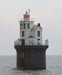
Fourteen Foot Bank Light Delaware Bay off Bowers Beach 39°02′54″N 75°10′56″W / 39.0482°N 75.1822°W / 39.0482; -75.1822 (Fourteen Foot Bank Light) 59 ft (18 m) 1887 1972 Active
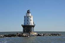
Harbor of Refuge Light Lewes 38°48′52″N 75°05′33″W / 38.8145°N 75.0924°W / 38.8145; -75.0924 (Harbor of Refuge Light) 72 ft (22 m) 1908/1925 1973 Active
Liston Range Front Light Bay View Beach 39°28′57″N 75°35′30″W / 39.4825°N 75.5917°W / 39.4825; -75.5917 (Liston Range Front Light)[note 3] 45 ft (14 m) 1906 1976 Inactive; light moved to adjacent skeleton tower
Liston Range Rear Light E of Biddles Corner 39°31′26″N 75°38′23″W / 39.5238°N 75.6397°W / 39.5238; -75.6397 (Liston Range Rear Light) 176 ft (54 m) 1906 1936[16] Active
Mahon River Light Port Mahon 39°11′06″N 75°24′03″W / 39.1850°N 75.4008°W / 39.1850; -75.4008 (Mahon River Light) 37 ft (11 m) 1831/1903 1955 replaced with skeleton tower; burned down in 1984
Marcus Hook Range Front Light near Bellefonte 39°46′34″N 75°28′31″W / 39.7760°N 75.4754°W / 39.7760; -75.4754 (Marcus Hook Range Front Light) 81 ft (25 m) 1925 active
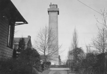
Marcus Hook Range Rear Light Bellefonte 39°45′44″N 75°30′12″W / 39.7622°N 75.5032°W / 39.7622; -75.5032 (Marcus Hook Range Rear Light) 278 ft (85 m) 1915/1920 1950s active
Mispillion Light on the Mispillion River 38°56′51″N 75°18′56″W / 38.9475°N 75.3156°W / 38.9475; -75.3156 (Mispillion Light) 46 ft (14 m)[11] 1831/1873 1926 1929 replaced with skeleton tower; burned in 2002
New Castle Range Rear Light near New Castle 39°38′54″N 75°35′56″W / 39.6482°N 75.5990°W / 39.6482; -75.5990 (New Castle Range Rear Light) 100 ft (30 m) 1876 1953 replaced by skeleton tower; original house burned in 1982
New Castle Range Front Light near New Castle 39°38′33″N 75°35′43″W / 39.6424°N 75.5954°W / 39.6424; -75.5954 (New Castle Range Front Light) 56 ft (17 m)[note 4] 1876 1963 replaced by skeleton tower
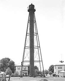
Reedy Island Range Rear Light near Taylors Bridge 39°24′23″N 75°35′25″W / 39.4065°N 75.5902°W / 39.4065; -75.5902 (Reedy Island Range Rear Light) 134 ft (41 m) 1910[17] unknown active

Notes

  1. If there is a second date, it represents the date the most recent tower was lit.
  2. Charts show the light up to 1930 but the light appears in listings to the end of the decade.
  3. current tower
  4. current tower

References

  1. "Lighthouses of the United States: Delaware". Russ Rowlett.
  2. 1 2 "Historic Light Station Information and Photography: Delaware". United States Coast Guard Historian's Office.
  3. Light List, Volume II, Atlantic Coast, Shrewsbury River, New Jersey to Little River, South Carolina (PDF). Light List. United States Coast Guard. 2012.
  4. "Baker Rear Range, DE". LighthouseFriends.
  5. 1 2 3 "Bellevue Rear Range, DE". LighthouseFriends.
  6. "Inventory of Historic Light Stations: Bellevue Range Rear Light". National Park Service.
  7. 1 2 List of Light-houses, Lighted Beacons, and Floating Lights of the Atlantic, Gulf, and Pacific Coasts of the United States. Treasury Department. January 1, 1868. pp. 24–25. Retrieved 2014-01-23.
  8. 1 2 3 "Delaware Breakwater Light". LighthouseFriends. Retrieved 2014-01-23.
  9. 1 2 List of Lights and Fog Signals on the Atlantic and Gulf Coasts of the United States. Washington, DC: Government Printing Office. June 30, 1900. p. 106.
  10. 1 2 "Cherry Island Range, DE". LighthouseFriends.
  11. 1 2 3 4 5 6 7 List of Lights and Fog Signals on the Atlantic and Gulf Coasts of the United States. Government Printing Office. March 1, 1907. p. 124. Retrieved 2014-01-15.
  12. 1 2 3 Trapani, Bob (2007). "Christiana River Light Station". Delaware Lights: A History of Lighthouses in the First State. History Press. pp. 46–49. Retrieved 2014-01-21.
  13. 1 2 List of Lights and Fog Signals on the Atlantic and Gulf Coasts of the United States. Government Printing Office. June 30, 1900. p. 94. Retrieved 2014-01-23.
  14. 1 2 3 "Delaware Breakwater Rear Range (Green Hill) Light". LighthouseFriends. Retrieved 2014-01-23.
  15. "Fenwick Island, DE". LighthouseFriends.
  16. "Liston rear Range, DE". Lighthouse Friends.
  17. "Inventory of Historic Light Stations: Delaware Lighthouses: Reedy Island Range Rear Light". National Park Service. Retrieved 2013-12-20.
This article is issued from Wikipedia. The text is licensed under Creative Commons - Attribution - Sharealike. Additional terms may apply for the media files.