List of Sites of Special Scientific Interest in Rutland

Rutland is a ceremonial county and unitary authority in the East Midlands of England. As of August 2017, there are 19 Sites of Special Scientific Interest (SSSIs) in the county.[1] Sixteen are designated for their biological importance, one for its geological importance and two under both criteria.

Key

Sites

Site name Photograph B G Area[lower-alpha 1] Public
access
Location[lower-alpha 1] Other
classifications
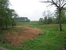
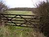
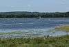
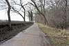
Map[lower-alpha 2] Citation[lower-alpha 3] Description
Bloody Oaks Quarry Bloody Oaks Quarry Green tick 1.1 hectares
(2.7 acres)
[2]
YES Stamford
52°41′10″N 0°33′50″W / 52.686°N 0.564°W / 52.686; -0.564 ([Bloody Oaks Quarry)
SK 971 108
[2]
LRWT[3] Map Citation This site has species-rich grassland on Jurassic limestone. The dominant grasses are tor-grass and upright brome and flora include rock-rose, salad burnet, yellow-wort and autumn gentian.[4]
Burley and Rushpit Woods Green tick 161.2 hectares
(398 acres)
Oakham
52°40′44″N 0°41′02″W / 52.679°N 0.684°W / 52.679; -0.684 (Burley and Rushpit Woods)
SK 891 098
Map Citation
Clipsham Old Quarry and Pickworth Great Wood Green tick Green tick 111.2 hectares
(275 acres)
Oakham
52°43′23″N 0°32′56″W / 52.723°N 0.549°W / 52.723; -0.549 (Clipsham Old Quarry and Pickworth Great Wood)
SK 981 149
GCR[5] Map Citation
East Wood, Great Casterton East Wood, Great Casterton Green tick 6.6 hectares
(16 acres)
Great Casterton
52°41′35″N 0°30′58″W / 52.693°N 0.516°W / 52.693; -0.516 (East Wood, Great Casterton)
TF 004 116
Map Citation
Empingham Marshy Meadows Green tick 14.0 hectares
(35 acres)
Oakham
52°40′23″N 0°35′17″W / 52.673°N 0.588°W / 52.673; -0.588 (Empingham Marshy Meadows)
SK 956 093
Map Citation
Eye Brook Reservoir Eye Brook Reservoir Green tick 201.3 hectares
(497 acres)
Uppingham
52°33′04″N 0°44′42″W / 52.551°N 0.745°W / 52.551; -0.745 (Eye Brook Reservoir)
SP 852 955
Map[lower-alpha 4] Citation
Greetham Meadows Green tick 12.4 hectares
(31 acres)
Oakham
52°43′52″N 0°36′43″W / 52.731°N 0.612°W / 52.731; -0.612 (Greetham Meadows)
SK 938 157
LRWT[6] Map Citation
Ketton Quarries Green tick Green tick 115.6 hectares
(286 acres)
Stamford
52°38′20″N 0°34′05″W / 52.639°N 0.568°W / 52.639; -0.568 (Ketton Quarries)
SK 970 055
GCR,[7][8] LRWT[9] Map Citation
Luffenham Heath Golf Course Green tick 75.1 hectares
(186 acres)
Stamford
52°36′36″N 0°35′13″W / 52.610°N 0.587°W / 52.610; -0.587 (Luffenham Heath Golf Course)
SK 958 023
Map Citation
Newell Wood Newell Wood Green tick 33.3 hectares
(82 acres)
Stamford
52°43′05″N 0°31′01″W / 52.718°N 0.517°W / 52.718; -0.517 (Newell Wood)
TF 003 144
Map Citation
North Luffenham Quarry Green tick 4.6 hectares
(11 acres)
Stamford
52°37′19″N 0°34′55″W / 52.622°N 0.582°W / 52.622; -0.582 (North Luffenham Quarry)
SK 961 036
Map Citation
Prior's Coppice Prior's Coppice Green tick 27.4 hectares
(68 acres)
Oakham
52°38′13″N 0°43′59″W / 52.637°N 0.733°W / 52.637; -0.733 (Prior's Coppice)
SK 831 051
LRWT[10] Map Citation
Rutland Water Rutland Water Green tick 1,555.3 hectares
(3,843 acres)
Oakham
52°39′14″N 0°39′43″W / 52.654°N 0.662°W / 52.654; -0.662 (Rutland Water)
SK 906 071
LRWT,[11] NCR,[12] Ramsar,[13] SPA[14] Map Citation
Ryhall Pasture and Little Warren Verges Green tick 6.2 hectares
(15 acres)
Stamford
52°42′40″N 0°29′24″W / 52.711°N 0.490°W / 52.711; -0.490 (Ryhall Pasture and Little Warren Verges)
TF 021 137
Map[lower-alpha 5] Citation
Seaton Meadows Seaton Meadows Green tick 11.4 hectares
(28 acres)
Oakham
52°34′16″N 0°39′04″W / 52.571°N 0.651°W / 52.571; -0.651 (Seaton Meadows)
SP 915 979
Map Citation
Shacklewell Hollow Green tick 3.2 hectares
(7.9 acres)
Oakham
52°39′29″N 0°33′29″W / 52.658°N 0.558°W / 52.658; -0.558 (Shacklewell Hollow)
SK 976 077
Map Citation
Tickencote Marsh Green tick 3.0 hectares
(7.4 acres)
Stamford
52°40′16″N 0°32′56″W / 52.671°N 0.549°W / 52.671; -0.549 (Tickencote Marsh)
SK 982 091
Map Citation
Tolethorpe Road Verges Green tick 1.0 hectare
(2.5 acres)
Stamford
52°40′55″N 0°30′14″W / 52.682°N 0.504°W / 52.682; -0.504 (Tolethorpe Road Verges)
TF 012 104
Map Citation
Wing Water Treatment Works Green tick 1.5 hectares
(3.7 acres)
Oakham
52°36′50″N 0°40′34″W / 52.614°N 0.676°W / 52.614; -0.676 (Wing Water Treatment Works)
SK 898 026
GCR[15] Map Citation

See also

Notes

  1. 1 2 The area and grid reference are taken from the "Details" page for each site on the Natural England database.[1]
  2. The maps are provided by Natural England on the Magic Map website.
  3. Citations are provided for each site by Natural England.
  4. Eye Brook Reservoir is partly in Leicestershire.
  5. Ryhall Pasture and Little Warren Verges is partly in Lincolnshire.

References

  1. 1 2 "Designated Sites View: Rutland". Natural England. Retrieved 3 August 2017.
  2. 1 2 "Designated Sites View: Bloody Oaks Quarry". Sites of Special Scientific Interest. Natural England. Retrieved 10 August 2017.
  3. "Bloody Oaks Quarry". Leicestershire and Rutland Wildlife Trust. Retrieved 10 August 2017.
  4. "Bloody Oaks Quarry citation" (PDF). Sites of Special Scientific Interest. Natural England. Retrieved 10 August 2017.
  5. "Clipsham Quarry (Aalenian - Bajocian)". Geological Conservation Review. Joint Nature Conservation Committee. Retrieved 11 August 2017.
  6. "Merry's Meadows". Leicestershire and Rutland Wildlife Trust. Retrieved 11 August 2017.
  7. "Ketton Quarry (Aalenian - Bajocian)". Geological Conservation Review. Joint Nature Conservation Committee. Retrieved 11 August 2017.
  8. "Ketton Quarry (Bathonian)". Geological Conservation Review. Joint Nature Conservation Committee. Retrieved 11 August 2017.
  9. "Ketton Quarry". Leicestershire and Rutland Wildlife Trust. Retrieved 11 August 2017.
  10. "Prior's Coppice". Leicestershire and Rutland Wildlife Trust. Retrieved 11 August 2017.
  11. "Rutland Water". Leicestershire and Rutland Wildlife Trust. Retrieved 11 August 2017.
  12. "Rutland Water citation" (PDF). Sites of Special Scientific Interest. Natural England. Retrieved 11 August 2017.
  13. "Designated Sites View: Rutland Water". Ramsar Site. Natural England. Retrieved 11 August 2017.
  14. "Designated Sites View: Rutland Water". Special Protection Area. Natural England. Retrieved 11 August 2017.
  15. "Wing (Quaternary of Midlands - Avon)". Geological Conservation Review. Joint Nature Conservation Committee. Retrieved 11 August 2017.

Coordinates: 52°39′N 0°38′W / 52.650°N 0.633°W / 52.650; -0.633

This article is issued from Wikipedia. The text is licensed under Creative Commons - Attribution - Sharealike. Additional terms may apply for the media files.