List of lakes in Oregon
This is an incomplete list of the lakes and reservoirs of Oregon.

Lake Abert and the Abert Rim

Applegate Lake in Jackson County
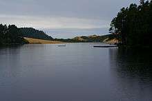
Cleawox Lake on the coast

Cullaby Lake in Clatsop County
Cultus Lake in Deschutes County

Elk Lake and South Sister
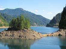
Fern Ridge Reservoir on the Long Tom River in Lane County
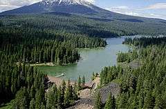
Fish Lake with Mount McLoughlin in the background

Goose Lake on the Oregon–California border

Guild's Lake at the 1905 Exposition, shortly before it was buried
_(harDA0021a).jpg)
Malheur Lake in Harney County
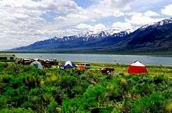
Mann Lake in Harney County
.jpg)
Odell Lake at sunrise
_(malD0133).jpg)
Owyhee Reservoir, a long and narrow reservoir on the Owyhee River
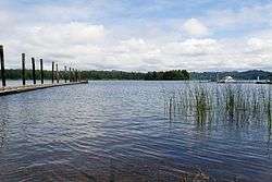
Siltcoos Lake on the central coast

Upper Klamath Lake, Oregon's largest lake by surface area

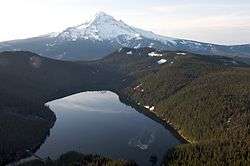
Waldo Lake in the Lane County Cascades
| Name | Description |
|---|---|
| Lake Abert | a large, shallow lake in central Lake County |
| Agate Lake | an impoundment of Dry Creek |
| Agency Lake | connected to Upper Klamath Lake |
| Lake Allison | former lake filling the Willamette Valley to a depth of 300 to 400 feet (91 to 122 m) |
| Alvord Lake | a terminus for streams near the Alvord Desert |
| Aneroid Lake | in the Eagle Cap Wilderness |
| Antelope Flat Reservoir | in central Oregon, an impoundment of Bear Creek |
| Antelope Reservoir | near Jordan Valley |
| Anthony Lakes | also known as North Powder Lakes, in the Elkhorn Mountains |
| Applegate Lake | a flood-control reservoir on the Applegate River |
| Aspen Lake | in the southern Cascade Range, just west of Klamath Falls |
| Baert Lake | a man-made lake in the Christmas Valley |
| Lake Billy Chinook | an impoundment of the Crooked, Deschutes, and Metolius rivers by the Round Butte Dam near The Cove Palisades State Park |
| Big Cliff Reservoir | a re-regulation reservoir below Detroit Lake |
| Blue Lake | a recreational lake in Fairview |
| Blue River Reservoir | an impoundment of the Blue River, a tributary of the McKenzie River |
| Lake Bonneville | an impoundment on the Columbia River formed by Bonneville Dam |
| Bonny Lakes | two ponds in the Eagle Cap Wilderness |
| Borax Lake | an alkali lake in Harney County, home to the Borax Lake chub |
| Breitenbush Lake | straddles the Cascade crest in the Warm Springs Reservation and headwaters of some of the Breitenbush River |
| Buckeye Lake | a lake in the Rogue-Umpqua Divide Wilderness near Fish Lake, visible from Grasshopper Mountain |
| Bull Run Lake | an impoundment of the Bull Run River northwest of Mount Hood, Portland's primary drinking water source |
| Bully Creek Reservoir | an impoundment of Bully Creek, a tributary of the Malheur River |
| Burnt Lake | in the Sandy River watershed |
| Bybee Lake | in the Columbia Slough watershed |
| Cabin Lake | a small, seasonally dry lake southeast of Newberry Volcano and a popular place for birdwatching |
| Camp Lake | a small lake at 6,975 ft (2,126 m) in elevation, northeast of South Sister |
| Cascade Lakes | a group of mountain lakes south of Mount Bachelor |
| Lake Celilo | an artificial lake of the Columbia River created by The Dalles Dam |
| Christmas Lake | a seasonally dry lake in the Christmas Valley |
| Clear Lake | the name of at least ten Oregon lakes |
| Cleawox Lake | dammed by sand dunes along the Oregon Coast near Florence |
| Cooper Creek Reservoir | near Sutherlin in the upper Umpqua River basin |
| Chickahominy Reservoir | an impoundment of Chickahominy Creek near Riley |
| Cottage Grove Reservoir | an impoundment of the Coast Fork Willamette River created by Cottage Grove Dam |
| Cougar Reservoir | an impoundment of the McKenzie River created by Cougar Dam |
| Crane Prairie Reservoir | a 5.34 sq mi (13.8 km2) reservoir in Deschutes County and one of the largest rainbow trout fisheries in Oregon |
| Crater Lake | the deepest lake in the Western Hemisphere and the seventh deepest in the world, excluding Lake Vostok in Antarctica |
| Crescent Lake | north of the town of Chemult in Klamath County |
| Cullaby Lake | a 1.7-mile (2.7 km) long north-south lake east of US 101 adjacent to Sunset Beach near Warrenton in Clatsop County |
| Cultus Lake | a mountain lake in the Deschutes River watershed, near the Cascade Lakes Scenic Byway |
| Davis Lake | a mountain lake southeast of Oakridge in the Cascade Range |
| Deep Lake (Oregon) | the name of at least five lakes and two lakebeds |
| Detroit Lake | an impoundment of the Breitenbush and Santiam rivers by Detroit Dam |
| Devils Lake | a small lake adjacent to the Cascade Lakes Scenic Byway |
| Devils Lake | the source of the D River, one of the shortest rivers in the world |
| Dexter Reservoir | also known as Dexter Lake, an impoundment of the Middle Fork Willamette River created by Dexter Dam |
| Diamond Lake | about 10 mi (16 km) north of Crater Lake, between Mount Bailey and Mount Thielsen |
| Dollar Lake | in the Eagle Cap Wilderness |
| Donaca Lake | in the Middle Santiam Wilderness |
| Dorena Reservoir | an impoundment of the Row River created by Dorena Dam |
| Doris Lake | a deep, high-elevation lake in Deschutes County |
| East Lake | one of two crater lakes at Newberry Volcano |
| Eel Lake | a large coastal lake near Lakeside in Coos County |
| E. E. Wilson Lake | |
| Elk Lake | a small lake along the Cascade Lakes Scenic Byway |
| Emigrant Lake | an impoundment of Emigrant Creek in Jackson County |
| Lake Ewauna | headwaters of the Klamath River |
| Fairview Lake | in the Columbia Slough watershed |
| Fern Ridge Reservoir | also known as Fern Ridge Lake, an impoundment on the Long Tom River in Lane County |
| Fish Lake (Jackson County, Oregon) | formerly a natural lake, now an impoundment of the north fork of Little Butte Creek |
| Fish Lake (Marion County, Oregon) | a 20-acre (8.1 ha) lake in the Cascades near Olallie Lake |
| Fish Hawk Lake | a private lake in Clatsop County near Birkenfeld |
| Flagstaff Lake | one of the Warner Lakes in southeastern Lake County |
| Floras Lake | natural lake behind dunes between Cape Blanco and Bandon |
| Fossil Lake | a seasonally dry lake in northern Lake County |
| Foster Reservoir | an impoundment on the South Santiam River created by Foster Dam |
| Fourmile Lake | an impoundment of Fourmile Creek |
| Frog Lake (Oregon) | the name for at least nine lakes, reservoirs, and related features |
| Gerber Reservoir | an impoundment on Miller Creek created by Gerber Dam |
| Goose Lake | in Oregon and California, formerly the headwaters of the Pit River |
| Green Peter Reservoir | an impoundment of the Middle Santiam River created by Green Peter Dam |
| Guild's Lake | a lake formerly in NW Portland between NW Yeon and St. Helens Road |
| Lake Harriet | an impoundment of the Oak Grove Fork Clackamas River |
| Hagg Lake | a 1,200-acre (4.9 km2) reservoir in the foothills of the Coast Range, just west of Forest Grove |
| Harney Lake | a natural, occasionally vanishing lake which merges with Malheur Lake in times of high water |
| Hells Canyon Reservoir | an impoundment of the Snake River |
| Henry Hagg Lake | an impoundment of Scoggins Creek, a tributary of the Tualatin River in Washington County |
| Hills Creek Reservoir | an impoundment of the Middle Fork Willamette River created by Hills Creek Dam |
| Hosmer Lake | a small lake just off the Cascade Lakes Scenic Byway |
| Howard Prairie Lake | a reservoir east of Ashland in Jackson County |
| Hyatt Reservoir | an impoundment of Keene Creek southwest of Howard Prairie Lake |
| Island Lake | an alpine lake in the Sky Lakes Wilderness |
| John C. Boyle Reservoir | an impoundment on the upper Klamath River formed by John C. Boyle Dam |
| Jubilee Lake | an impoundment of Motett Creek in Union County north of Elgin and a popular recreation site in the Umatilla National Forest |
| Junipers Reservoir | an artificial lake west of Lakeview and the mouth of Lake County's Muddy Creek |
| Lake of the Woods (Oregon) | a natural lake west of Upper Klamath Lake and southeast of Mount McLoughlin |
| Langdon Lake | an impoundment of Morning Creek and source of Lookingglass Creek, a tributary of the Grande Ronde River |
| Lava Lake | a small lake along the Cascade Lakes Scenic Byway |
| Leaburg Reservoir | an impoundment of the McKenzie River near Leaburg |
| Lemolo Lake | an impoundment of the North Umpqua River about 10 miles (16 km) north of Diamond Lake |
| Little Crater Lake | a tiny lake which about as deep as it is wide, northeast of Timothy Lake |
| Little Cultus Lake | a small lake near the Cascade Lakes Scenic Byway |
| Little Lava Lake | a small lake the head of the Deschutes River and near the Cascade Lakes Scenic Byway |
| Little Three Creeks Lake | a small lake very close to Three Creeks Lake Near Sisters |
| Lofton Reservoir | an impoundment within the Fremont–Winema National Forest |
| Lookout Point Reservoir | an impoundment of the Middle Fork Willamette River by Lookout Point Dam |
| Loon Lake | a 216-acre (0.87 km2) lake in the Coast Range 15.5 miles (24.9 km) ESE of Reedsport |
| Lost Creek Lake | an impoundment on the Rogue River |
| Lost Lake | a name for at least 20 lakes in Oregon |
| Maidu Lake | source of the North Umpqua River, in Douglas County |
| Magone Lake | in the Malheur National Forest north of John Day |
| Malheur Lake | the terminus of the Donner und Blitzen River and the Silvies River |
| Malheur Reservoir | an irrigation impoundment on Willow Creek (Malheur River) |
| Mann Lake | the largest playa lake in the north Alvord Valley, Harney County |
| Marion Lake | in the Mount Jefferson Wilderness, the largest wilderness lake in Oregon |
| McGuire Reservoir | an impoundment of the Nestucca River |
| McKay Reservoir | an impoundment of McKay Creek, a tributary of the Umatilla River. |
| Miller Lake | natural lake near Pacific Crest Trail west of Chemult, Oregon |
| Minam Lake | reservoir in Eagle Cap Wilderness; source of Lostine and Minam rivers |
| Mink Lake (Lane County, Oregon) | second-largest wilderness lake in Oregon |
| Mirror Pond | an impoundment of the Deschutes River in central Bend |
| Mud Lake | nineteen Oregon lakes share this name, but are distributed throughout the state |
| North Fork Reservoir | an impoundment of the Clackamas River |
| North Tenmile Lake | adjacent to Tenmile Lake near Reedsport |
| Nuss Lake | a small lake in Klamath County, Oregon |
| Ochoco Reservoir | a reservoir east of Prineville, Oregon |
| Odell Lake | a mountain lake southeast of Willamette Pass |
| Olallie Lake | a mountain lake 10 miles (16 km) north of Mount Jefferson |
| Oswego Lake | a privately owned natural lake (though artificially enlarged) that is a former channel of the Tualatin River |
| Owyhee Reservoir | an impoundment of the Owyhee River by Owyhee Dam in Eastern Oregon; Oregon's longest lake (52 miles (84 km)) |
| Paulina Lake | one of two crater lakes in Newberry Caldera |
| Phillips Lake | an impoundment of the Powder River |
| Perkins Lake | a lake in Douglas County |
| Pine Hollow Reservoir | impoundments of Threemile and Pine Hollow creeks, located 45°14′55″N 121°17′36″W / 45.24858°N 121.29338°W two miles NW of Wamic, Oregon[1] |
| Prineville Reservoir | an impoundment of the Crooked River by Arthur R. Bowman Dam in central Crook County |
| River Mill Hydroelectric Project and River Mill Dam | an impoundment of the Clackamas River abeam Estacada and producing electricity since 1911 |
| Santiam Lake | headwaters of the North Santiam River in southwestern Mount Jefferson Wilderness |
| Siltcoos Lake | largest lake dammed by sand dunes along the Oregon coast; near Florence |
| Silver Lake | SE Oregon within the Great Basin |
| Silverton Reservoir | an impoundment of Silver Creek |
| Smith Lake | in the Columbia Slough watershed |
| Sparks Lake | mountain lake west of Mount Bachelor and along the Cascade Lakes Scenic Byway |
| Strawberry Lake | biggest lake in the Strawberry Mountain Wilderness near Prairie City |
| Summer Lake | SE Oregon within the Great Basin |
| Summit Lake | There are at least seven Summit Lakes in Oregon, and at least two communities |
| Suttle Lake | A lake on the east side of Santiam Pass |
| Tahkenitch Lake | Between Reedsport and Florence, dammed by sand dunes along the Oregon coast. |
| Teardrop Pool | a small lake on the summit of the South Sister, Oregon's highest lake at 10,400 feet (3,200 m) elevation, 44°06′09″N 121°46′19″W / 44.10255°N 121.77199°W |
| Tenmile Lake (Oregon) | Largest lake in the Tenmile Creek basin near Reedsport |
| Thief Valley Reservoir | an impoundment on the Powder River |
| Thorn Lake | a seasonally dry lake in Christmas Valley |
| Three Creeks Lake | a warm lake near Sisters popular for Trout fishing |
| Timothy Lake | an impoundment of the Oak Grove Fork Clackamas River |
| Todd Lake | A small, yet popular lake along the Cascade Lakes Scenic Byway |
| Triangle Lake | A small lake 22 miles (35 km) west of Cheshire |
| Trillium Lake | a historic artificial lake |
| Upper Klamath Lake | Oregon's largest lake by surface area, located near the California border, fed by the Williamson River (Oregon), and drained by the Link River into Lake Ewauna |
| North and South Twin Lakes | two small lakes near the Cascade Lakes Scenic Byway |
| Lake Umatilla | impoundment of the Columbia River formed by the John Day Dam |
| Wahtum Lake | a small lake on the NNW flank of Mount Hood |
| Waldo Lake | headwaters of the North Fork Middle Fork Willamette River |
| Lake Wallula | impoundment of the Columbia River formed by McNary Dam |
| Warm Springs Reservoir | an impoundment of the Malheur River |
| Walling Pond | A public use, privately owned fishing pond in Salem |
| Walter Wirth Lake | A former gravel pit turned fishing pond in Salem |
| Wallowa Lake | A melted glacier near Joseph |
| Wickiup Reservoir | A reservoir south of Mount Bachelor |
| Willow Creek Lake | formed by Willow Creek Dam impounding Willow Creek near Heppner |
| Woahink Lake | Deepest lake (relative to sea level) dammed by sand dunes along the Oregon coast; near Florence |
Summit Lake
| name | type | elevation | coordinate | USGS Map | GNIS ID |
|---|---|---|---|---|---|
| Criterion Summit (Wasco County, Oregon) | Summit | 3,363 ft (1,025 m) | 44°58′58″N 120°59′26″W / 44.98278°N 120.99056°W | Shaniko Junction | 1136193 |
| Summit Lake (Clackamas County, Oregon) | Lake | 4,183 ft (1,275 m) | 45°01′53″N 121°47′17″W / 45.03139°N 121.78806°W | Timothy Lake | 1150623 |
| Summit Lake Recreation Site (Clackamas County, Oregon) | Locale | 4,190 ft (1,280 m) | 45°01′54″N 121°47′24″W / 45.03167°N 121.79000°W | Timothy Lake | 1156510 |
| Summit Lake Trail | Trail | 4,570 ft (1,390 m) | 45°00′54″N 121°46′54″W / 45.01500°N 121.78167°W | Timothy Lake | 1150625 |
| Summit Lake (Jackson County, Oregon) | Lake | 4,744 ft (1,446 m) | 42°00′52″N 123°01′09″W / 42.01444°N 123.01917°W | Squaw Lakes | 1150620 |
| Summit Lake (Klamath County, Oregon) | Lake | 5,558 ft (1,694 m) | 43°27′23″N 122°07′20″W / 43.45639°N 122.12222°W | Cowhorn Mountain | 1150624 |
| Summit Lake Boat Launch (Klamath County, Oregon) | Locale | 5,564 ft (1,696 m) | 43°27′44″N 122°08′00″W / 43.46222°N 122.13333°W | Emigrant Butte | 2700239 |
| Summit Lake Recreation Site (Klamath County, Oregon) | Locale | 5,568 ft (1,697 m) | 43°27′46″N 122°07′59″W / 43.46278°N 122.13306°W | Emigrant Butte | 1155874 |
| Summit Lake (Jackson County, Oregon) | Lake | 5,755 ft (1,754 m) | 42°28′30″N 122°17′09″W / 42.47500°N 122.28583°W | Mount McLoughlin | 1150621 |
| Summit Lake (Jefferson County, Oregon) | Lake | 5,909 ft (1,801 m) | 44°27′45″N 121°50′39″W / 44.46250°N 121.84417°W | Three Fingered Jack | 1150622 |
| Little Summit Lake | Lake | 6,952 ft (2,119 m) | 44°52′41″N 118°12′16″W / 44.87806°N 118.20444°W | Anthony Lakes | 1123294 |
| Summit Lake (Baker County, Oregon) | Lake | 7,251 ft (2,210 m) | 44°52′31″N 118°11′46″W / 44.87528°N 118.19611°W | Anthony Lakes | 1127716 |
See also
References
- ↑ "Pine Hollow Reservoir (Wasco County)". Atlas of Oregon Lakes. Retrieved 2012-08-20.
This article is issued from
Wikipedia.
The text is licensed under Creative Commons - Attribution - Sharealike.
Additional terms may apply for the media files.
.jpg)

_(jefDA0042).jpg)