Lindås (village)
| Lindås | |
|---|---|
| Village | |
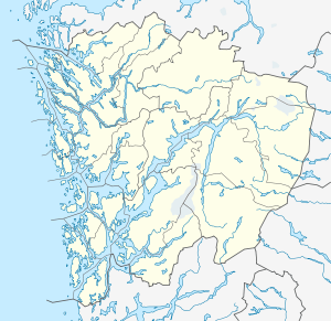
 Lindås  Lindås Location in Hordaland county | |
| Coordinates: 60°44′10″N 05°09′39″E / 60.73611°N 5.16083°ECoordinates: 60°44′10″N 05°09′39″E / 60.73611°N 5.16083°E | |
| Country | Norway |
| Region | Western Norway |
| County | Hordaland |
| District | Nordhordland |
| Municipality | Lindås |
| Area[1] | |
| • Total | 1.08 km2 (0.42 sq mi) |
| Elevation[2] | 70 m (230 ft) |
| Population (2013)[1] | |
| • Total | 1,271 |
| • Density | 1,177/km2 (3,050/sq mi) |
| Time zone | CET (UTC+01:00) |
| • Summer (DST) | CEST (UTC+02:00) |
| Post Code | 5955 Lindås |
Lindås is a village in Lindås municipality in Hordaland county, Norway.[3] The village is located on the Lindås peninsula, about 25 kilometres (16 mi) north of the village of Knarvik and about 10 kilometres (6.2 mi) southeast of the Mongstad industrial area. The village of Hundvin lies about 8 kilometres (5.0 mi) southeast of Lindås.
The village was the old administrative centre of Lindås, prior to the 1964 merger that greatly expanded the municipality. Lindås Church is located in the village. The 1.08-square-kilometre (270-acre) village has a population (2013) of 1271, giving the village a population density of 1,177 inhabitants per square kilometre (3,050/sq mi).[1]
References
- 1 2 3 Statistisk sentralbyrå (1 January 2013). "Urban settlements. Population and area, by municipality.".
- ↑ "Lindås" (in Norwegian). yr.no. Retrieved 2014-03-25.
- ↑ Store norske leksikon. "Lindås" (in Norwegian). Retrieved 2014-03-25.
This article is issued from
Wikipedia.
The text is licensed under Creative Commons - Attribution - Sharealike.
Additional terms may apply for the media files.