Leigh, Wiltshire
| Leigh | |
|---|---|
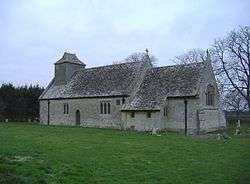
 All Saints Church, Leigh | |
 Leigh | |
| Leigh shown within Wiltshire | |
| Population | 362 (in 2011)[1] |
| OS grid reference | SU062921 |
| Civil parish |
|
| Unitary authority | |
| Ceremonial county | |
| Region | |
| Country | England |
| Sovereign state | United Kingdom |
| Post town | Swindon |
| Postcode district | SN6 |
| Dialling code | 01285 |
| Police | Wiltshire |
| Fire | Dorset and Wiltshire |
| Ambulance | South Western |
| EU Parliament | South West England |
| UK Parliament | |
| Website |
leigh-village |
Leigh is a village and civil parish in north Wiltshire, England, 1.5 miles (2.4 km) southeast of Ashton Keynes and 2.5 miles (4.0 km) west of Cricklade. It is on the edge of the Cotswold Water Park and near to the border with Gloucestershire.
The infant River Thames forms part of the northern boundary of the parish. Near the river is Upper Waterhay Meadow, a biological Site of Special Scientific Interest.
Church
The first All Saints Church dated from the 13th century and was at Waterhay, north of the village.[2] In 1896 parts of it were rebuilt by Charles Ponting at a site closer to the village and less prone to flooding.[3] The chancel of the old church still stands; both it and the newer church are Grade II* listed.[4][5]
References
- ↑ "Wiltshire Community History - Census". Wiltshire Council. Retrieved 22 February 2015.
- ↑ "All Saints Church, Waterhay, Leigh". Wiltshire Community History. Wiltshire Council. Retrieved 22 February 2015.
- ↑ "Church of All Saints, Swan Lane, Leigh". Wiltshire Community History. Wiltshire Council. Retrieved 22 February 2015.
- ↑ Historic England. "Leigh All Saints Old Chancel (1023137)". National Heritage List for England. Retrieved 22 February 2015.
- ↑ Historic England. "Church of All Saints, Leigh (1356042)". National Heritage List for England. Retrieved 22 February 2015.
External links
- "Leigh". Wiltshire Community History. Wiltshire Council. Retrieved 22 February 2015.
![]() Media related to Leigh, Wiltshire at Wikimedia Commons
Media related to Leigh, Wiltshire at Wikimedia Commons