Laurel Municipal Airport
| Laurel Municipal Airport | |||||||||||||||||||
|---|---|---|---|---|---|---|---|---|---|---|---|---|---|---|---|---|---|---|---|
| Summary | |||||||||||||||||||
| Airport type | Public | ||||||||||||||||||
| Owner | Yellowstone County Airport Authority | ||||||||||||||||||
| Operator | Yellowstone County | ||||||||||||||||||
| Serves | Laurel & Billings | ||||||||||||||||||
| Location | Laurel, Montana | ||||||||||||||||||
| Elevation AMSL | 3,517 ft / 1,072 m | ||||||||||||||||||
| Coordinates | 45°42′16″N 108°45′34″W / 45.70444°N 108.75944°WCoordinates: 45°42′16″N 108°45′34″W / 45.70444°N 108.75944°W | ||||||||||||||||||
| Maps | |||||||||||||||||||
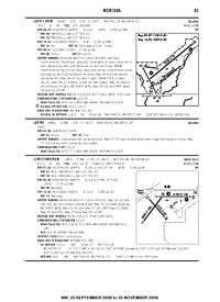
 FAA Airport/Facility Directory, 2008 | |||||||||||||||||||
 6S8 Location in Montana | |||||||||||||||||||
| Runways | |||||||||||||||||||
| |||||||||||||||||||
| Statistics (2010) | |||||||||||||||||||
| |||||||||||||||||||
Laurel Municipal Airport (FAA LID: 6S8) is two miles north of Laurel, in Yellowstone County, Montana, and eleven miles (17 km) southwest of Billings, Montana. [1] The National Plan of Integrated Airport Systems for 2011–2015 categorized it as a general aviation facility.[2] It sees no airlines.[1]
Facilities
Laurel Municipal Airport covers 254 acres (103 ha) at an elevation of 3,517 feet (1,072 m). It has three runways: 4/22 is 5,200 by 75 feet (1,585 x 23 m) asphalt; 14/32 is 2,725 by 50 feet (831 x 15 m) asphalt; 9/27 is 1,100 by 60 feet (335 x 18 m) turf.[1]
In the year ending September 15, 2010 the airport had 41,900 general aviation aircraft operations, average 114 per day. 89 aircraft were then based at the airport: 84% single-engine, 6% multi-engine, 7% helicopter, and 3% ultralight.[1]
Northern Skies Aviation is the only fixed-base operator.
References
- 1 2 3 4 5 FAA Airport Master Record for 6S8 (Form 5010 PDF). Federal Aviation Administration. Effective May 31, 2012.
- ↑ "2011–2015 NPIAS Report, Appendix A" (PDF). National Plan of Integrated Airport Systems. Federal Aviation Administration. October 4, 2010. Archived from the original (PDF, 2.03 MB) on September 27, 2012. External link in
|work=(help)
External links
- Northern Skies Aviation, the fixed-base operator (FBO)
- Aerial image as of August 1996 from USGS The National Map
- FAA Terminal Procedures for 6S8, effective August 17, 2017
- Resources for this airport:
- FAA airport information for 6S8
- AirNav airport information for 6S8
- FlightAware airport information and live flight tracker
- SkyVector aeronautical chart for 6S8