Kovvur, West Godavari district
| Kovvur Govur | |
|---|---|
| Town | |
|
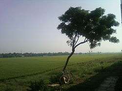
View of paddy fields near Kovvur from train | |
 Kovvur Location in Andhra Pradesh, India | |
| Coordinates: 17°01′01″N 81°43′52″E / 17.017°N 81.731°ECoordinates: 17°01′01″N 81°43′52″E / 17.017°N 81.731°E | |
| Country | India |
| State | Andhra Pradesh |
| District | West Godavari |
| Mandal | Kovvur |
| Government[1] | |
| • Type | Municipal council |
| • Body | Kovvur Municipality |
| • MLA | Kothapalli Samuel Jawahar (Telugu Desam Party) |
| Area[1] | |
| • Total | 24.56 km2 (9.48 sq mi) |
| Elevation[2] | 9 m (30 ft) |
| Population (2011)[3] | |
| • Total | 39,667 |
| • Density | 1,600/km2 (4,200/sq mi) |
| Languages | |
| • Official | Telugu |
| Time zone | IST (UTC+5:30) |
| PIN | 534 350 |
| Telephone code | +91–8813 |
Kovvur is a town in West Godavari district of the Indian state of Andhra Pradesh. It is a municipality and the mandal headquarters of Kovvur mandal in Kovvur revenue division.[4][5]
Etymology
This Town was earlier referred as Govur.[6]
Geography
Kovvuru is situated on the west bank of the Godavari River, at a distance of 92 km (57 mi) from the district headquarters, Eluru. It is located at 17°01′00″N 81°44′00″E / 17.0167°N 81.7333°E and has an average elevation of 10 m (33 ft).[7] Kovvur Is The Most Peaceful Town In The District And Devotional Town, "Goshpada Kshetram" Very Well Known Tourist Place Where Godavari Pushkaralu Takes Place.[8]
Demographics
As of 2001 India census,[9] Kovvur had a population of 39,193. Males constitute 50% of the population and females 50%. Kovvur has an average literacy rate of 70%, higher than the national average of 59.5%: male literacy is 74%, and female literacy is 66%. In Kovvur, 11% of the population is under 6 years of age.[10]
Governance
Civic administration
Kovvur municipality was formed in the year 1965.[11] It is a III–Grade Municipality, which is spread over an area of 24.56 km2 (9.48 sq mi) and has 23 election wards.[1]
Transport
The transport is mainly supported by the presence of bridges across Godavari River such as, the Godavari Bridge,[12] which is the second longest railroad bridge in Asia;[13] and the Godavari Arch Bridge, commissioned on 14 March 1997 for Howrah–Chennai main line.[14] While, the Old Godavari Bridge (The Havelock Bridge) was the earliest of all, built in 1897 and was decommissioned in 1997.[13][15]
Roadways
The town has a total road length of 70.45 km (43.78 mi).[16] The Andhra Pradesh State Road Transport Corporation operates bus services from Kovvur bus station[17] The depot was reopened in 2015.[18]
Railways
Kovvur is one of the fourteen D–category stations in the Vijayawada railway division of South Central Railway zone.[19] Kovvur will become a Potential Railway junction Between both Telugu States After Completion of Kovvur-Badrachalam road Railway line.[20]
Education
The primary and secondary school education is imparted by government, aided and private schools, under the School Education Department of the state.[21][22] The medium of instruction followed by different schools are English, Telugu.There Are Many Famous Institutions Like ABN&PRR College Of Sciences, Sankrit colleges[11] and Many Other Private Institutions.
References
- 1 2 3 "Municipalities, Municipal Corporations & UDAs" (PDF). Directorate of Town and Country Planning. Government of Andhra Pradesh. Archived from the original (PDF) on 28 January 2016. Retrieved 29 January 2016.
- ↑ "Elevation for Kovvur". Veloroutes. Retrieved 19 July 2015.
- ↑ "Census 2011". The Registrar General & Census Commissioner, India. Retrieved 12 August 2014.
- ↑ "West Godavari District Mandals" (PDF). Census of India. p. 431,466. Retrieved 19 January 2015.
- ↑ "District Census Handbook - West Godavari" (PDF). Census of India. pp. 22–23, 54. Retrieved 18 January 2015.
- ↑ "The stream of eternity". The Hans India. 12 July 2015. Retrieved 18 January 2016.
- ↑ Kovvur is Main Gate for WestGodavari Dist from Northcoast of Andhrapradesh Falling Rain Genomics, Inc - Kovvuru
- ↑ "Where the Ganga flows as Godavari". Retrieved 15 May 2017.
- ↑ "Census of India 2001: Data from the 2001 Census, including cities, villages and towns (Provisional)". Census Commission of India. Archived from the original on 2004-06-16. Retrieved 2008-11-01.
- ↑ "Kovvur Census 2011". Retrieved 15 May 2017.
- 1 2 "A Serene Town on the Banks". Retrieved 15 May 2017.
- ↑ "Rail-Cum-Road Bridge to be Illuminated".
- 1 2 R.R.Bhandari. "Bridges: The Spectacular Feat of Indian Engineering" (PDF). Indian Railway Service of Mechanical Engineers. Retrieved 15 May 2017.
- ↑ Dayaratnam, P. International Conference on Suspension, Cable Supported, and Cable Stayed Bridges: November 19-21, 1999, Hyderabad. Universities Press. p. 219. ISBN 9788173712715.
- ↑ Khan, Mukram. "The Havelock Bridge Memorial Stone". Flickr. Retrieved 1 August 2012.
- ↑ "Details of Roads in each ULB of Andhra Pradesh". Commissioner and Directorate of Municipal Administration. Municipal Administration and Urban Developmemt Department - Government of Andhra Pradesh. Retrieved 28 March 2017.
- ↑ "Bus Stations in Districts". Andhra Pradesh State Road Transport Corporation. Archived from the original on March 22, 2016. Retrieved 9 March 2016.
- ↑ "RTC depot restores link to Agency". Retrieved 15 May 2017.
- ↑ "Vijayawada Division and stations" (PDF). South Central Railway. Retrieved 19 July 2015.
- ↑ "Centre Urged to Sanction Kovvur-Bhadrachalam Rail Line". Retrieved 15 May 2017.
- ↑ "School Eduvation Department" (PDF). School Education Department, Government of Andhra Pradesh. Archived from the original (PDF) on 21 October 2016. Retrieved 7 November 2016.
- ↑ "The Department of School Education - Official AP State Government Portal | AP State Portal". www.ap.gov.in. Archived from the original on 7 November 2016. Retrieved 7 November 2016.
