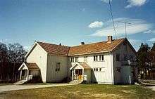
Koppang

![]() Koppang is a Norwegian town, the administrative centre of Stor-Elvdal municipality. It is served by Koppang Station. The village has 1,174 inhabitants as of 1 January 2011, and is located about 51 km (32 mi) north of Rena.[1] The name comes from a kaupang (village, town) that is thought to have been here in the Middle Ages. The site currently has several schools, shops, and a cultural center as well as a movie theater, library, bookstore and bank. The newspaper Østerdølen has been published in Koppang since 1999.[2]
Koppang is a Norwegian town, the administrative centre of Stor-Elvdal municipality. It is served by Koppang Station. The village has 1,174 inhabitants as of 1 January 2011, and is located about 51 km (32 mi) north of Rena.[1] The name comes from a kaupang (village, town) that is thought to have been here in the Middle Ages. The site currently has several schools, shops, and a cultural center as well as a movie theater, library, bookstore and bank. The newspaper Østerdølen has been published in Koppang since 1999.[2]
The valley is divided by the Glomma River. The settlement has a large modern sawmill with planing. There are many opportunities for fitness trips in the area whether by skiing, riding or on foot.[3]
History
From early on, the settlement had a stave church at Koppanjordet, traces of which still remain.[3] According to legend, the church was taken by a flood and the logs washed ashore in the shape of a cross at Kirkemoen. A new stave church was built on the site, dedicated to Saint Michael. The Røros Line reached Koppang in 1875, the village being served by Koppang Station.[4] From 1877 to 1885, the trains on the line had an overnight stop at Koppang, leading to increased commerce and an expansion of the settlement.[5] From ancient times, people lived in the valley, but repeated flooding caused them to move higher up along its sides. Barns remain at Koppanjordet which have survived many floods. The Old King's Road ( Gamle Kongevei) to Trondheim runs through Koppan. It was used not only by the king and his entourage but also by pilgrims on their way to Nidaros as Trondheim used to be called.[3]
References
- ↑ "Koppgang (stor-Elvdal)". City Popularion. Retrieved 20 January 2014.
- ↑ Store norske leksikon: Østerdølen.
- 1 2 3 "Kulturminneløype på Koppang, Stor-Elvdal" (in Norwegian). lokalhistoriewiki.no. Retrieved 20 January 2013.
- ↑ "Koppang" (in Norwegian). Jernbaneverket. Retrieved 20 January 2014.
- ↑ "Koppang stasjon" (in Norwegian). Norske jernbanestasjoner. Retrieved 20 January 2014.
Coordinates: 61°34′N 11°04′E / 61.567°N 11.067°E